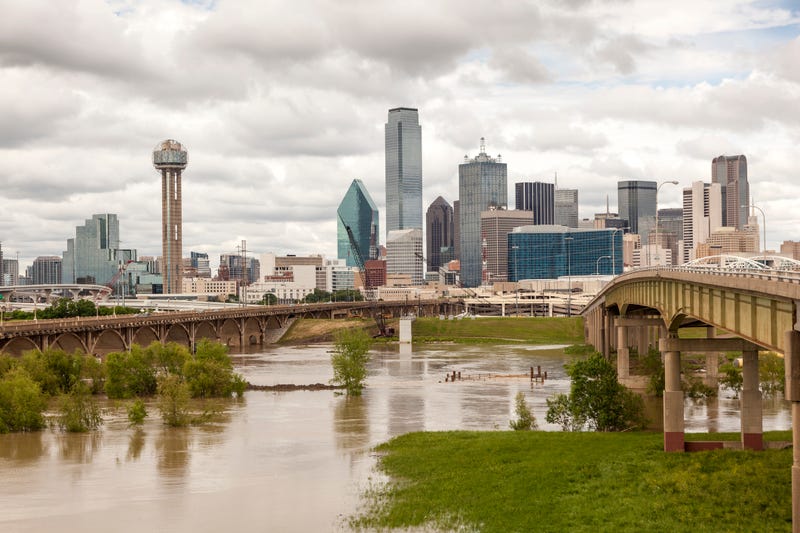

Texas Governor Greg Abbott is in Dallas today surveying flood damage.
Governor Abbott is signing a disaster declaration for 23 counties, saying the “effect of this storm has been dramatic.”
Abbott says he wants to commend mayor & city staff in Dallas “for responding so prolifically” to the biggest rainfall in 90 years. He says he’s been in touch with the mayor of Fort Worth and other North Texas cities to ensure no one has unmet needs.
Listen live on 1080 KRLD
The once in a 100-year flooding event took place across North Texas Sunday into Monday is over. Things have calmed down considerably this morning. However, be careful this morning, there may be some flooded roadways in isolated areas.
Speaking of rainfall, 9.19" of rain fell at DFW airport in a 24-hour period Sunday into Monday. This ranks number two in the top 10 for most rain for that time frame. The most rain we've seen in 24 hours is 9.57" in way back in the Great Depression of 1932. We've also received over 10 inches of rain for the month of August ranking US number two for the rainiest August since records have been kept. We also have put a huge dent in our rainfall deficit for the year which now sits at a little over an inch and a quarter. A couple of days ago we were 10 inches below average for 2022.
Again, things are quiet for your morning commute with just some patchy drizzle and low clouds hanging around the area. Unfortunately, we're not done with the rainfall yet.
The upper level low that was partly responsible for the record rainfall recently, is still hanging out just to the east of Dallas. It will stay stationary today and tomorrow, so as we heat up into the mid to upper 80s both days, scattered afternoon and evening showers and storms will develop. This will not be a widespread event and these will dissipate by sunset both today and tomorrow. Afternoon highs will reach the mid to upper 80s.
A very isolated chance for a shower storm on Thursday with a high near 90°. We're dry for Friday and Saturday with highs and the low 90s. Scattered showers and storms may return to the forecast for Sunday and Monday with highs in the low 90s again.
My thoughts and prayers go out to everyone that suffered damage from the historical flooding event. We all can rebuild!
*Yest Rain: 5.66” *Yest High: 80; Low: 72
*Today’s Averages: High: 95; Low: 75
*Record high: 107 (1952, 2010); Record low: 64 (1949, 1956, 1961)
*August rain: 10.08”; August surplus: +8.68”
*2022 Rain: 12.82”; 2022 deficit: 1.28"
*Sunrise: 6:57am; Sunset: 8:04pm
Today: Morning clouds and drizzle, becoming partly cloudy and warmer. Slight chance of afternoon and evening showers and storms. High: Mid 80s. Wind: North 10-15 mph.
Tonight: Partly cloudy. Low: Low to mid 70s. Wind: NE 5 mph.
Tomorrow: A 20 percent chance of showers and thunderstorms after 1pm. Partly cloudy, warm and humid. High: Mid to upper 80s.Wind: NE 5 mph.
Thursday - Saturday: Partly cloudy, warm and humid. High: Near 90.
Sunday and Monday: Partly cloudy, hot and humid. Slight chance of showers and storms. High: Low 90s.
Related

LISTEN on the Audacy App
Sign Up and Follow NewsRadio 1080 KRLD