
We're waking up to temperatures ranging between 26゚ and 32゚ across North Texas. This has caused residual moisture to refreeze, especially on bridges and high flyovers. Please delay your travels until after 9 AM this morning. Temperatures will safely be above freezing by then.
Say goodbye to the ice and hello to warmth. Those are our weather stories over the next several days. And, I promise you, no Arctic air is expected anytime soon.
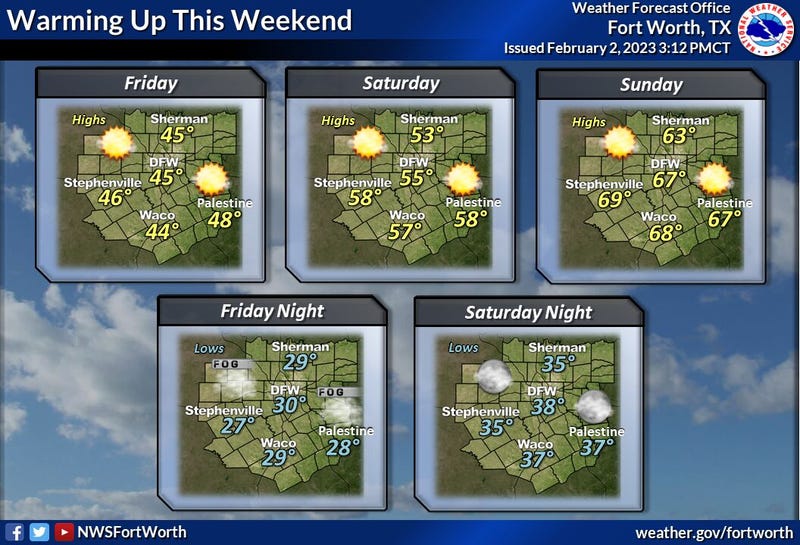
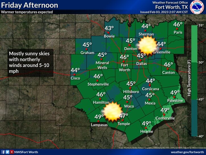
Plenty of sunshine will dominate our weather through the weekend. We'll warm into the mid to upper forties today. Sunny and breezy this weekend with highs in the mid fifties Saturday, mid sixties on Sunday. By Monday, temperatures will warm up into the low 70s.
Our next weather change arrives the 2nd half of Tuesday lasting through early Thursday. Looks like we have more welcome rain on the way. Temperatures will be in the low mid 60s on Tuesday, cooling into the 50s for Wednesday and Thursday.
*Yest Rain: 0.41"; High: 35; Low: 31
*Today’s Averages: High: 59; Low: 38
*Record high: 84 (1911); Record low: 14 (1905,1985, 1996)
*February Rain: 0.69"; Surplus: 0.54"
*2023 rain: 2.07"; Deficit: 0.61"
*Sunrise: 7:22am; Sunset: 6:02pm

Today: Morning black ice and areas of freezing fog. Thawing our after 10am. Clear and chilly. High: Mid to upper 40s. Wind: North 5-10 mph.
Tonight: Clear and cold. Areas of morning freezing fog. Low: Near freezing (32 degrees). Wind: Lt. Var.
Tomorrow: Passing high clouds, breezy and cool. High: Mid to upper 50s. Wind: South 10-20 mph.
Sunday: Mostly sunny, windy and warmer. High: Mid to upper 60s.
Monday: Increasing high clouds, windy and nice. High: Low 70s.
Tuesday: Increasing clouds. Afternoon cold front. Chance of rain. High: Low 60s.
Wednesday: Cloudy and cooler. Chance of rain. High: Low 50s.
Thursday: Morning rain, afternoon sunshine and cool. High: Mid 50s.
Related

LISTEN on the Audacy App
Sign Up and Follow NewsRadio 1080 KRLD