
UPDATE 5:45 P.M.
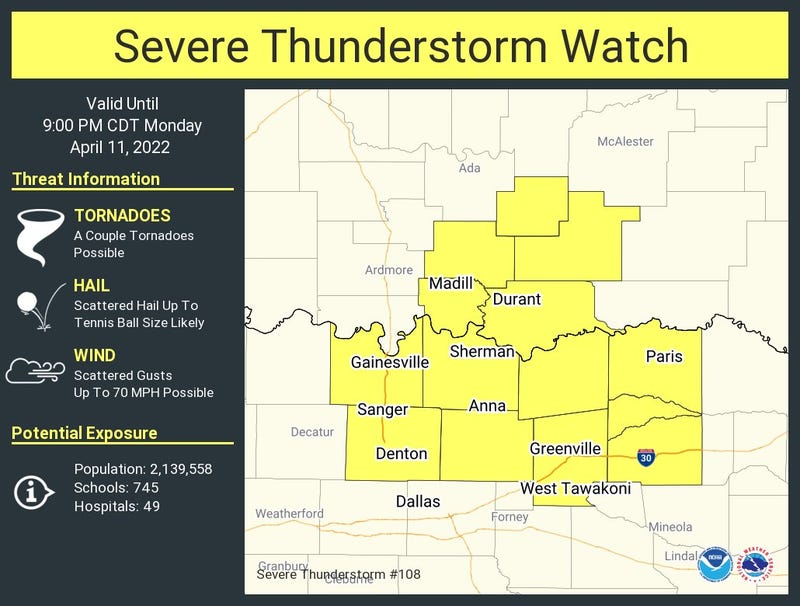
Heads up North Texas! A Severe Thunderstorm Watch is now in effect for the counties in yellow (below) until 9 p.m. Main concerns are large hail, damaging wind gusts, and a couple of tornadoes are possible. This watch does not include DFW.
As of 5:30 pm., nothing is showing up on radar.
We are waking up to considerable cloudiness and temperatures near 70゚. Still getting wind gusts over 30mph, but they'll calm down a little bit with gusts to 25mph through the day Monday.
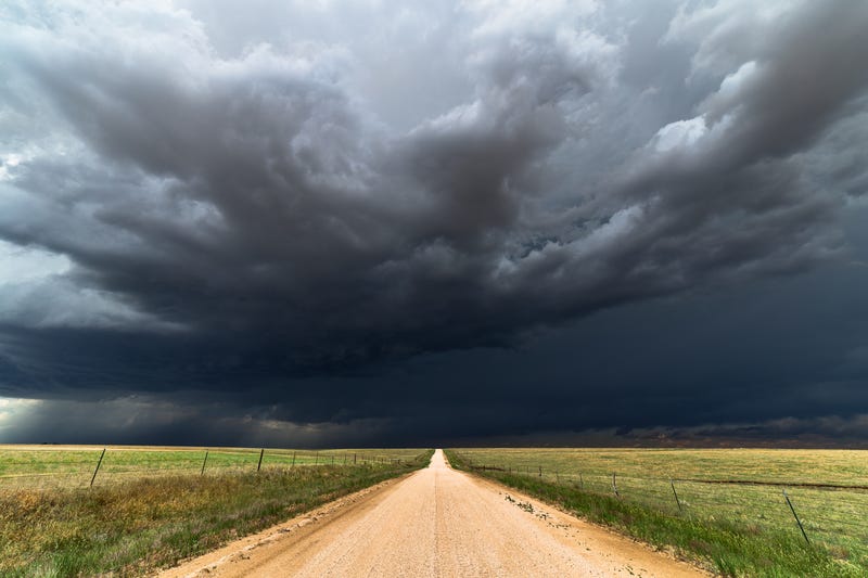
Sunshine will reappear before lunch time and temperatures will really warm up. Afternoon highs in the upper eighties to low nineties. There's a very slight chance for an isolated supercell to form late this afternoon into the early evening, especially north and NE of the Dallas/Fort Worth area. Any storms that do form will contain large hail. Chances are very slim across north Texas though.
Now tomorrow, that's a different story. Morning lows Tuesday will drop to near 70゚ again with considerable cloudiness. Sunshine will break through by early afternoon as we warm into the mid to upper eighties. Speaking of the mid afternoon, I'm going to keep my eye on a surging dryline heading our direction into the early evening hours. Scattered strong to severe supercells will break out along highway 281 (50 miles west of 35W) and head our direction after dinner time. All modes of severe weather are possible. Please keep in mind, with a level 3 out of 5 for storm development, this doesn't mean everybody in the colored area will see storms. It's just a general area that people need to monitor. As usual, I'll be keeping an eye all things for you. After 9pm or 10pm, these severe storms will shift east of DFW, so you'll be able to sleep soundly.
By Wednesday late morning, a cold front will move through the area. The greatest chance for severe storms will shift east and southeast of the Dallas/Fort Worth area on Wednesday, and especially in east Texas. Wind will shift to the north and cooler dryer air will rush in, bringing temperatures down for Wednesday and Thursday into the upper seventies for highs. The mornings will be comfortable into Friday... 50s will be felt.
This cold front will lift back to the north early Friday morning, sparking a few strong thunderstorms, but I'm not overly concerned. Something I will monitor though.
Our next weather change arrives late Saturday into early Easter Sunday as another cold front comes through the area. This will be a pretty strong front. It's still way too early to tell how severe, the coverage area, and the timing. We will cross that bridge when we get there. One thing is for certain... Easter Sunday, it'll turn windy and much cooler. The cooler temperatures will continue into the following week.
Remember, the day to be most concerned about is Tuesday between 5pm and 9pm. Stay tuned for more information as we get closer to this event.
*Yest Rain: 0.00”; *Yest High: 86; Low: 62
*Today’s Averages: High: 75; Low: 54
*Record high: 96 (1948); Record low: 29 (1989)
* April rain: 1.33”; April surplus: + 0.35”
*2022 Rain: 5.56”; 2022 deficit: 4.01"
*Sunrise: 7:03 am; Sunset: 7:56pm
Today: Morning clouds, afternoon sun. An isolated severe storm or two towards the Red River. Windy and warm. High: 88-92. Wind: SSW 15-25 mph.
Tonight: Increasing clouds, mild, muggy and breezy. Low: Near 70. Wind: South 15-25 mph.
Tomorrow: Morning clouds, afternoon sun. Scattered severe storms (3pm-9pm) Threats: Large hail, damaging wind, isolated tornadoes. High: Mid to upper 80s. Wind: South 15-25, G30 mph.
Wednesday: Late morning cold front. Scattered showers and storms, mainly east and southeast of DFW. High: Upper 70s.
Thursday: Back to sunshine, windy and pleasant. High: Upper 70s.
Friday: Slight chance of showers and storms (Warm front). High: Low to mid 80s.
Saturday: Partly cloudy, warm and windy. Slight chance for showers and storms. High: Upper 80s.
Easter Sunday: Slight chance for morning showers and storms. Turning windy and cooler. High: Near 70.
Related

LISTEN on the Audacy App
Sign Up and Follow NewsRadio 1080 KRLD