
Buffalo, N.Y. (WBEN) - Just the mere mention of a warmup in Western New York may be enough to call for celebrations.
Following some lingering snow showers Friday and the start of the weekend, temperatures will begin a day to day warming trend.
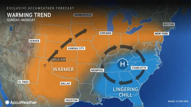
High pressure moving east from the Ohio valley will set the stage for a moderation in temperatures with day to day warming slated through much of next week.
The warming trend will have to wait for some remaining snow showers to work out of the area Friday, National Weather Service meteorologist Phillip Pandolfo tells WBEN.
"We're not looking at too much more in terms of total accumulation," Pandolfo notes. "Maybe another inch or two where the snows are most persistent."
A total of about 2 to 4 inches of snow was reported across much of the area Thursday, with some localized areas seeing as much as 7 inches of snow.
The Warmup
"We will be looking at a day to day warming trend," Pandolfo promises. However we will need to get through one more cold day Friday.
There will be improvement by the day as the weekend and coming week approaches.
"As we go through the weekend we will slowly climb into the 30's for high temperatures," Pandolfo predicts. "We'll actually be looking at a stretch early next week where we'll be seeing high temperatures in the 40's."
The warming won't last, however, with another shot of much colder air into our region, resulting in temperatures falling back to below average at some point later on next week.