It's never a "sure thing" but confidence levels are rising about a quick snow event late tonight into Tuesday, probably plowable with a fair amount of skidding, slipping and sliding by midday. Before the snow tapers to flurries Tuesday evening many of us in the immediate metro will have 3-5" of snow on the ground; less far northern and western suburbs, but potentially a little more just south and east of St. Paul.
Headlines:
- Dry this evening. Run out now and buy milk, bread and a 5-year supply of toilet paper. Snow arrives after midnight; we may wake up to about 1" Tuesday morning.
- Snow becomes heavier and steadier during the day tomorrow with 2-5" by evening, possibly 6" south/east metro. A plowable snowfall event.
- This will NOT be a blizzard. Wind speeds will be in the 10-20 mph range, capable of minor drifting, but not even close to blizzard criteria.
- Travel should improve Wednesday, but cold 30 mph+ wind gusts will make it feel like single digits. Suggestion: try to get the snow off your driveway or sidewalk Tuesday evening because that cold wind on Wednesday will be uncomfortable.
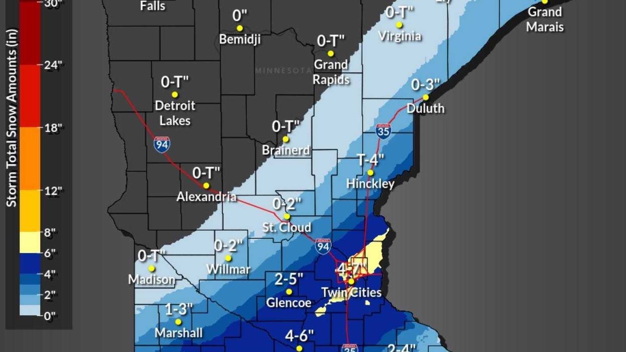
 The official National Weather Service outlook for snow.(Image courtesy of the National Weather Service / NOAA)
Above is the official Twin Cities National Weather Service Snowfall outlook. The local NWS office predicts the axis of heaviest snow may set up directly over the Twin Cities, which is certainly possible. Some weather models keep the heaviest snowfall just south and east of MSP. Whether it's 4" or 6" it probably won't make much of a difference for the PM commute tomorrow, which will be slow. Little question about that.
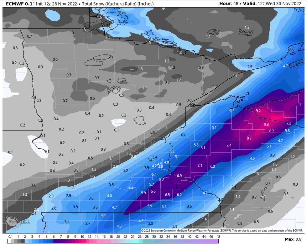 The European model snow map(Image courtesy of WeatherBell)
ECMWF guidance fairly consistently predicts the axis of heaviest snow just southeast of the downtowns, with St. Paul standing a better chance of 6" amounts than Minneapolis. I do agree that a coating to a half inch is likely from Willmar to St. Cloud to Duluth from this system.
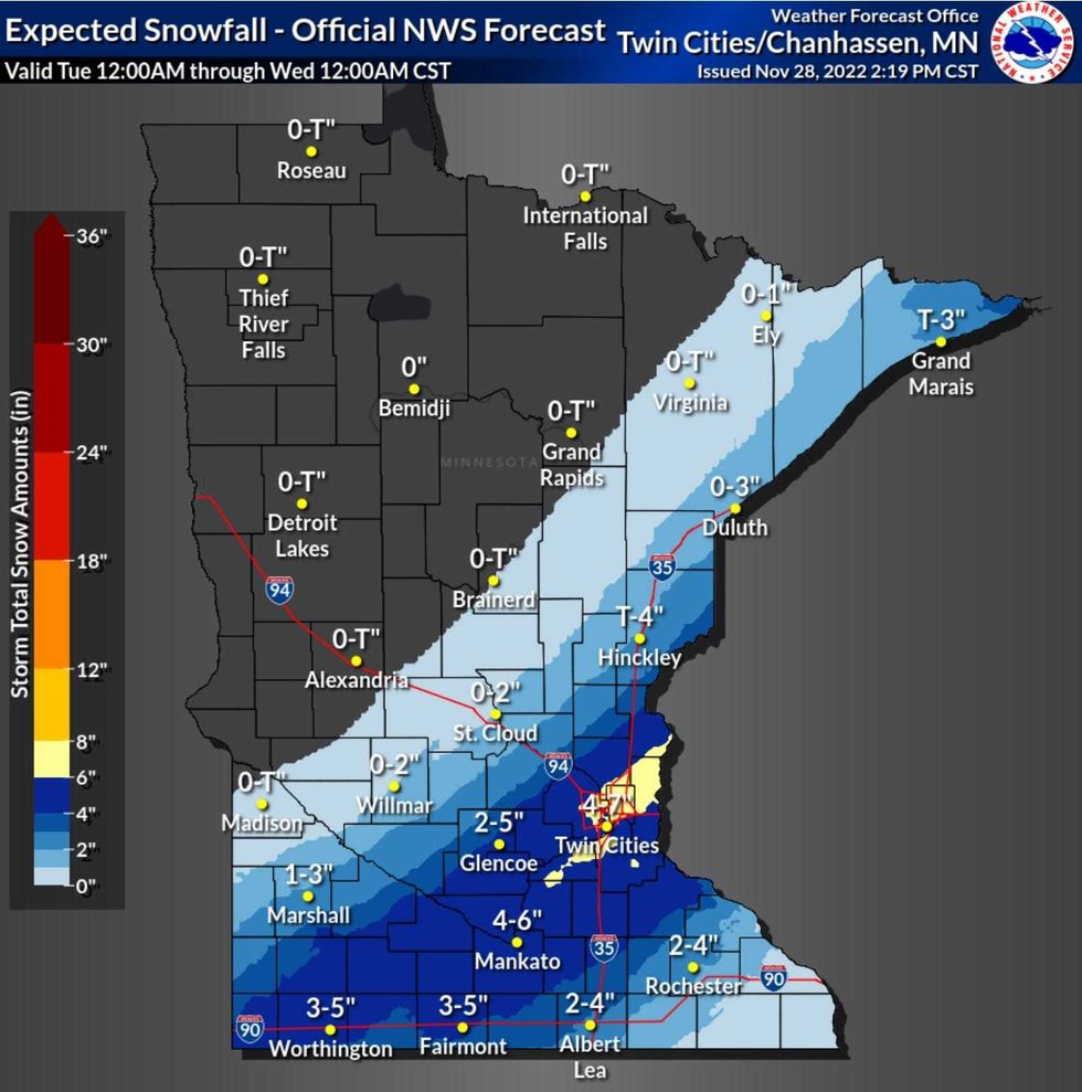
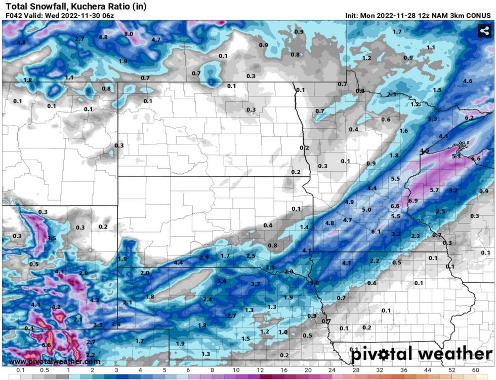 The NOAA snow model.(Image courtesy of pivotalweather.com)
NOAA's models by and large keep the axis of heaviest snow (5-6") right over the immediate metro area into northwestern Wisconsin, with a few inches for Duluth. This could still verify, but I suspect that most of us in the immediate Twin Cities will wind up with 3-5" before the snow winds down Tuesday evening.
Meteorological Winter kicks off on Thursday, December 1 - but as far as the atmosphere is concerned it's already winter, and that should become apparent tomorrow. Leave extra time to get around town Tuesday - I expect somewhat better (plowed/salted) roads for Wednesday's commute.
Remember, it's just frozen water. We can do this.
Stay alert and stay tuned to WCCO Radio for the very latest updates on this plowable snow event.