

This winter, when in doubt, just predict snow. Chances are you'll be close to the mark.
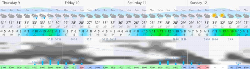
No signs of Snowpocalyse, but a couple of plowable snow events are shaping up from Thursday into Monday morning. The meteogram (storm timeline) below shows the best chance of significant snow falling Thursday afternoon and night, again Saturday night into Sunday morning. The blue bars at the bottom of the graphic show the European solution for snow intensity. The bigger the bars the heavier it may snow.
Stormy headlines:
- Light snow Wednesday, maybe a coating to an inch.
- Heavier snow kicks in Thursday afternoon and Thursday night, with 3-5" possible by Friday morning.
- We get a brief break Friday afternoon through Saturday morning.
- A vigorous clipper may drop another 2-4" on much of the area Saturday afternoon into Sunday morning.
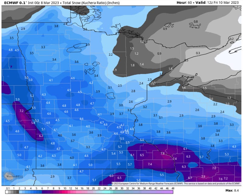
ECMWF Snowfall by Friday Morning
The European solution (above) predicts 3-5" of snow by Friday morning, most of that falling Thursday afternoon and Thursday night. The best chance of 6" comes over far southeastern Minnesota.
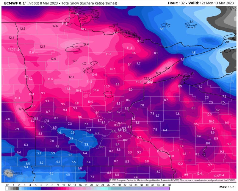
ECMWF Total Snowfall by Monday Morning
The weather model above shows total expected snowfall from the European model, with upwards of 8", give or take, in the metro by Monday morning, and even more than that over central and northern Minnesota and far southeastern counties. I suspect another 2-4" will fall from a strong clipper Saturday PM into Sunday AM in the Twin Cities metro.
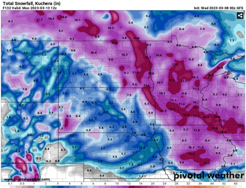
NOAA GFS Total Snowfall by Monday Morning
NOAA's GFS guidance is more aggressive with total snowfall by Monday morning, hinting at more than a foot between the 2 systems coming in.
This is certainly a possible solution, but I'm leaning toward the more conservative ECMWF, which keeps total metro snowfall to closer to 8", give or take.
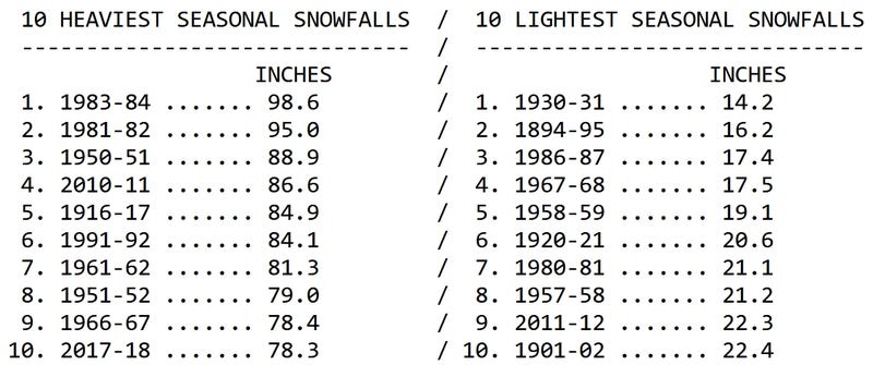
Snowfall Records Courtesy of the Minnesota DNR and State Climatology Office
Winter snowfall in the Twin Cities is 74.7", to date. If we pick up another 3.7" of snow this will be a Top 10 Winter Snowfall for the Twin Cities, which is possible by Friday, and likely by Sunday. Anything over 85" means a Top 5 Winter Snowfall for the metro area.
Hey, if it's going to snow let's set records. Bragging rights. Scare friends and family in other (boring weather) parts of the USA.
It's helping the drought, and if we experience a slow-motion thaw in the weeks to come (without much heavy rain) maybe we'll ease into spring without serious river flooding. Stay tuned - if you've had serious flooding in previous springs you should definitely stay alert and stay tuned for updates.
Related
