
WAYNE COUNTY (WWJ) - A strong line of storms rocked through Wayne County just before 1 p.m. on Wednesday, causing high winds, widespread power outages and witness reports of trees down and debris on roadways.
The National Weather Service issued a Severe Thunderstorm Warning for Wayne County after thunderstorms strengthened over southeast Michigan early Wednesday afternoon.
"This is a dangerous situation," the National Weather Service warned residents. "These storms are producing wind damage across portions of downtown Detroit. Seek shelter now inside a sturdy structure and stay away from windows."
Meteorologists said radar indicated wind gusts clocked in at 60 mph, and hail was possible.
Related

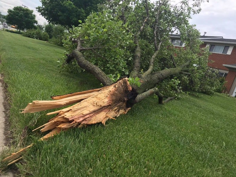
Early Wednesday afternoon, calls were coming into the WWJ newsroom about widespread damage. Wayne County residents reported power outages, flooded roadways, trees knocked down and debris across roads.
According to the DTE Outage Map, over 28,000 residents were in the dark as of 1 p.m., affecting Garden City, Romulus, Redford, Detroit's west side, Downriver, and south of Willow Run Airport.
As of 8 a.m. on Thursday, there were still more than 17,000 Metro Detroit homes and businesses without power.
The utility says it had more than 1,400 crews in the field. There was no estimated time of restoration at the moment.
Mike W. told WWJ's Sandra McNeill that he was driving in the southbound lanes of the Southfield Freeway near 11 Mile when the storm moved in and left damage on roads just north of Schoolcraft.
"There's a tree down, looks like it fell across the Service Drive and could've hit a car," he said. "Part of the branches are actually on the expressway, southbound lane. And they're in the middle lane."
Resident Tyrone Bennett was driving on southbound Beech Daly when the storms rolled in.
"It looks like a tornado was going through," Bennett said. "EMS and fire driving through there right now."
Bennett said the southbound lanes were covered in debris, forcing drivers to get into the northbound lanes to get around tree branches and "very nice sized-trees laying down" across the roadway.
"Half a mile to a mile of just trees down, water over the road and it's right there at the Warren Golf Course," Bennett said, as sirens could be heard in the background. "They way you look at it, I would say a small sized tornado came through there."
As the storms raced across the area, 68mph wind gusts were reported at Grosse Pointe Yacht Club, a 57 mph wind gust reported at Detroit Metro Airport and 50 mph wind gusts were reported at Lake St. Clair Metropark.
Meteorologist Rich Pollman told WWJ there was not a tornado, but sustained winds near 70 mph was fairly unusual for not having a tornado.
This is a developing story. Stay tuned to WWJ Newsradio 950 for the latest updates.