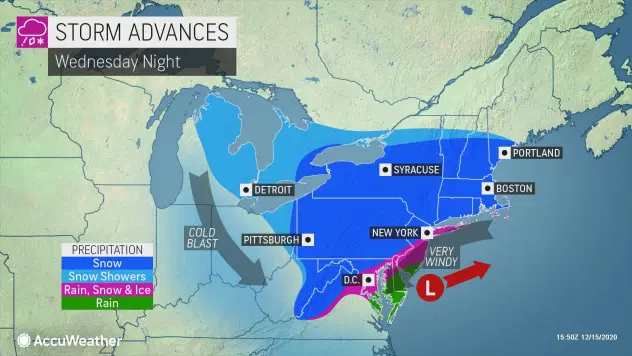
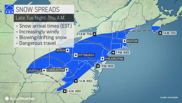
NEW YORK (1010 WINS) -- A winter storm warning has been issued by the National Weather Service for New York City, northwest Long Island and northeast New Jersey until Thursday at 1 p.m. ahead of a storm that could bring a foot of snow to the city.
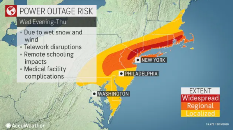
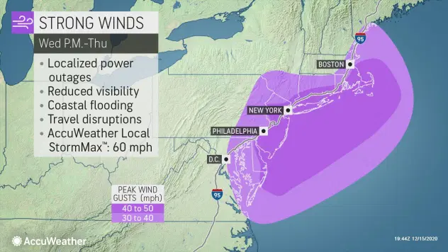
Wednesday night is expected to be windy, with falling snow that could be heavy at times. The snow could change to rain and sleet in coastal areas, but the city and inland suburbs could see blizzard conditions, with poor visibility, through Thursday morning.
Newark Airport reported a two-inch per hour snowfall rate between 7 p.m. and 8 p.m.
A travel advisory went into effect Wednesday afternoon, Mayor Bill de Blasio's office said. New Yorkers have been advised to avoid driving or walking outside.
New Jersey Gov. Phil Murphy, meanwhile, declared a state of emergency, starting at 2 p.m. Wednesday. State offices closed at 1 p.m.
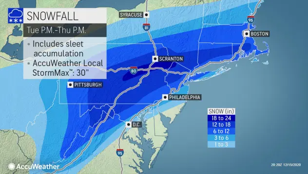
New York City could see a foot of snow accumulate, while the New Jersey and Hudson Valley suburbs could see one to two feet of snow, according to AccuWeather. Long Island and the Jersey Shore are expected to see less accumulation as the snow turns to rain and sleet.
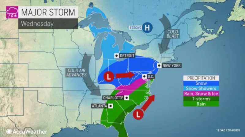
Winds may also gust as high as 40 mph to 60 mph during the course of the storm.
The low Wednesday night is 25. Thursday’s high is 30. RealFeels during the storm may be in the single digits.
Looking ahead at Friday, expect it to be brisk and cold. High 32.
This weekend will probably be dry. It'll still be cold Saturday with highs in the
mid 30s; not as cold Sunday with highs in the low 40s.