


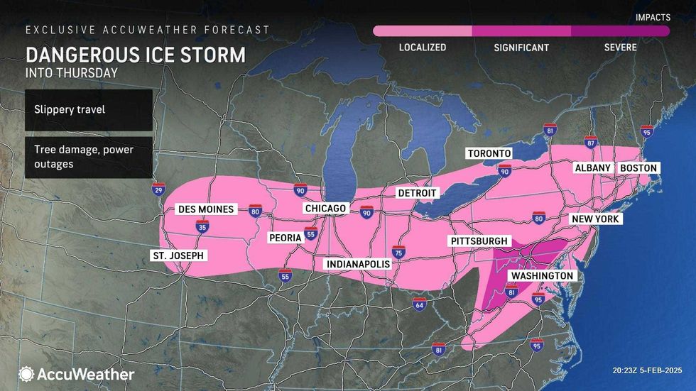
NEW YORK (1010 WINS) – Days after Punxsutawney Phil predicted six more weeks of winter, a nasty ice storm packing sleet, snow and freezing rain is blasting the East Coast Thursday—and two more winter storms are in the forecast for Friday and next week.
The National Weather Service issued a winter weather advisory until Thursday afternoon. Alternate Side Parking rules are suspended in NYC. Public schools are in session.
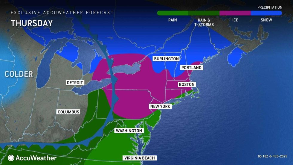
The snow and sleet arrived overnight and are set to continue through much of the morning, creating slippery conditions on the roads and sidewalks. The worst of the snow will likely be between 7 a.m. and 10 a.m.
A coating to an inch of snow is expected in the city and along the coasts, while 1-3 inches is in the forecast for the northern suburbs, according to AccuWeather.
The sleet and snow will eventually change over to freezing rain and then to rain by Thursday afternoon as temps rise towards a high of 40 in the evening.
 AccuWeather
 AccuWeather
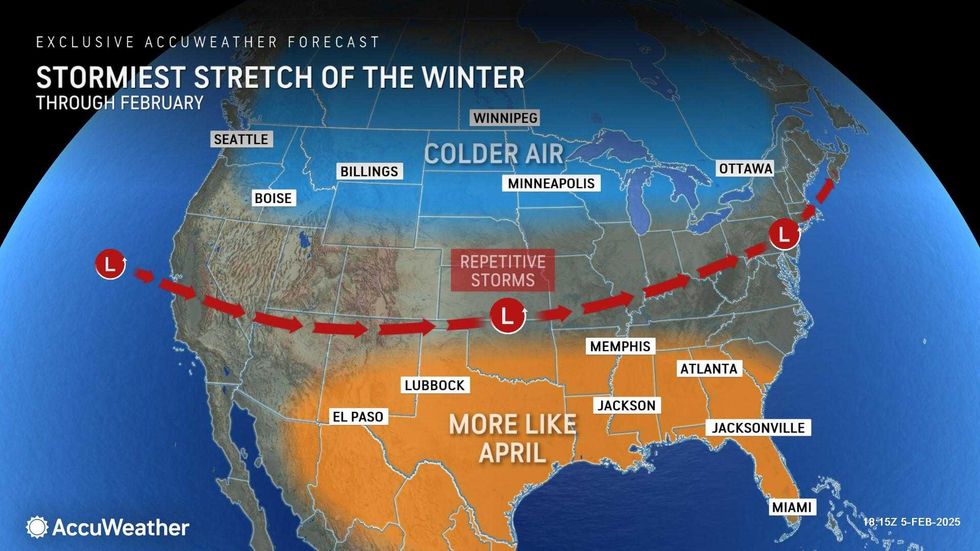
According to AccuWeather, the messy winter weather is due to "a clash of warm, humid air and cold Arctic air" across the Midwest and Northeast.
In fact, Thursday's storm could herald "one of the stormiest periods of the winter" for the first half of February, AccuWeather said.
 AccuWeather
 AccuWeather
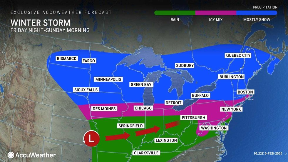
While Thursday's rain will move out for a sunny and windy Friday with a high of 41, the clear skies won't last. Snow and sleet are set to return Saturday evening before changing over to rain overnight.
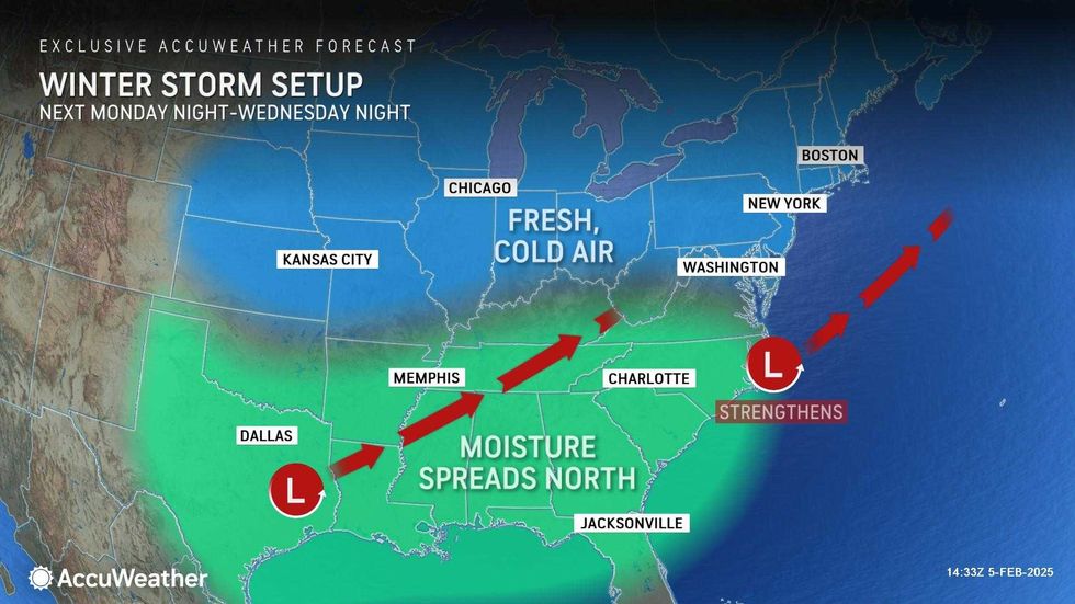
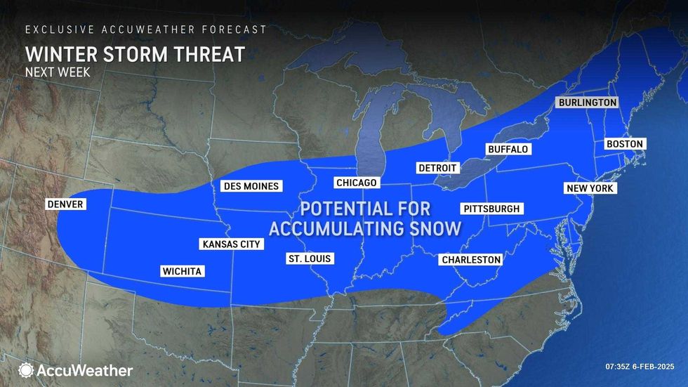
Looking ahead to next week, a third winter system originating in Texas will move east towards the Atlantic, bringing the potential for accumulating snow across the East Coast starting Tuesday.
 AccuWeather
 AccuWeather
 AccuWeather


