


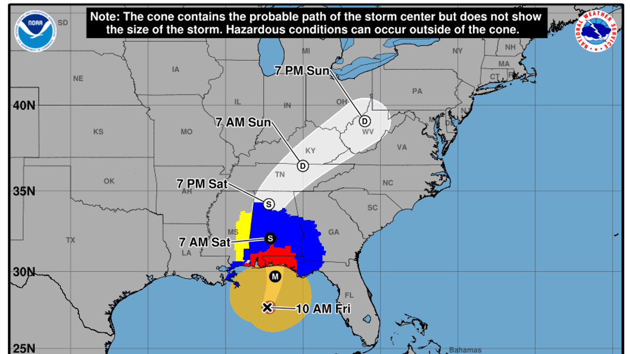

The South Carolina Department of Natural Resources State of Climatology Office says Isaias has strengthened and is now a Category 3 major hurricane over the northern Gulf. It will likely weaken as it approaches landfall near Pensacola, Florida Friday night, but will likely be a Category 2 hurricane when the center comes ashore around midnight.
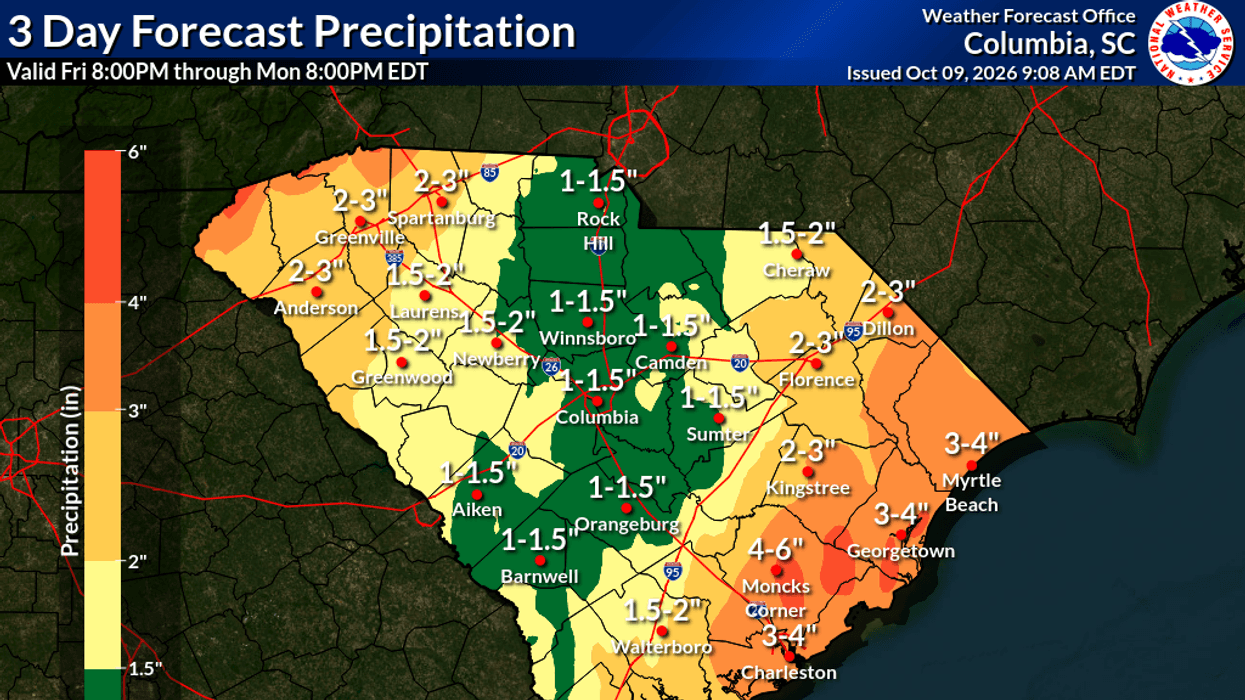 SCDNR State of Climatology Office
Effects From Isaias in SC
Key Points:
- The worst of Isaias will pass well to our west this weekend, but South Carolina will still see some impacts:
- Downpours will cause isolated flooding, especially in the Upstate and near our coast.
- It will turn windy later tonight and remain windy through Saturday. No widespread damaging winds are forecast, but local gusts up to around 40 mph are possible in the Upstate, and coastal areas may see gusts of 40-45 mph.
- Those gusty onshore winds will cause coastal flooding near both high tides on Saturday. The morning high tide will cause the worst flooding.
- There will be a risk of isolated tornadoes:
- Late tonight for some of the coastal Lowcountry.
- Spreading northward over the state during Saturday.
- Over most of the state Saturday night.
- Over eastern parts of the state Sunday, mainly in the afternoon.
It will turn windy later tonight as the front moves in. Coastal areas and the Upstate will also see the strongest winds, though damaging winds are unlikely except in any thunderstorms embedded in the rain. Peak gusts will be 35-40 mph in the Upstate, though high spots along the state line could see much stronger winds. Along the coast, peak gusts will be 40-45 mph. The Grand Strand has the best chance to see winds gusting over 40 mph. In between, peak gusts will be 30-35 mph. Again, winds can be locally stronger in any thunderstorm.
Those strong winds will come from the east to southeast, resulting in a risk of coastal flooding from the onshore flow. We're likely to see flooding at both the morning and evening high tides along our coast on Saturday. The morning high tide should be the worse of the two. Rain is likely at high tide, which always worsens tidal flooding, and a downpour at high tide is the last thing we want. We may have major flooding around the Charleston area Saturday morning; that area is most vulnerable to coastal flooding.