


“A dreary weekend is in store for much of the Mid-Atlantic,” the National Weather Service said Friday. On Saturday, the service said Tropical Storm Ophelia was expected to produce heavy rain, gusty winds, and dangerous storm surge over parts of the Mid-Atlantic this weekend.
A weather system designated early Friday as “a Potential Topical Cyclone Sixteen” by the National Hurricane Center was headed to the East Coast, bringing rain and wind to the area. It was expected to develop into a tropical storm by Friday evening.
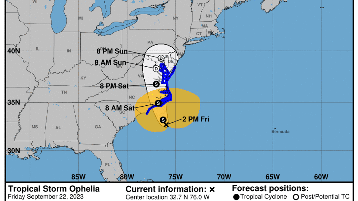
Per the National Hurricane Center, the storm’s given name is “Ophelia,” The Weather Channel reported. It made landfall near Emerald Isle, North Carolina, Saturday morning, according to CNN.
By Saturday, the NWS predicted the storm would move onshore over eastern North Carolina. It was moving north late Saturday morning, bringing tropical storm conditions along portions of the southeastern and mid-Atlantic coasts.
Tropical storm warnings have been issued in the area. According to PowerOutage.us, 70,000-plus homes and businesses lost power across North Carolina and the mid-Atlantic Saturday morning.
“Gusty winds and large swells along beaches will likely cause life-threatening surf and rip currents,” the National Weather Service warned. “Coastal flooding due to storm surge is also a concern, especially across eastern North Carolina and southeastern Virginia. Additionally, heavy rainfall is expected to spread into much of the Mid-Atlantic and eventually southern New England, creating the potential for scattered flash floods and isolated urban and small stream flooding.”
According to the service, the area at greatest risk for flooding is between Cape Fear and the Outer Banks of North Carolina. CNN said that storm surges of more than 3 feet hit North Carolina Saturday. The storm system is expected to move north, over Chesapeake Bay and the Delmarva Peninsula, by Monday.
“Heavy rain may linger from the northern Mid-Atlantic to southern New England, with continued strong east-northeasterly flow along coastal regions,” said the NWS.


