


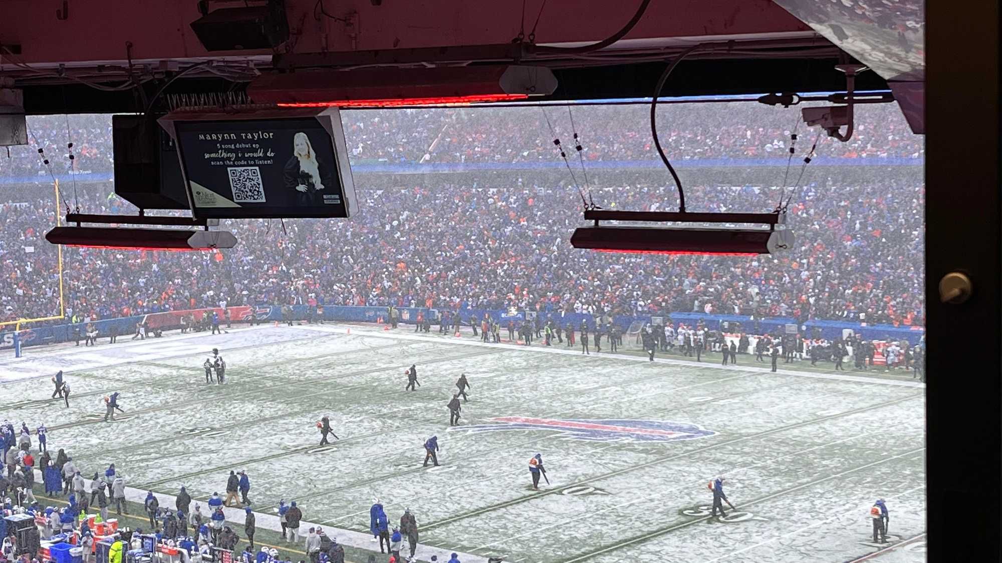
Buffalo, N.Y. (WBEN) - Here we go. A wintry weekend is in store with powerful winds and eventually significant lake effect snow.
The good news? Friday.
"Today should be relatively quiet during the daylight hours," National Weather Sevice meteorologist Kirk Apfel tells WBEN. It's actually above normal temperatures, a high of 40."
Friday night the rain and gusty winds move in. "The worst of it won't be tonight, but we're still looking at gusts up to 60 mph," Apfel says. "The worst of that will be along the thruway from Buffalo south to the PA state line."
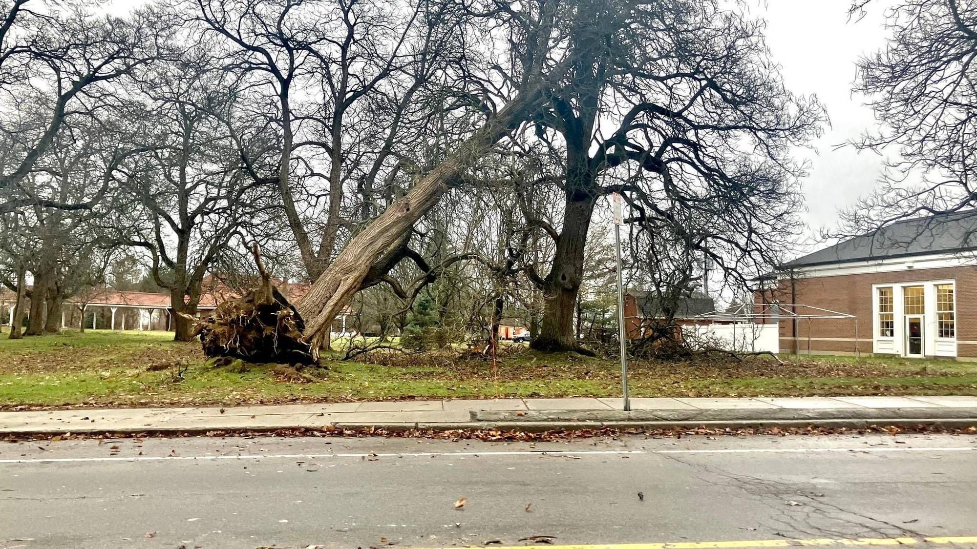
Again, the winds will start out of the southeast, not the prevailing direction for Western New York and potentially problematic for weakened trees.
On Saturday, widespread and stronger winds will overspread the area with gusts up to 65 mph during the day. "The worst will be Saturday, but it's going to continue to be very windy Saturday night, and the winds will last into Sunday."
A High Wind Warning is posted for ALL of WNY late Friday through early Sunday morning. A Lakeshore Flood Warning is also posted for the Lake Erie shoreline in Erie and Chautauqua counties.
The Lake Effect ?
Lake effect snow will begin to develop Saturday afternoon. "Pretty much there's going to be some sort of a band in the general Buffalo metro area, either across it or more off to the south, all the way through the weekend," Apfel says. Pinpointing where the band will be located at any given moment is a challenge, Apfel cautions us. "But wherever that band is, you're going to have extremely difficult, if not impossible, travel conditions once the band gets going."
As for accumulations, there is the potential for a foot or more of snow for areas within the snow band from late Saturday through Sunday evening. "It's going to keep going after that, so some areas could get locally higher than that. The wind will also be a factor, causing blowing, drifting and extremely poor visibility within the snow band.
How confident are forecasters?
"We're confident there's going to be a lake effect snow band, the challenge is knowing exactly where it will be."
HIGH WIND WARNING IN EFFECT FROM 7 PM THIS EVENING TO 4 AM EST SUNDAY
* WHAT...Southeast winds 20 to 30 mph with gusts to 50 mph tonight, becoming southwest 30 to 40 mph with gusts up to 65 mph Saturday and Saturday night.
* WHERE...Niagara, Orleans, Monroe, Northern Erie, and Genesee counties.
* WHEN...From 7 PM this evening to 4 AM EST Sunday.
* IMPACTS...Damaging winds will blow down trees and power lines.
Widespread power outages are expected. Travel will be difficult, especially for high profile vehicles.
PRECAUTIONARY/PREPAREDNESS ACTIONS...
People should avoid being outside in forested areas and around trees and branches. If possible, remain in the lower levels of your home during the windstorm, and avoid windows. Use caution if you must drive.
HIGH WIND WARNING IN EFFECT FROM 4 PM THIS AFTERNOON TO 4 AM EST SUNDAY
* WHAT...Southeast winds 25 to 35 mph with gusts to 60 mph late today and tonight, becoming southwest 30 to 40 mph with gusts up to 60 mph Saturday and Saturday night.
* WHERE...Wyoming, Livingston, Chautauqua, Cattaraugus, Allegany, and Southern Erie counties.
* WHEN...From 4 PM this afternoon to 4 AM EST Sunday.
* IMPACTS...Damaging winds will blow down trees and power lines.
Widespread power outages are expected. Travel will be difficult, especially for high profile vehicles.
PRECAUTIONARY/PREPAREDNESS ACTIONS...
People should avoid being outside in forested areas and around trees and branches. If possible, remain in the lower levels of your home during the windstorm, and avoid windows. Use caution if you must drive.
LAKESHORE FLOOD WARNING IN EFFECT FROM 7 AM SATURDAY TO 4 AM EST SUNDAY
* WHAT...Significant lakeshore flooding expected. Rapid rises are expected Saturday morning with the highest levels Saturday afternoon.
* WHERE...Erie and Chautauqua counties.
* WHEN...From 7 AM Saturday to 4 AM EST Sunday.
* IMPACTS...The rapid rise in water levels at the eastern end of Lake Erie will result in lakeshore flooding along the Lake Erie shore. Flooding is likely along Route 5 in Hamburg, Buffalo Harbor and Canalside, Dunkirk Harbor, and other flood prone locations. Very high wave action will also result in significant shoreline erosion.
PRECAUTIONARY/PREPAREDNESS ACTIONS...
A Lakeshore Flood Warning means lakeshore flooding is occurring, is imminent, or is expected to occur. For your safety, stay off breakwaters, piers, rock outcroppings and beaches! Waves are often larger than they appear and can easily wash you away.
Expect significant beach erosion and debris, local road closures and extremely dangerous boating conditions.
WINTER STORM WATCH REMAINS IN EFFECT FROM SATURDAY AFTERNOON THROUGH MONDAY MORNING
* WHAT...Heavy lake effect snow possible. Total snow accumulations of more than a foot possible in the most persistent lake snows. Winds could gust as high as 65 mph Saturday and Saturday evening, with somewhat lower winds then expected through the bulk of the lake effect snow event.
* WHERE...Erie, Genesee, Wyoming, Chautauqua, and Cattaraugus counties.
* WHEN...From Saturday afternoon through Monday morning.
* IMPACTS...Travel could be extremely difficult. Widespread blowing snow could significantly reduce visibility.
PRECAUTIONARY/PREPAREDNESS ACTIONS...
Narrow bands of heavy snow could impact portions of the region.
Localized travel problems will be possible.