


We're waking up to temperatures in the mid-60s this Monday morning. A south wind of 10 to 20 mph continues to pump in the Gulf of Mexico moisture and the low clouds. There are also a few isolated showers dotting the area, but they do not amount to too much.
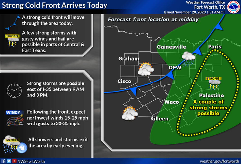
I'm tracking our next cold front that's now working its way through the Panhandle. It will be arriving here close to lunch time. A few showers and storms will form along the front as it moves into the eastern half of north Texas, mainly along and east of a McKinney to Mid Cities to Burleson line. I'm not concerned about severe weather, but as stated above, a different story across far east Texas and the lower Mississippi River Valley as the day wears on. All modes of severe weather are possible in these areas. Afternoon highs today will reach the upper 60s close to noon, and then slowly fall into the 50s by this evening. There will be some breaks in the clouds later today. A north wind will gust to 30 mph.
 NAtional Weather Service - Fort Worth
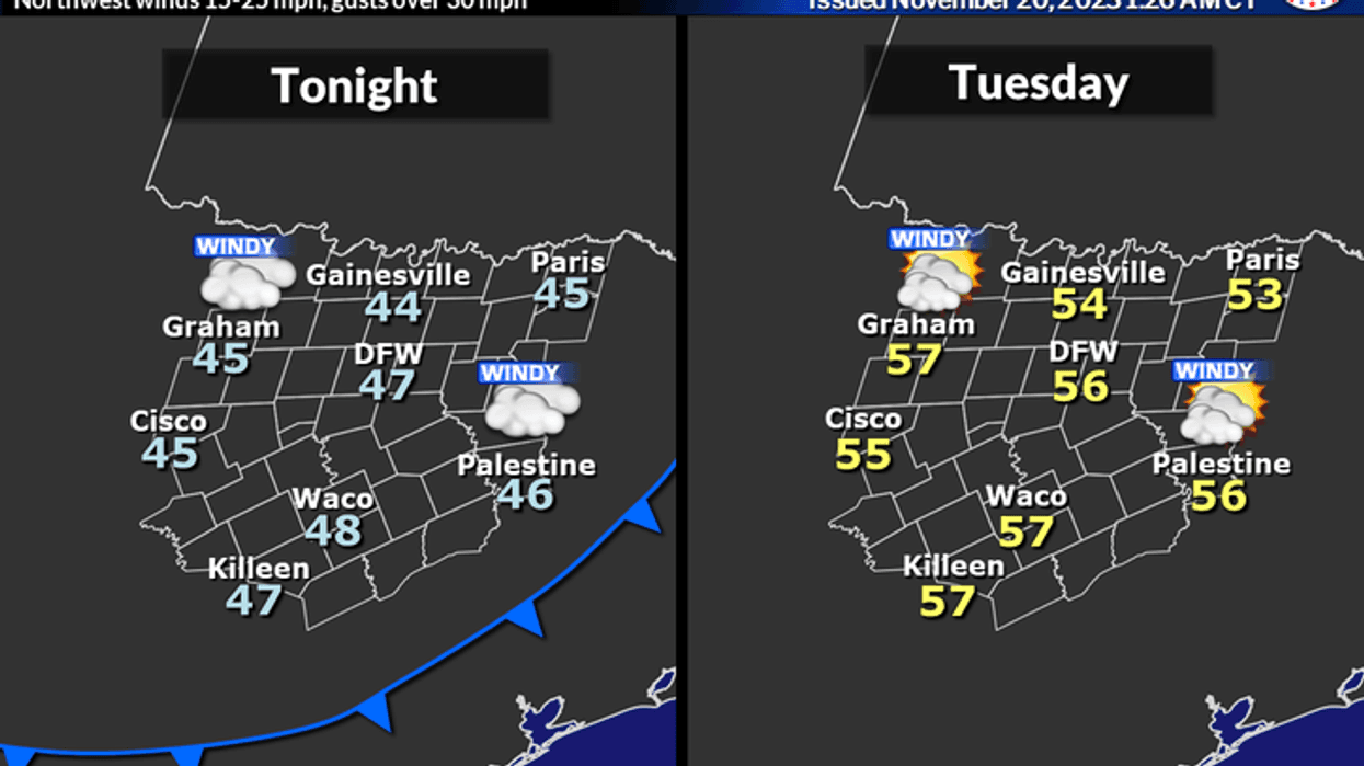
Some wrap around clouds will invade overnight tonight with morning lows in the mid to upper 40s, with northerly winds gusting to 30 mph.
Morning clouds afternoon sun tomorrow with highs in the mid 50s.
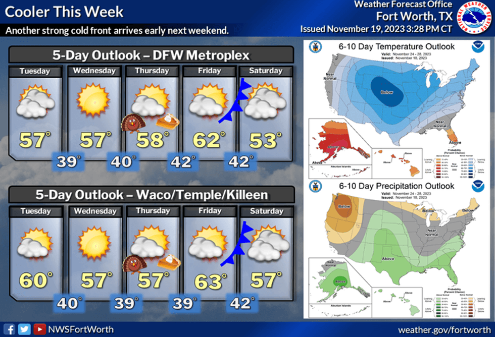
Chilly mornings and cool afternoons will be our weather story Wednesday through Friday with plenty of sunshine. Afternoon highs will range between 55° and 60°, with morning lows in the low 40s.
 NOAA / National Weather Service - Fort Worth
Our next weather change arrives late Friday into Saturday, as another cold moves through the area. There is a slight chance of rain late Saturday into early Sunday with afternoon highs in the low 50s Saturday, near 50 on Sunday. Morning lows will dip into the 30s.
*Yest Rain: 0.03"; Yest High: 64; Low: 53
*Today's Averages: High: 65; Low: 45
*Record high: 84 (2007); Record low: 23 (1937)
*November rain: 0.27"; Deficit: 1.46"
*2023 Rain: 25.56"; Deficit: 7.81"
*Sunrise: 7:03am; Sunset: 5:24pm
Today: Morning showers, lunchtime cold front brings some storms, mainly east of a McKinney to Mid Cities to Granbury line. Severe threat is very low. Turning windy and cooler. High: Near 70, falling into the 50s by dinnertime. Wind: Shifting NNW 15-25, G30 mph.
Tonight: Partly cloudy, windy and cool. Low: Mid to upper 40s.
Tomorrow: Morning clouds, afternoon sun. Windy and cool. High: Mid to upper 50s. Wind: NNW 15-25, G30 mph.
Wednesday: Mostly sunny and cool. High: Near 60.
Thanksgiving: Mostly sunny and cool. High: Near 60.
Friday: Mostly sunny, continued cool. High: Low 60s.
Weekend. Partly cloudy, windy and chilly. Slight rain chance. High: Low 50s.
LISTEN on the Audacy App
Tell your Smart Speaker to "PLAY 1080 KRLD"
Sign Up to receive our KRLD Insider Newsletter for more news
Follow us on Facebook | Twitter | Instagram | YouTube


