


Rain will finally return to north Texas, but not until Friday. In the meantime, we have a couple of more relatively nice days ahead.
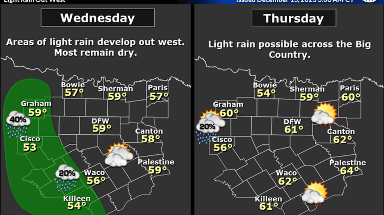
Wednesday morning begins with temperatures mainly in the 40s, there are a few readings in the 30s east of the Dallas-Fort Worth area. The wind is relatively light so we're not dealing with wind chills this morning. Nothing is on the weather radar as well, but skies are cloudy across a good chunk of the area.
We'll have lots of high clouds around here over the next couple of days with afternoon highs in the low 60s. There will be some rain moving close to the Dallas-Fort Worth area on Thursday, but most of it will stay well to the west of I-35W.
 National Weather Service - Fort Worth
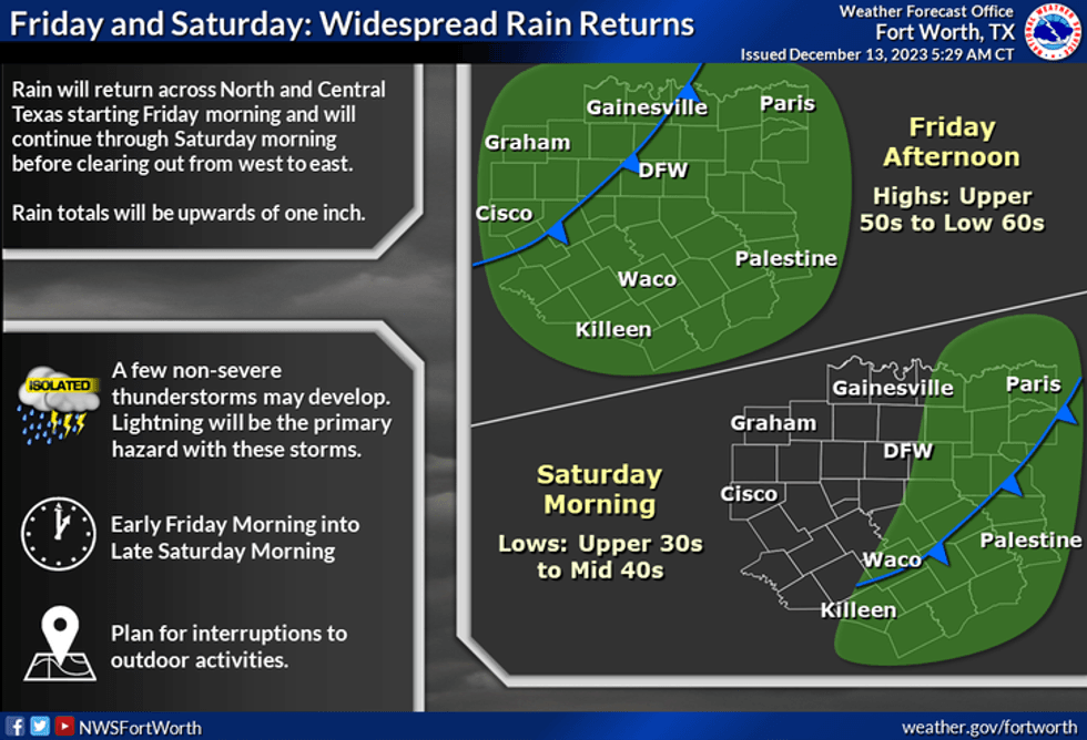
A strong area of low pressure in the upper levels of the atmosphere continues to spin in the desert southwest. This upper-level low will track along Interstate 40 today through Friday. By late Friday, this upper-level low will be around Oklahoma City. This will help drag all the moisture currently in West Texas and the Panhandle in our direction. This area of rain will cruise across north Texas on Friday. Plan on a messy Friday morning commute. Rain will press east of DFW by late afternoon. Average rainfall totals will be around one inch. Some areas may pick up a little bit more than that from Dallas and areas to the east. Severe weather is not a threat. Temperatures will start off in the mid-50s early in the morning and drop into the upper 40s by afternoon.
Clouds will be slow to move out on Saturday with some areas of drizzle through late morning. Afternoon highs will top out in the low 50s.
 National Weather Service - Fort Worth
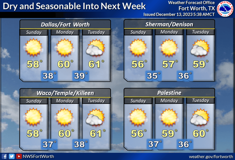
Sunday through Tuesday look nice with highs in the upper 50s to low 60s.
*Yest Rain: 0.00"; Yest High: 65; Low: 40
*Today's Averages: High: 58; Low: 39
*Record high: 83 (1933); Record low: 14 (1917)
*December rain: Trace; Deficit: 1.07"
*2023 Rain: 25.76"; Deficit: 9.48"
*Sunrise: 7:22am; Sunset: 5:23pm
Today: High clouds, breezy and cool. High: Low 60s. Wind: ESE 10-20 mph.
Tonight: High clouds and cool. Low: 45-50. Wind: East 5-10 mph.
Thursday: Mostly cloudy, breezy and cool. A few showers along Hwy 281 (W-Falls, Mineral Wells, Stephenvile) and points west. High: Near 60. Wind: East 10-20 mph.
Friday: Cloudy with a widespread chilly rain. Average totals near 1.00". Moving out by late afternoon. High: Mid 50s early, falling into the upper 40s.
Saturday: Morning clouds and drizzle, late afternoon clearing. Breezy and cool. High: Low to mid 50s.
Sunday: Sunny and perfect. High: Near 60.
Monday: Mostly sunny and cool. High: Upper 50s
Tuesday: Mostly sunny and cool. High: Low 60s.
LISTEN on the Audacy App
Tell your Smart Speaker to "PLAY 1080 KRLD"
Sign Up to receive our KRLD Insider Newsletter for more news
Follow us on Facebook | Twitter | Instagram | YouTube


