We're waking up to plenty of cloud cover, high humidity, and very mild temperatures for this time of the year. Readings have only fallen into the upper 60s. We'll see some breaks in the clouds later today and a few showers as well with afternoon highs in the low 80s. South winds will gust to 30 mph.
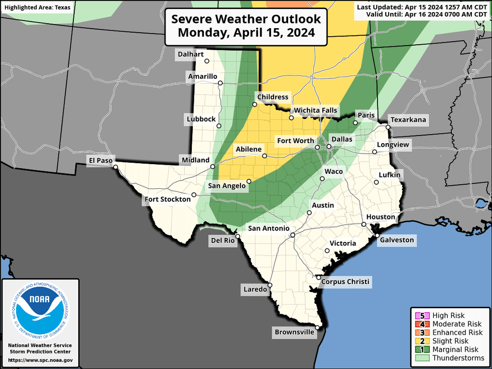
By late Monday afternoon, scattered severe storms will break out well to the west of the Dallas-Fort Worth area and slide in our direction. We will have a very strong cap in place, so as these storms approach by mid to late evening, they will weaken significantly.
 NOAA
NOAA
Some rain showers will continue through early Tuesday morning. Morning lows will be mild again into the upper 60s.
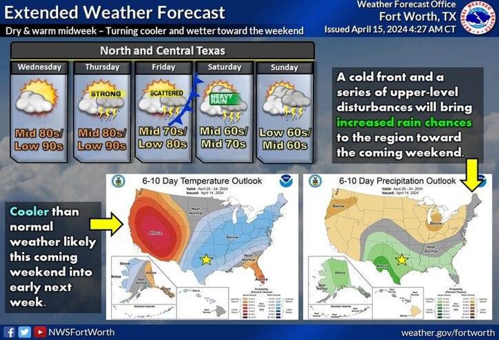
The wind will veer more southwestly on Tuesday under a partly cloudy sky. This will allow temperatures to warm into the mid to upper 80s.
Morning clouds and afternoon sun will be our weather story on Wednesday and Thursday. The mid 80s for Wednesday, and upper 80s for Thursday.
 National Weather Service - Fort Worth
By Thursday evening, a cold front will be approaching from the northwest. Scattered showers and thunderstorms, some severe, will break out across the area.
It'll be cooler on Friday behind the front. A few leftover showers early otherwise partly cloudy with highs in the low 70s.
A second push of cooler air will arrive on Saturday along with a very strong upper-level disturbance. This disturbance will produce widespread shower and thunderstorm activity during the day. The severity looks low due to the cooler temperatures. Afternoon highs may not get out of the low 60s! Some leftover showers in the first half of Sunday as we struggle to warm above 60°
*Yest Rain: 0.00"; Yest High: 82; Low: 64
*Today's Averages: High: 76; Low: 55
*Record high: 93 (1940); Record low: 33 (1928)
*March Rain: 1.43"; Surplus: 0.06"
*2024 Rain: 12.23"; Surplus: 2.27"
*Sunrise: 6:58am; Sunset: 7:59pm
LISTEN on the Audacy App
Tell your Smart Speaker to "PLAY 1080 KRLD"
Sign Up to receive our KRLD Insider Newsletter for more news
Follow us on Facebook | Twitter | Instagram | YouTube