


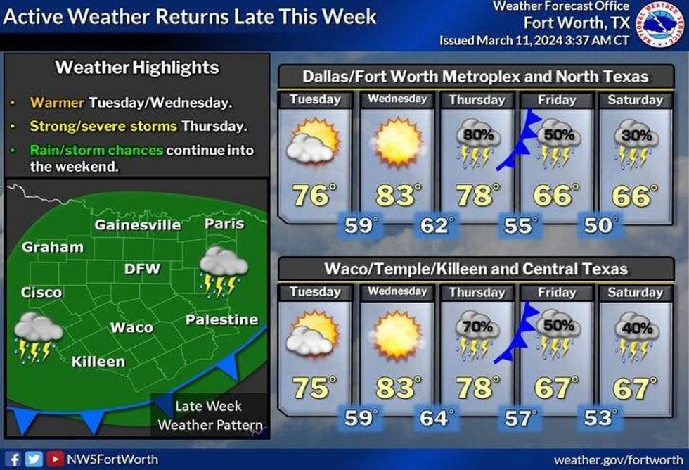
This week's weather highlights include a few sprinkles this morning, a warming trend through mid-week, the threat for severe storms late Thursday, leftover showers Friday and Saturday, and a decent St. Patrick's Day on Sunday.
Grab your jacket before you head out the door this morning as temperatures have fallen into the 40s. There's also a weak disturbance crossing the area this morning. This will produce a few light rain showers through noonish. By this afternoon, the sun will be back out and we'll warm to near 70°.
Increase the clouds tonight with morning lows near 50°. Tuesday looks nice but a bit breezy. Afternoon highs will reach the mid-70s. There is a very slight chance of a few showers east of DFW by late evening.
 National Weather Service - Fort Worth
Temperatures will continue to warm on Wednesday with afternoon highs in the low to mid 80s. South winds will gust to 35 mph.
 National Weather Service - Fort Worth
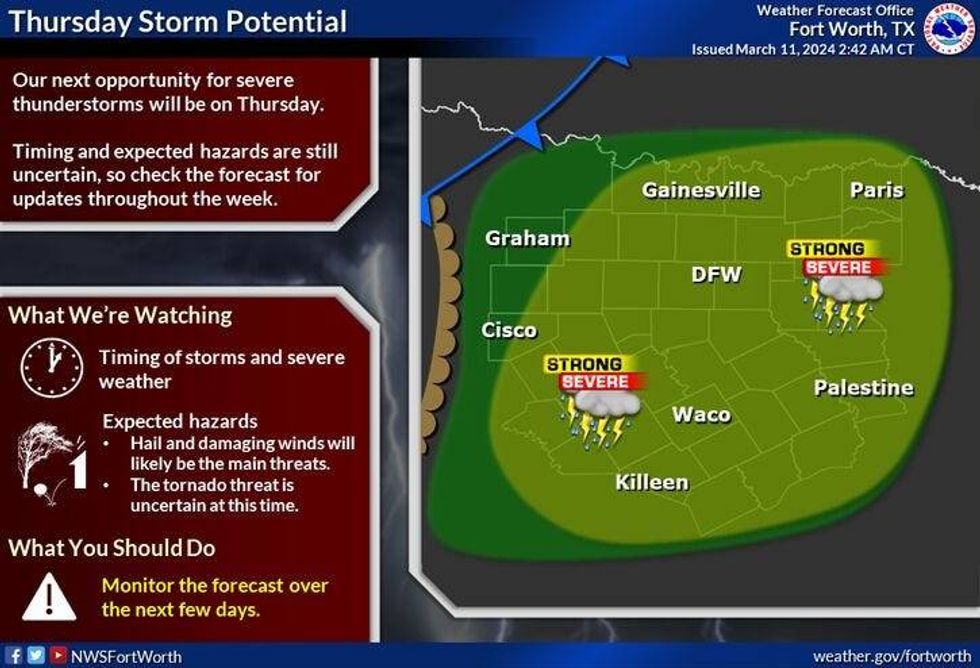
Thursday will start off okay as we warm into the upper 70s. By evening, the dry line will surge out of west Texas and a cold front will approach from the northwest. This combined with plenty of surface moisture will produce widespread shower and thunderstorm activity to our west. Some of these may become severe as they move across North Texas before midnight.
Friday and Saturday look mostly cloudy with a chance of showers, as a couple of disturbances ride up and over the slightly cooler air mass behind the front. Afternoon highs each day will be in the mid-60s.
As of now, St Patrick's Day looks nice. Partly cloudy and seasonable with highs in the mid-60s.
*Yest Rain: 0.00"; Yest High: 64; Low: 40
*Today's Averages: High: 67; Low: 47
*Record high: 93 (1955); Record low: 11 (1948)
*March Rain: 2.76"; Surplus: 1.65"
*2024 Rain: 7.90"; Surplus: 1.50"
*Sunrise: 7:43am; Sunset: 7:34pm
LISTEN on the Audacy App
Tell your Smart Speaker to "PLAY 1080 KRLD"
Sign Up to receive our KRLD Insider Newsletter for more news
Follow us on Facebook | Twitter | Instagram | YouTube


