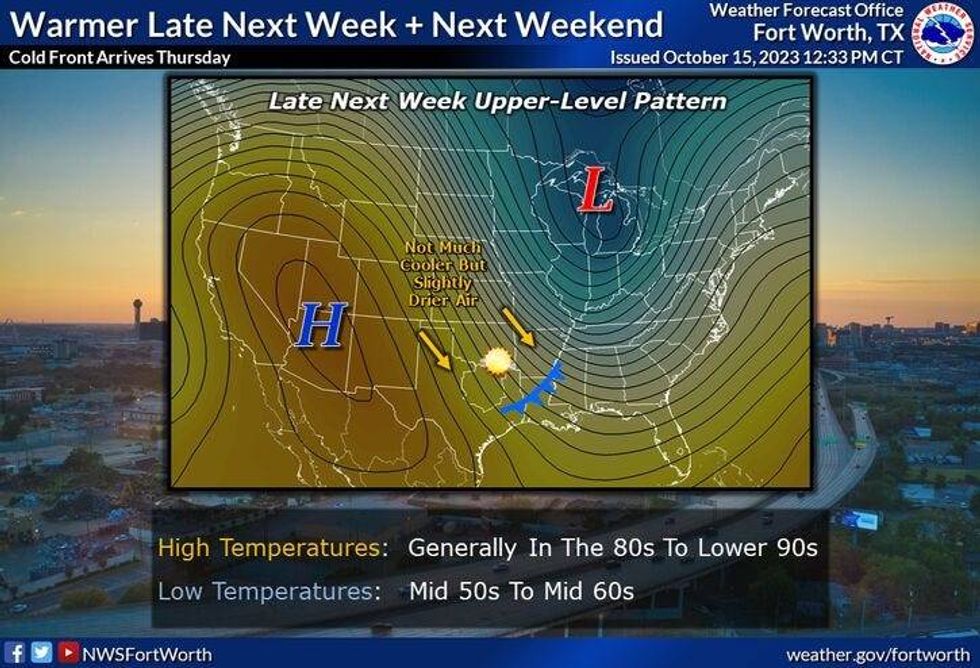
A beautiful weekend has come to an end and our cool weather pattern will continue through tomorrow. After that, a warming trend is on the way through the rest of the week and into the weekend. Unfortunately, no rain is in the forecast for at least the next 7 days.
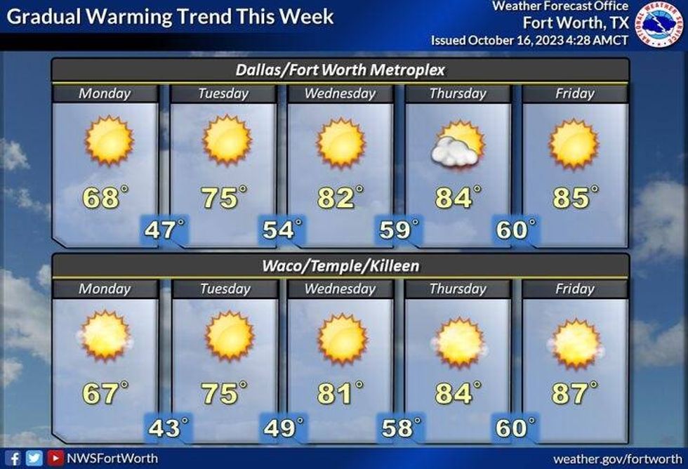
Grab your jackets this morning folks as temperatures have fallen into the 40s across north Texas. Yesterday we hit 68° at DFW airport. Today we'll reach that number again with a north wind at 10 - 20 mph. We're back in the 40s tonight and into the mid 70s tomorrow afternoon, as the wind slowly returns from the south.
 National Weather Service Fort Worth
Wednesday will be sunny, windy and warmer with highs in the low 80s. A south wind will gust as high as 30 mph.
A weak cold front moves through during the day on Thursday, but there won't be any cool air behind it. Afternoon highs will top out near 80°.
 National Weather Service Fort Worth
Temperatures will warm back up Friday through the weekend. Friday's high will reach the middle 80s. How about the upper 80s with plenty of sunshine this weekend? As of now, our next possible weather change may arrive by early next week.
*Yest Rain: 0.00"; Yest High: 68; Low: 51
*Today's Averages: High: 79; Low: 57
*Record high: 93 (1972): Record low: 39 (1966)
*October Rain: 1.04"; Deficit: 0.81"
*2023 Rain: 16.70"; Deficit: 12.42"
*Sunrise: 7:33am; Sunset: 6:54pm
Today: Sunny, breezy and cool. High: Mid to upper 60s. Wind: North 10-20 mph.
Tonight: Clear and chilly again! Low: Low to mid 40s. Wind: North 5-10 mph.
Tomorrow: Sunny and pleasant. High: Low to mid 70s. Wind: South 5-10 mph.
Wednesday: Sunny, windy and warmer. High: Low 80s.
Thursday: Sunny and seasonable. High: Near 80.
Friday: Sunny and a bit warmer. High: Mid 80s.
Weekend: Sunny and warm. High: Upper 80s.
LISTEN on the Audacy App
Tell your Smart Speaker to "PLAY 1080 KRLD"
Sign Up to receive our KRLD Insider Newsletter for more news
Follow us on Facebook | Twitter | Instagram | YouTube