


A lot of wind today through Easter weekend, a rapid warm-up, scattered strong storms late Monday, and then windy and cooler for Tuesday and Wednesday. Those are your weather stories over the next 7 days.
I'm not touching the cloud and rain forecast for April 8th (Eclipse) just yet. I will start counting the days down with your official cloud forecast starting next Monday.
We have a beautiful Easter weekend ahead with warming temperatures.
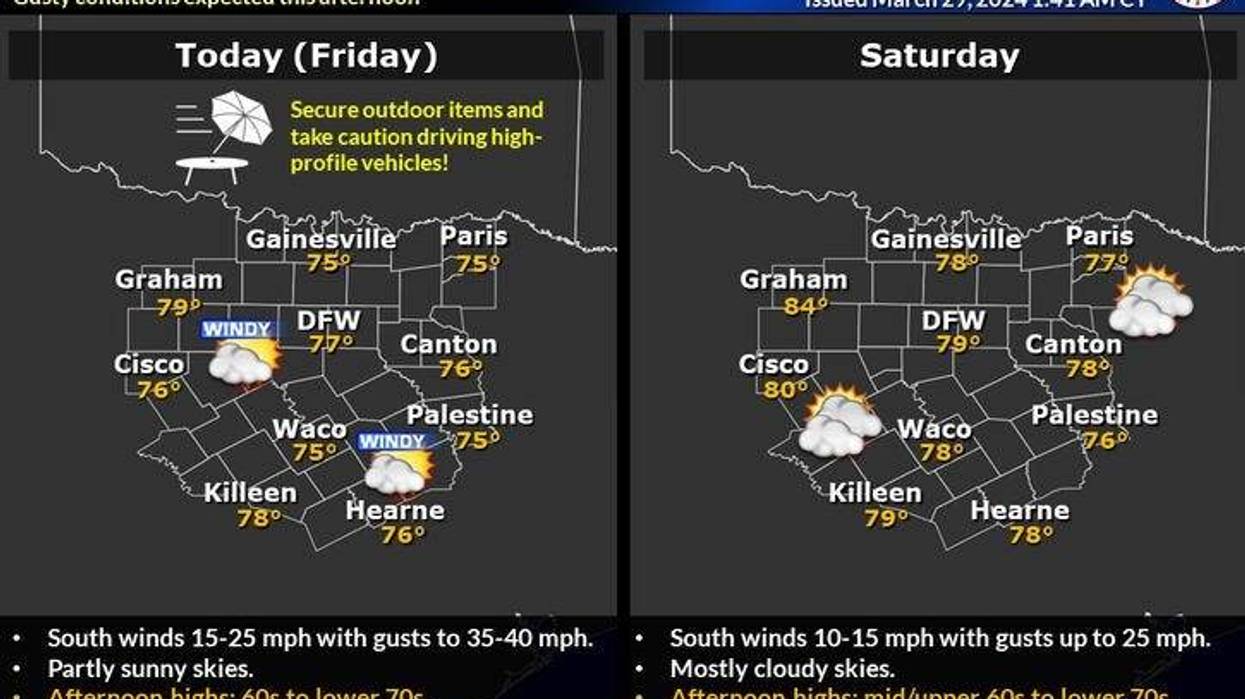
It's a lot milder this morning with a veil of high clouds overhead. Temperatures have fallen into the mid to upper 50s. A south wind will pick up today and gust as high as 40 mph. Not a good day to be out on the area lakes. Afternoon highs will reach the upper 70s.
More wind this weekend with considerable high cloudiness. Afternoon highs each day will reach 80°. Easter egg hunts will have temperatures in the low 60s with a lot of cloud cover. There will be some scattered strong to severe storms about a hundred miles to the west of the Dallas-Fort Worth area Sunday evening, but they will not make it into our area. We will have a very strong cap in place.
 National Weather Service - Fort Worth
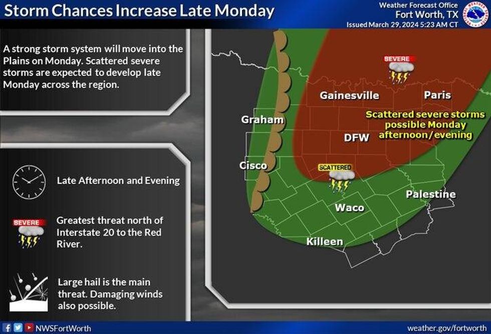
Another mostly cloudy day is ahead for Monday. Afternoon highs will reach the Low 80s. By Monday evening, the dry line will surge out of West Texas again. There will be some scattered strong storms along the dryline. Right now it's too early to tell how widespread the coverage will be.
A cold front will overtake the dryline late Monday night and early Tuesday morning. Clearing, windy, and cooler temperatures will dominate Tuesday and Wednesday with highs in the mid-60s.
*Yest Rain: 0.00"; Yest High: 72; Low: 42
*Today's Averages: High: 73; Low: 51
*Record high: 88 (1946, 1967); Record low: 28 (1944)
*March Rain: 5.66"; Surplus: 2.67"
*2024 Rain: 10.80"; Surplus: 2.52"
*Sunrise: 7:19am; Sunset: 7:47pm
LISTEN on the Audacy App
Tell your Smart Speaker to "PLAY 1080 KRLD"
Sign Up to receive our KRLD Insider Newsletter for more news
Follow us on Facebook | Twitter | Instagram | YouTube


