As we approach the end of February, North Texas can expect a tranquil weather pattern. However, upon entering March, the scenario changes as upper-level patterns transform, increasing precipitation probabilities by mid-week.
Good morning, and welcome to almost Friday. Currently, I am monitoring a weak cold front traversing the area. Temperatures post-front will not be significantly cold, but humidity levels will decrease throughout the day. Initial temperatures will range from the low to mid-50s. Abundant sunshine will prevail, with highs reaching the mid-to-upper 70s. This forecast will remain consistent for Friday.
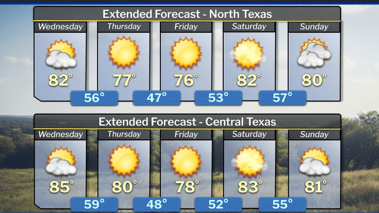
By late Friday into Saturday, south winds will rapidly return, accompanied by wind gusts up to 25 mph. This will facilitate the resurgence of mountain cedar pollen from the Hill Country. Ensure you take your allergy medication. Temperatures will be unusually warm, with afternoon highs in the low 80s on Saturday and mid-80s on Sunday. Note that there is a slight chance of showers near the Red River into southern Oklahoma late Saturday evening.
By Sunday night, a strong cold front will gradually move through the area. Monday morning will bring north winds gusting up to 25 mph, with temperatures in the 40s. You will definitely need your jacket throughout the day. There may be a few showers as the front passes, but the precipitation will be minimal. Afternoon highs on Monday will only reach the low to mid-50s, making for a chilly and blustery day.
This cold front will slowly lift north on Tuesday, allowing temperatures to warm into the low to mid 60s. By mid-week, an upper-level trough of low pressure will dig into the western United States. Spokes of upper-level energy will traverse the northwestern half of Texas throughout the week. It is still too early to determine the highest coverage of rain and potential severity. Currently, data suggests the heaviest rain will remain northwest of the Dallas-Fort Worth area. I will continue to monitor this situation, as severe weather season is rapidly approaching. One certainty is that humidity will be significantly higher throughout the period.
Have a terrific day today, and please enjoy the weather when you can, it's the only weather you've got!
7-Day Headlines:
* DFW Airport reached 82 yesterday.
* A weak morning cold front, air dries out.
* Elevated grass fire danger today, west of DFW.
* A windy and warm weekend.
* Sunday night 'BRIEF' cold front. A few showers.
* Colder Monday, warming Tuesday and Wednesday.
* Increasing showers and thunderstorms after Tuesday.
*Yest Rain: 0.00"; Yest High: 82; Low: 56
*Today's Averages: High: 63; Low: 43
*Record high: 94 (2024, 1934); Record low 21 (1960)
*February rain: 1.31"; Deficit:
*2026 Rain: 2.24"; Snow: 2.4" Deficit:
*Sunrise: 6:58am; Sunset: 6:24pm
Thursday: Sunny, breezy and a tad cooler. Grass fire danger west of DFW. High: Mid to upper 70s. Wind: NNE 10-20 mph.
Thursday night: Clear and cool. Low: 48-52. Wind: NE 5-10 mph.
Friday: Sunny and perfect. High: Near 80. Wind: North to South 5-10 mph.
Weekend: Mostly sunny, windy and warm. Grass fire danger west of DFW. Highs: Low to mid 80s.
Sunday night: Another cold front. A few showers. Turning windy and colder. Low: Mid to upper 40s.
Monday: Partly cloudy, windy and MUCH cooler. High: Mid 50s.
Tuesday: Cloudy and cool. Scattered showers NW of DFW. High: Mid 60s.
Wednesday: Cloudy and mild. Scattered showers and storms. High: Low 70s.
LISTEN on the Audacy App
Tell your Smart Speaker to "PLAY 1080 KRLD"
Sign Up to receive our KRLD Insider Newsletter for more news
Follow us on Facebook | Twitter | Instagram | YouTube