


UPDATE: 8:00 P.M. The last storm will slowly dissipate southeast of Dallas Tuesday evening, a quiet night and a quiet day expected Wednesday. Storm chances ramp up mid to late evening Wednesday and then again off and on Thursday and ending by Friday noon. Some storms may become severe with hail and wind being the primary threats.
Our friends to the east of DFW have enjoyed some noise this morning. There have been some reports of some 1-inch hail to the east of the Dallas-Fort Worth area. These storms continue to weaken a bit as they slide to our east. No rain officially fell at DFW overnight.
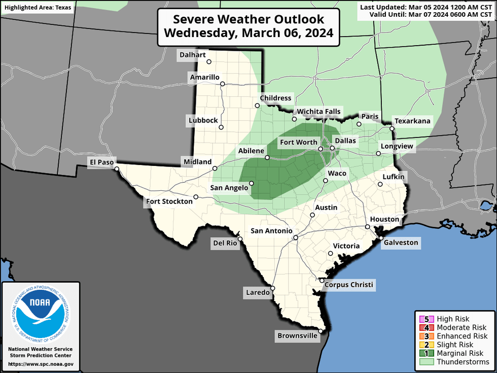
An active weather pattern will slowly unfold across North Texas over the next few days. A weak front will slowly drift through the area today but will still manage to hit the 80° mark. There may be a few severe storms popping from Dallas and points east and NE later on this afternoon and evening again. Hail and wind will be the primary threats.
Tonight will be dry and cool under a partly cloudy sky. Low temperatures will fall into the low to mid-50s with a light north Wind.
 National Weather Service - Fort Worth
The cold front that moves through today will drift back to the north tomorrow as a warm front. I wouldn't be surprised to see scattered showers and some severe storms break out to the west of us around dinner time tomorrow. These will slowly drift across the area tomorrow evening through early Thursday morning. Hail and wind will be the primary threats again. Please remember, that isolated tornadoes can never be ruled out in a severe thunderstorm.
 National Weather Service - Fort Worth
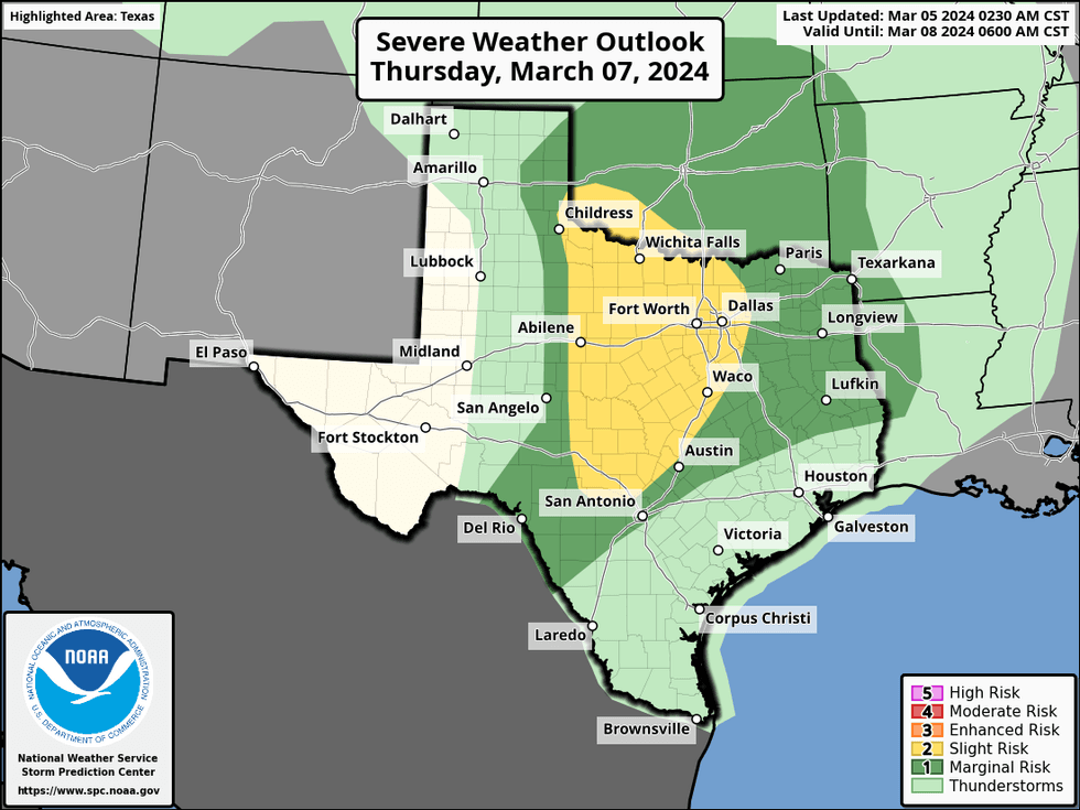
A warm front will be draped across parts of north Texas on Thursday. This coupled with a strong upper-level disturbance, plenty of surface moisture, and fast-moving winds in the upper levels of the atmosphere will promote the threat of scattered severe storms on Thursday. Hail, wind, and isolated tornadoes will be the threats. It's still too early to talk about rainfall totals but everyone looks to see rain on Thursday. Afternoon highs tomorrow we'll reach the mid to upper 70s, near 70 on Thursday.
 National Weather Service - Fort Worth
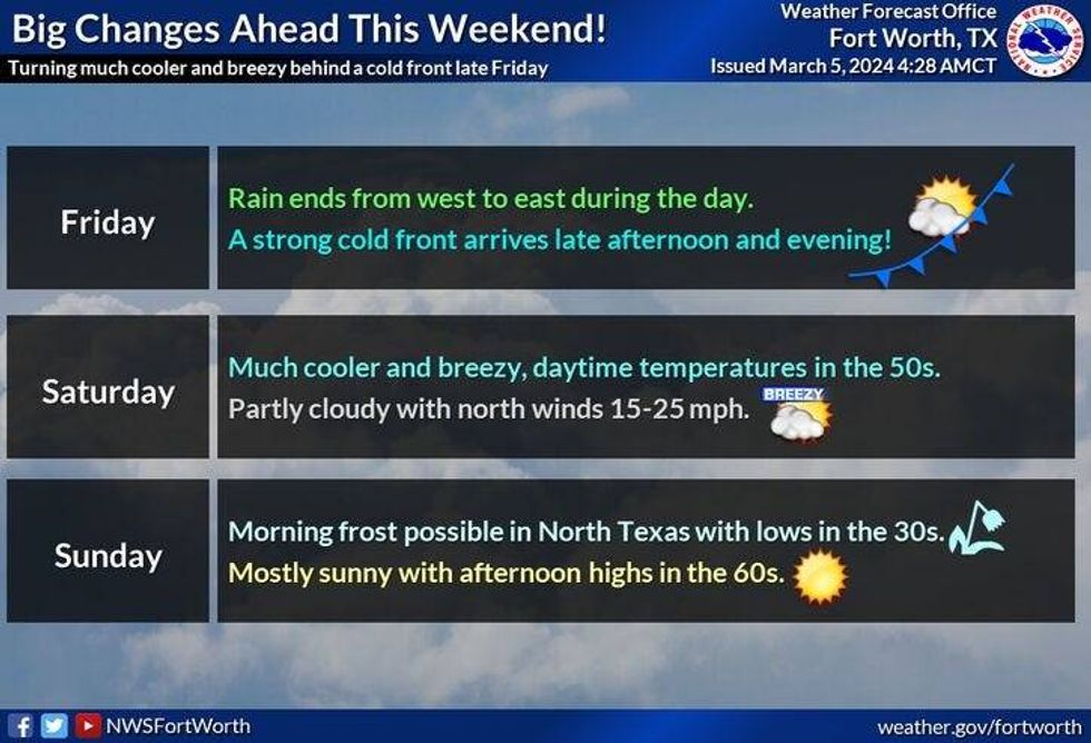
Everything presses to the east by mid-morning Friday. Afternoon highs will reach the mid-70s before a strong cold front arrives by mid to late afternoon. We'll wake up Saturday morning to a clear sky and temperatures in the low to mid-40s. Wind chills will be in the 30s! Partly cloudy near 60 degrees for Saturday afternoon.
Sunday looks equally as nice with plenty of sunshine and less wind. Highs will reach the mid-60s. Sunny, low to mid-70s on Monday.
*Yest Rain: 0.00"; Yest High: 83; Low: 67
*Today's Averages: High: 65; Low: 45
*Record high: 96 (1991); Record low: 20 (1989)
*March Rain: 0.00"; Deficit: 0.32"
*2024 Rain: 5.14"; Deficit: 0.57"
*Sunrise: 6:52am; Sunset: 6:28pm
LISTEN on the Audacy App
Tell your Smart Speaker to "PLAY 1080 KRLD"
Sign Up to receive our KRLD Insider Newsletter for more news
Follow us on Facebook | Twitter | Instagram | YouTube


