


We're waking up to a Harvest Moon setting in the western sky this morning. We're also waking up the temperatures mainly in the low to mid-70s with nothing showing up on the radar.
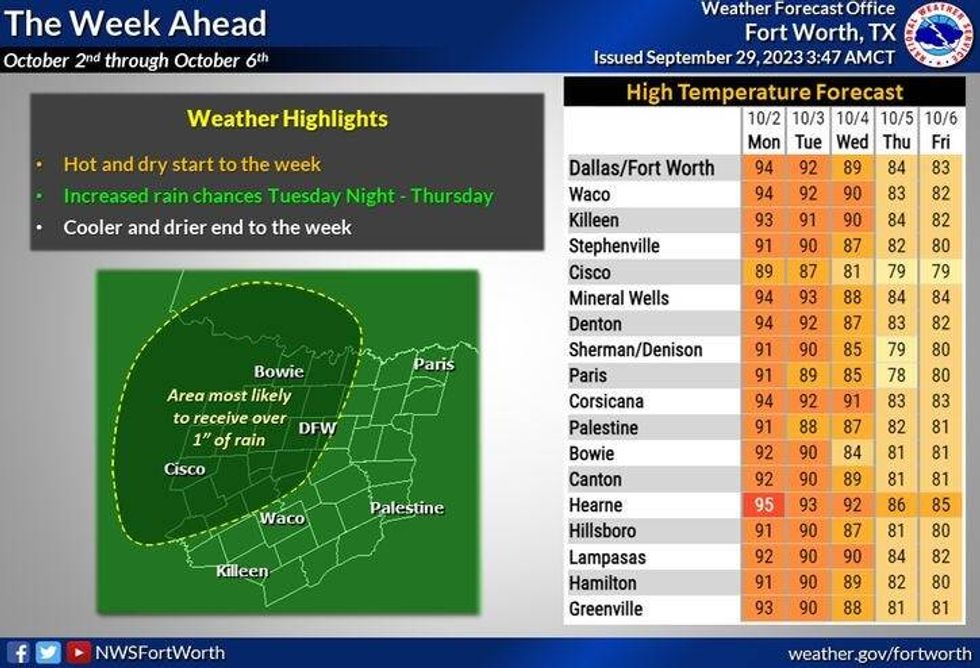
No rain is in the forecast until late Tuesday and Wednesday, with our unseasonably warm temperatures continuing. But by next Wednesday, scattered showers and thunderstorms will be across the area as a cold front approaches. It will be much cooler to round out next week into the following weekend.
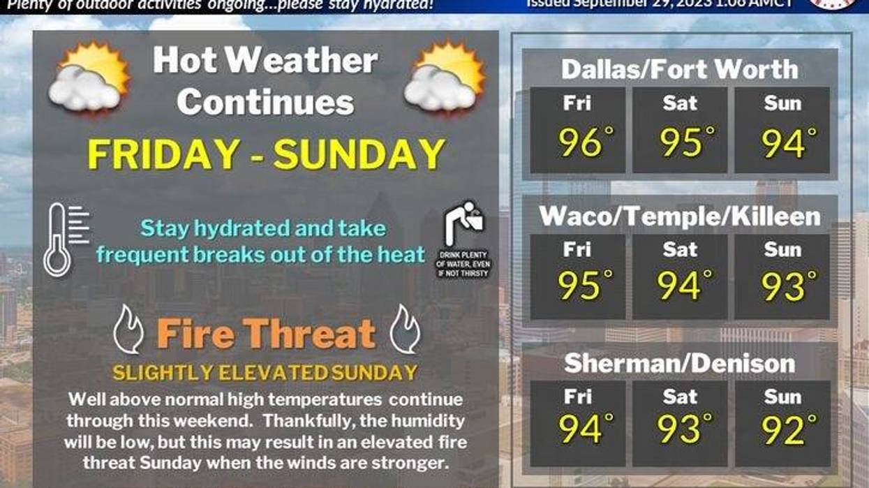
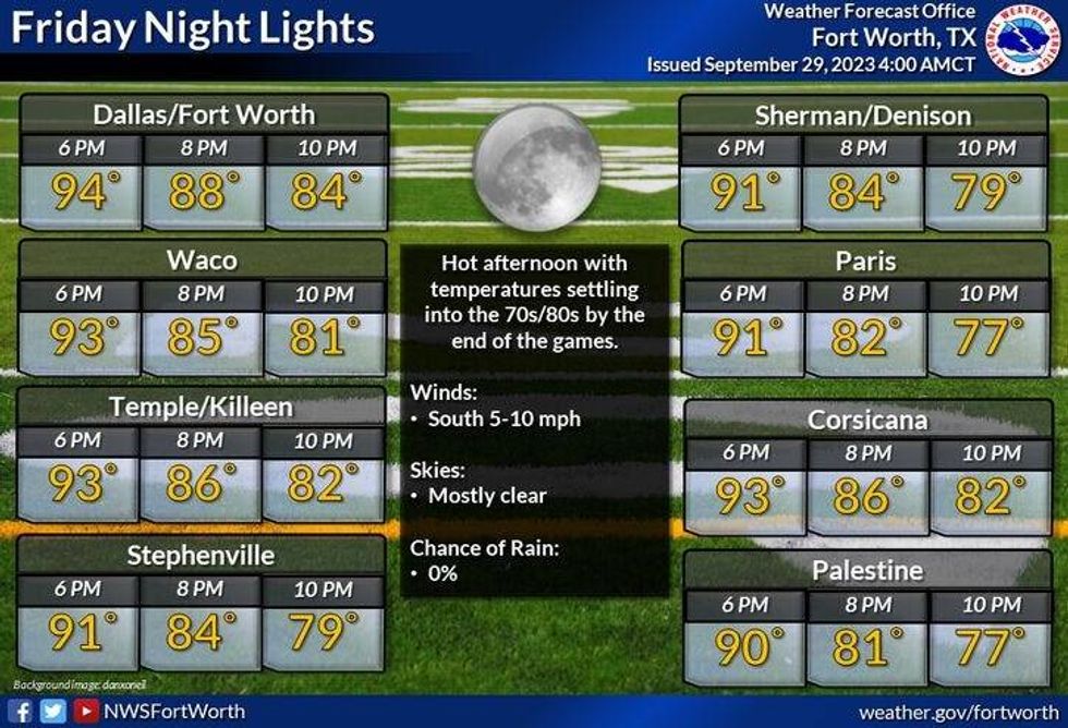
Sunny breezy and hot is our weather story today all the way through next Tuesday with afternoon highs in the middle 90s. Morning lows will be in the low to mid-70s.
 National Weather Service - Fort Worth
By Tuesday afternoon, widespread strong and isolated severe storms will break out across the western half of the state. Some of these will sneak into our western counties after midnight into Wednesday morning in a weakened state, so don't be surprised if Wednesday morning's commute is a little bit wet. A cold front will be rapidly heading our direction during the day on Wednesday. Scattered showers and storms will redevelop along the front by late afternoon and evening. Some of these may be strong to severe however, it's way too early to say if this will be a widespread event, or confined to the southeastern half of North Texas.
 National Weather Service - Fort Worth
A strong north wind will accompany the front and will continue during the day Thursday with slow clearing. Afternoon highs on Wednesday will be in the middle 80s, cooling into the mid to upper 70s on Thursday. By this time next week, temperatures could be in the 50s across much of the area to round out your work week. Afternoon highs will reach the upper 70s by Friday afternoon. A beautiful weekend will follow suit. That is the weekend to go to the State Fair.
*Yest Rain: 0.00"; Yest High: 97; Low: 72
*Today's Averages: High: 85; Low: 64
*Record high: 101 (2011): Record low: 46 (1967)
*September Rain: 0.83"; Deficit: 1.73"
*2023 Rain: 15.66"; Deficit: 11.45"
*Sunrise: 7:21am; Sunset: 7:16pm
Today: *Air Quality Alert* Partly cloudy, warm and breezy. High: Mid 90s. Wind: SE 10-20 mph.
Tonight: Clear and comfortable. Low: 68-73. Wind: SE 5-10 mph.
Tomorrow: Partly cloudy, breezy and warm. High: Mid 90s. Wind: SE 10-20 mph.
Sunday: Passing high clouds, breezy and warm. High: Mid 90s.
Monday: Passing high clouds, breezy and continued warm. High: Mid 90s.
Tuesday: Increasing clouds, windy and warm. Scattered showers and storms move in late. High: Low 90s.
Wednesday: Mostly cloudy. Scattered showers and storms. Some may be strong. Cold front late. High: Mid 80s.
Thursday: Slow clearing, windy and cooler. High: Mid 70s. Lows in the 50s on Friday.
LISTEN on the Audacy App
Tell your Smart Speaker to "PLAY 1080 KRLD"
Sign Up to receive our KRLD Insider Newsletter for more news
Follow us on Facebook | Twitter | Instagram | YouTube


