After a stormy weekend, there are a couple of beautiful days ahead in North Texas before rain returns to the forecast late Wednesday. The rain chances stick around off and on through the weekend.
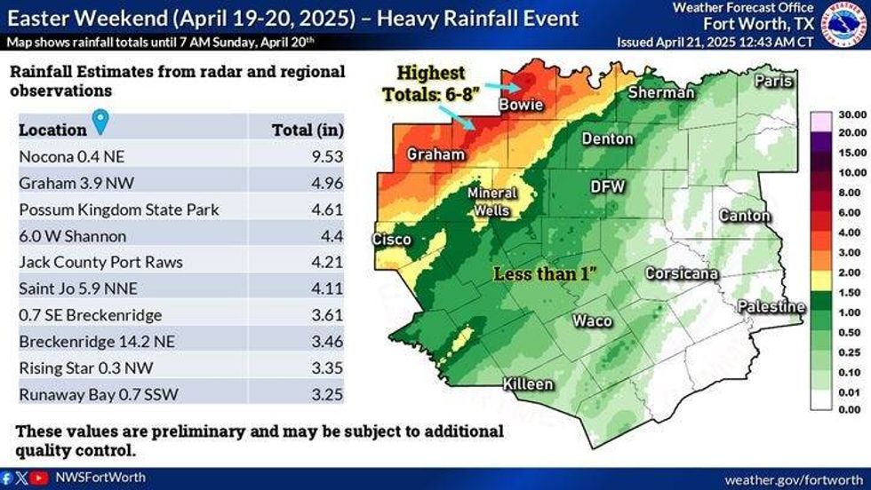
Residents to the west of the Dallas-Fort Worth area experienced severe weather over the weekend. The National Weather Service will be conducting surveys this week to assess damage in Erath, Hood, Parker, Jack, and Montague counties, where possible tornadoes touched down. They will determine the strength, path, and width of each damage area. The weather drastically improved on Easter Sunday, turning out to be a spectacular day. Unfortunately, only about a quarter of an inch of rainfall was officially recorded at DFW Airport.
 National Weather Service
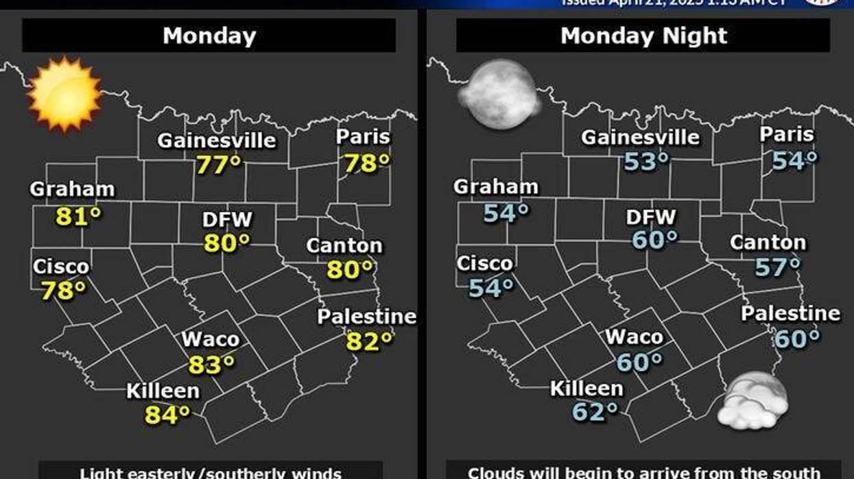
Monday began with a clear sky and cool conditions. Temperatures fell into the low to mid-50s. It will be sunny and beautiful, with highs in the low 80s. Another nice day is in store for us on Tuesday, with plenty of sunshine and afternoon highs reaching the mid-80s.
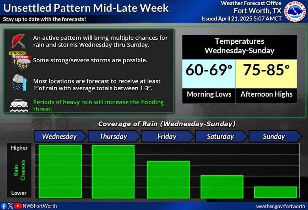
By Tuesday evening, a complex of storms will form in the Texas Panhandle. These storms will become severe and head east-southeast toward North Texas before daybreak on Wednesday. It could be a bit wet for the Wednesday morning commute. More showers and storms will develop Wednesday through Friday.
Most of the storms will form along the dry line by late afternoon in West Texas and then move east late at night through the early morning hours. Some of these storms may become severe, especially west of the Dallas-Fort Worth area. Afternoon highs will reach the low 80s. By late Friday, a cold front will sag into the area, producing scattered showers and storms. Some of these may become severe. This front will stall somewhere near North Texas late Friday through the weekend, becoming the focal point for more showers and storms to develop.
Some data suggests that this front will lift to the north late Saturday, taking the storm activity into Oklahoma on Sunday.
 National Weather Service
7-Day Headlines
DFW hit 77 degrees on Sunday. 0.09" of rain.
Only 0.28" of rain over the weekend at DFW Airport.
Quiet Monday and Tuesday. Nice weather!
Storms return to the forecast late Tuesday – the weekend.
Severe threat ramping up in areas.
Stalling cold front late Friday – the weekend.
*Sunday Rain: 0.09"; Sunday High: 77 Low: 59
*Monday's Averages: High: 77; Low: 57
*Record high: 95 (1955): Record low: 37 (2021)
*April Rain: 1.31"; Deficit:
*2025 Rain: 10.02"; Deficit:
*Sunrise: 6:50am; Sunset: 8:04pm
Monday: Sunny and beautiful! High: Low 80s. Wind: ESE 5 mph.
Monday night: Mainly clear and cool. Low: Mid to upper 50s. ESE 5 mph.
Tuesday: Partly cloudy and warm. Scattered late evening showers and storms are approaching from the west. Some severe. High: Mid 80s.
Wednesday and Thursday: Showers and strong storm chances continue. High: Low 80s.
Friday: Partly cloudy and tolerable. Scattered showers and strong storms, especially by evening. High: Low 80s.
LISTEN on the Audacy App
Tell your Smart Speaker to "PLAY 1080 KRLD"
Sign Up to receive our KRLD Insider Newsletter for more news
Follow us on Facebook | Twitter | Instagram | YouTube