Another gasp of winter, but spring rapidly returns towards Easter weekend.
A few clouds are streaming overhead this morning and it's another chilly start. Readings have fallen anywhere between 35 and 45 degrees, with the coolest air up along the Red River.
 National Weather Service - Fort Worth
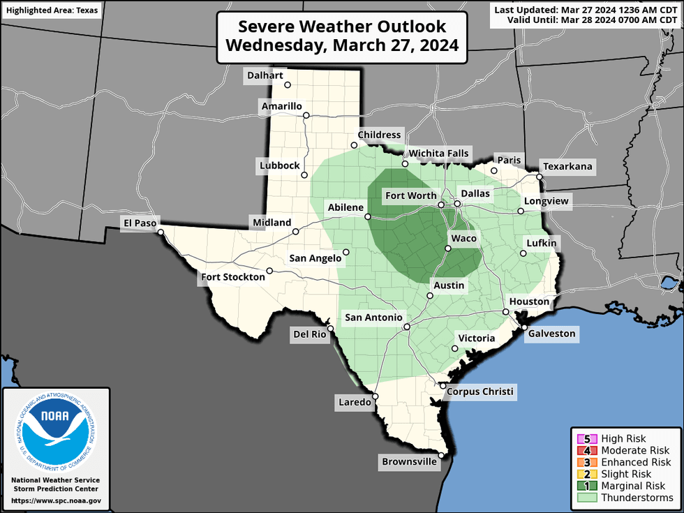
The radar is quiet right now, but it'll light up a little bit late this afternoon through this evening as a very strong upper-level low cruises close to the area. Even though the air is very dry at the surface, a pocket of very cold air will travel overhead late this afternoon and evening. This combined with a bit of daytime heating will produce some scattered strong thunderstorms, mainly south and west of the Dallas-Fort Worth area. The air is very dry at the surface, so precipitation totals will be light. Small hail and gusty wind will be the threats. Everything winds down after sunset. Afternoon highs will reach the mid-60s. The average high is 72°.
 National Weather Service - Fort Worth
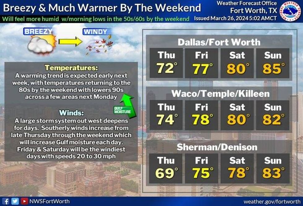
An absolutely perfect day will be enjoyed tomorrow. Readings will jump up into the low 70s with a very light wind.
So much for the light wind on Friday. A south wind will pick up and gust to 40 mph during the afternoon hours. A wind advisory may be issued. High temperatures will jump up into the mid to upper 70s.
Our warming Trend will continue into Easter weekend. Afternoon highs will reach the low 80s on Saturday, mid-80s on Easter Sunday. There will also be a lot more cloud cover around.
Surface moisture will continue to increase as we work our way into Monday. This combined with temperatures in the 80s and the dry line surging out of west Texas will cause scattered showers and storms to race east towards us by late evening. Some storms may become severe.
A strong cold front will catch up with the dryline early Tuesday morning. This should push all the rain out of the area as cooler/drier air filters in. Afternoon highs will only reach the mid 60s.
 National Weather Service - Fort Worth
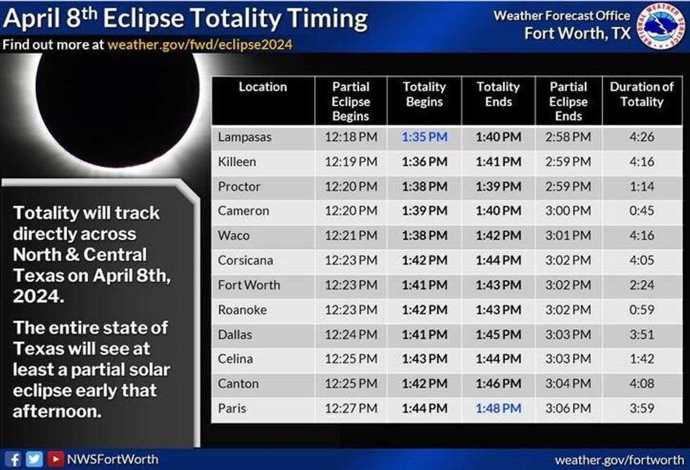
By the way, it's still way too early to talk about cloud cover for the eclipse on Monday April 8th. I will start updating you early next week.
*Yest Rain: 0.00"; Yest High: 60; Low: 39
*Today's Averages: High: 72; Low: 50
*Record high: 96 (1956); Record low: 23 (1955)
*March Rain: 5.66"; Surplus: 2.87"
*2024 Rain: 10.80"; Surplus: 2.72"
*Sunrise: 7:22am; Sunset: 7:45pm
LISTEN on the Audacy App
Tell your Smart Speaker to "PLAY 1080 KRLD"
Sign Up to receive our KRLD Insider Newsletter for more news
Follow us on Facebook | Twitter | Instagram | YouTube