Another spectacular day is ahead after we get out of the 50s this morning, and sunny and warm again this afternoon. Friday afternoon highs will reach the mid-80s again. 74° is our average high on this date.
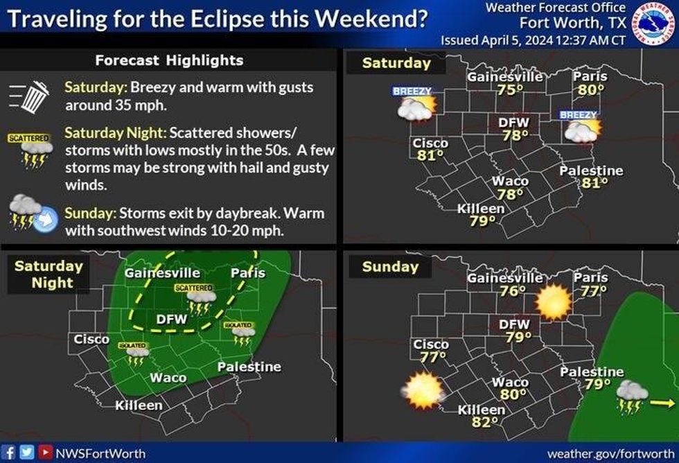
We'll start Saturday off near 60°. A bunch of wind will invade the area through the day with afternoon highs near 80°. There is a very slight chance for a shower or storm on Saturday evening, but most will stay dry.
 National Weather Service - Fort Worth
Sunday looks mostly sunny, breezy, and warm as the air dries out briefly. Afternoon highs will top out near 80°.
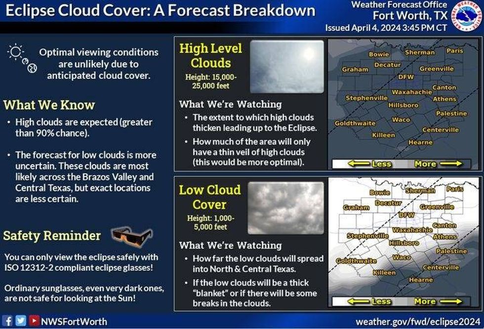
Nothing has changed with the forecast over the past 24 hours for the viewing of the eclipse early Monday afternoon. It still looks like a veil of high clouds will move into the area.
 National Weather Service - Fort Worth
What's still uncertain is how far north the low clouds will progress through the day. Right now it looks like the eclipse viewing will be poor across central and south Texas due to lower cloud ceilings (5k feet). We might just luck out here across north Texas with cloud ceilings at 15k to 20,000 ft. causing a filtered view.
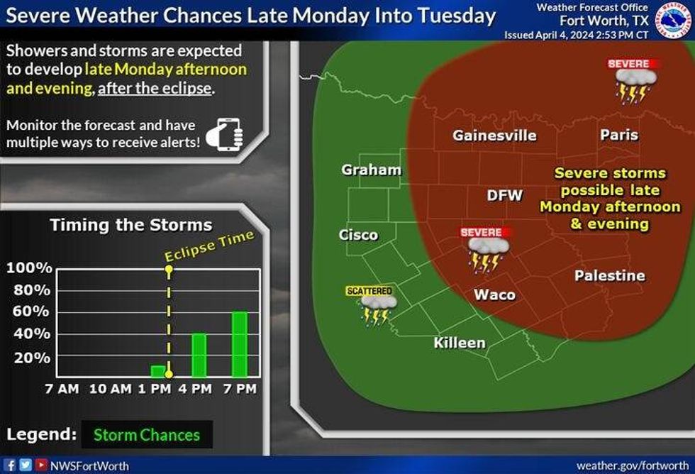
We'll once again reach 80° on Monday. By Monday late afternoon and evening, scattered showers and thunderstorms will rapidly move in from the south. A few of them could become severe by evening.
 National Weather Service - Fort Worth
Tuesday and Wednesday look stormy as well. I will be monitoring the weather on Tuesday for the possibility of more severe storms. Wednesday, the severe weather threat shifts to our east, but waves of heavy rain will continue. Flooding may be a concern. Afternoon highs both days will be in the 70s.
By Wednesday night into early Thursday morning, the whole system will swing directly overhead giving us another burst of heavy rain and thunder. Everything should be east of us by Thursday morning. Before all is said and done, 2 to 4 inches of rain may fall across north Texas with isolated higher totals possible, especially east of DFW. Updates to come through the weekend and into early next week.
*Yest Rain: 0.00"; Yest High: 84; Low: 48
*Today's Averages: High: 74; Low: 53
*Record high: 95 (2022); Record low: 32 (1920)
*March Rain: 0.50"; Surplus: 0.11"
*2024 Rain: 11.30"; Surplus: 2.32"
*Sunrise: 7:10am; Sunset: 7:52pm
LISTEN on the Audacy App
Tell your Smart Speaker to "PLAY 1080 KRLD"
Sign Up to receive our KRLD Insider Newsletter for more news
Follow us on Facebook | Twitter | Instagram | YouTube