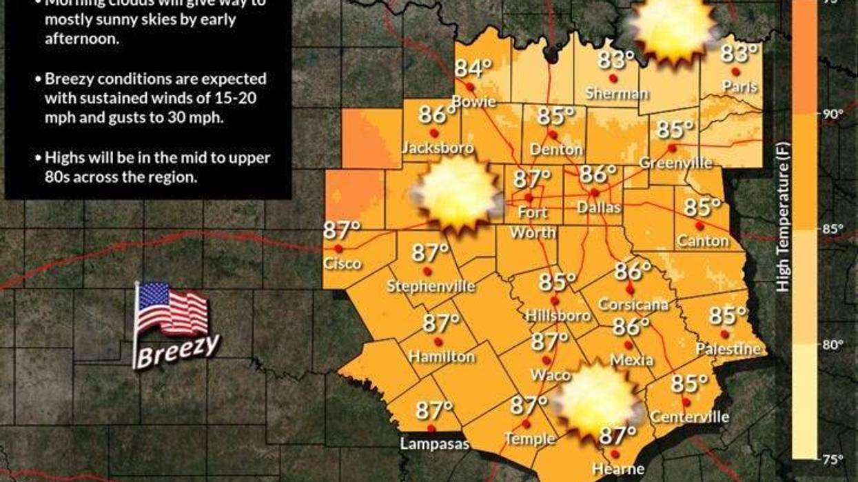
Good morning everyone and welcome to Friday! Once again we're starting off with low clouds, temperatures near 70゚ and breezy conditions across north Texas. Sunshine will show its face by late morning into the early afternoon with highs in the mid eighties. South winds will gust as high as 35mph.
For tonight, low clouds will invade after midnight and it will be very mild, muggy, and windy. Morning lows will drop into the upper sixties with south winds gusting to 40 mph!
Morning clouds afternoon sunshine will be our weather story on Saturday with more wind. Afternoon highs will reach the mid eighties once again. South winds will gust to 35mph. There could be a few scattered showers and storms to the north and west of DFW Saturday night.
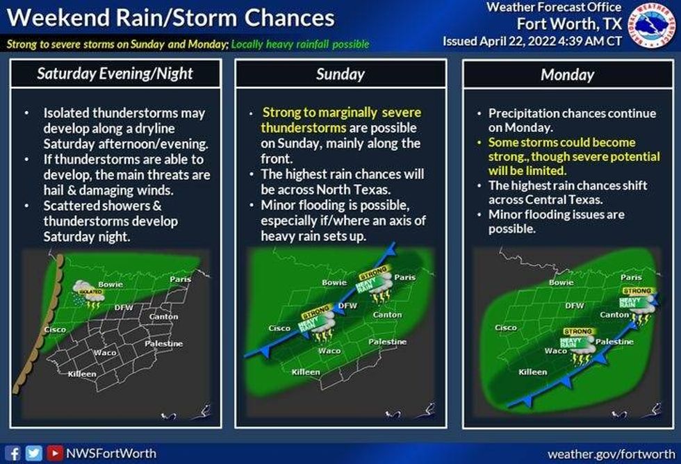 Rain chances this weekendNational Weather Service - Fort Worth
We'll have to wait until the 2nd half of Sunday into the 1st half of Monday for the widespread rain to arrive in the Metroplex... as a slow moving cold front drifts through the area. As of now, I'm not looking for anything to severe, but 1 or 2 storms could become strong with some small hail and gusty wind.
Average rainfall totals will range between 1" and 3". We definitely need the rain!
By Monday afternoon, the bulk of the rain will press south of the Dallas Fort Worth area. Windy and much cooler temperatures will be the weather story through the day. Afternoon highs will be in the low to mid sixties!
Beautiful weather will dominate north Texas Tuesday through Thursday with a slow warm up. Sunny, low seventies for Tuesday, sunny upper seventies for Wednesday, and we'll be pushing the mid eighties by Thursday.
Have a terrific weekend everybody and enjoy the welcome rain!
*Yest Rain: 0.00"; *Yest High: 86; Low: 73
*Today's Averages: High: 77; Low: 57
*Record high: 94 (1963); Record low: 39 (1927)
* April rain: 1.59"; April deficit: 0.53"
*2022 rain: 5.82"; 2022 deficit 4.89"
*Sunrise: 6:50am; Sunset: 8:04pm
Today: Morning clouds, afternoon sun. Windy and warm. High: Mid 80s. Wind: South 15-25, G35 mph
Tonight: Increasing clouds, windy and mild. Low: Upper 60s. Wind: SSE 20-30, G40 mph.
Tomorrow: Morning clouds, afternoon sun. Windy and warm. Slight chance of evening storms (West of I-35W) High: Mid 80s. Wind: South 15-25, G35 mph.
Sunday: Mostly cloudy and breezy. Showers and thunderstorms increase by late afternoon and evening. Some strong with wind and small hail the threats. High: Upper 70s.
Monday: Morning rain, ending by afternoon. Windy and much cooler. High: Low to mid 60s
Tuesday: Sunny and pleasant. High: Mid 70s.
Wednesday. Sunny and seasonable. High: Upper 70s.
Thursday: Mostly sunny, breezy and warmer. High: Mid 80s.

LISTEN on the Audacy App
Sign Up and Follow NewsRadio 1080 KRLD