
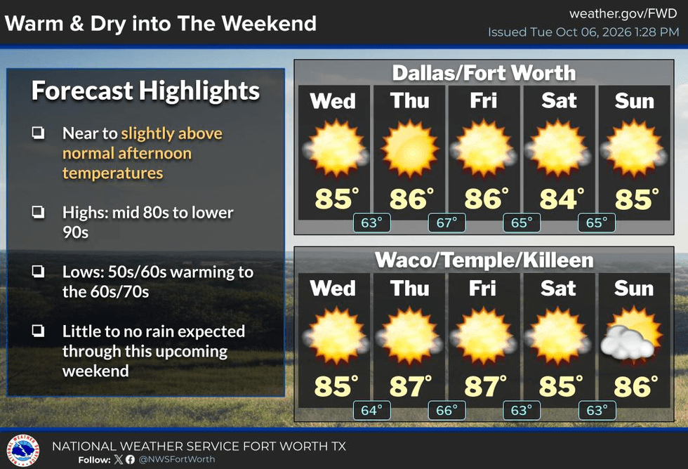
GOOD MORNING, NORTH TEXAS! BEAUTIFUL WEATHER HERE… BUT THE GULF IS GETTING BUSY!
Good morning, my friends! I hope everyone is having a great work week. It’s HUMP DAY! And honestly, the weather here across North Texas has been fantastic!
THIS MORNING:
We’re waking up to temperatures in the upper 50s to low 60s across North Texas with clear skies and light winds. It’s a beautiful, cool start to the day!
THE FORECAST:
A strong area of high pressure is building across the state in the upper levels of the atmosphere. That high pressure is doing a great job of suppressing clouds and rainfall.
And remember… no clouds, no rain!
For the rest of this week and through the weekend, expect mostly sunny skies with afternoon temperatures generally in the mid-80s, with a few upper 80s possible Friday, Sunday and Monday.
NO SIGNIFICANT RAIN IS EXPECTED THROUGH THE WEEKEND.
There are some signs that showers could begin returning to North Texas around Tuesday, with a better chance of rain toward the end of next week.
And THAT’S when things get interesting!
A pretty strong cold front will come plowing through North Texas toward the end of next week — our first real “plowing” cold front of the fall season.
That front should bring us the coolest temperatures we’ve experienced so far this fall.
It’s still WAY too early to determine exactly how much rain the front will produce, but there are indications that we could see some showers and thunderstorms develop as we get closer to that timeframe.
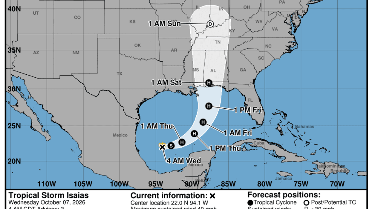
TROPICAL STORM ISAIAS — FIRST HURRICANE OF THE 2026 SEASON?
Meanwhile, my attention — and the attention of many meteorologists across the Southeast — is focused on the southwestern Gulf of Mexico.
Tropical Storm Isaias has formed, and current forecasts indicate it could strengthen into the first hurricane of the 2026 Atlantic hurricane season within the next 24–36 hours.
The good news for North Texas:
This storm is NOT expected to impact us.
As of this morning, Isaias has maximum sustained winds around 40 mph and is located roughly 580 miles southwest of the mouth of the Mississippi River, moving northeast at about 8 mph.
Its central pressure is around 1004 millibars.
The current forecast track takes the storm generally northeastward before turning more toward the north Friday and heading toward the Gulf Coast somewhere between Biloxi, Mississippi, and Pensacola, Florida.
THE THREATS WILL BE FLOODING RAIN, DAMAGING WIND, STORM SURGE AND TORNADOES.
Areas across southern Louisiana, Mississippi, Alabama and the western Florida Panhandle could see a tremendous amount of rainfall, major flooding from storm surge this weekend, serious wind damage and tornadoes.
And remember, with tropical systems, the tornado threat is typically found east of the center of circulation.
That could put parts of Alabama — including areas around Montgomery, Birmingham and Huntsville — as well as eastern Tennessee, Atlanta and Macon, at risk for strong thunderstorms and tornadoes, depending on the eventual track.
Heavy rain is also possible across the mountains of eastern Tennessee and surrounding areas.
FORECAST LANDFALL:
Current forecasts suggest maximum winds around 110–115 mph near landfall Saturday morning, which would put the storm near Category 3 major hurricane strength.
There will also be dangerous surf and strong rip currents along the Texas coast and especially farther east along the Gulf Coast this weekend.
The good news is that North Texas is looking fantastic!
So get outside, take advantage of this beautiful weather, enjoy the cooler mornings and warm afternoons, and make the most of it!
As always, THANK YOU for following my page!
Please LIKE and SHARE this forecast with your friends, family and coworkers so more people can stay informed about the weather.
Stay weather aware… and enjoy the beautiful weather while we can!
— Dan the Weatherman