


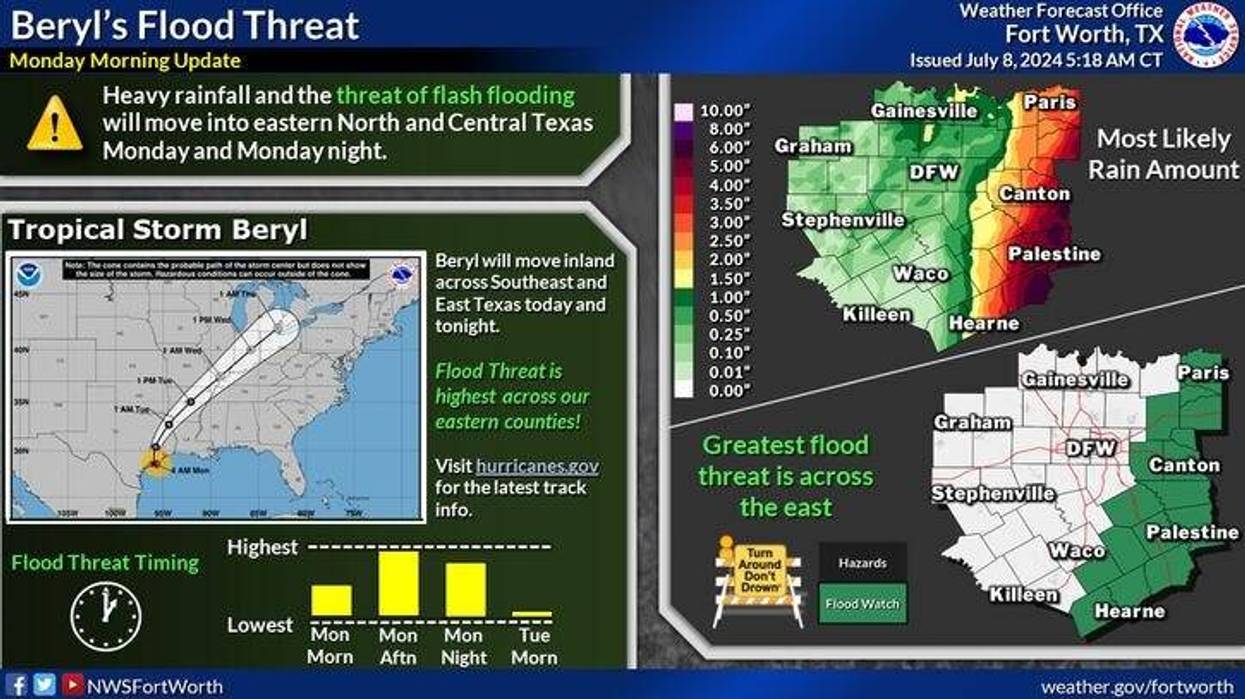
Hurricane Beryl made landfall early Monday morning along the Texas coast with wind speeds at 80 mph. It will slowly diminish through the day and become a tropical storm later Monday morning. It was moving north at 12 mph and a turn to the northeast is expected through the day. The heaviest rain Monday fell along the mid and upper-Texas coastal plains. Flash Flood Watches extend from the mid and upper Texas coast all the way into east Texas.
One weak rain band arrived in North Texas on Monday morning and there will be others throughout the day. Rain totals of more than one inch will be along and east of a McKinney to Dallas to Waxahachie line. The 3-5 inch rainfall totals will be confined to East Texas. It will be quite breezy Monday with wind gusts to 30 mph in DFW. Afternoon highs will hover in the 70s with some 80s west and north of DFW.
Clouds will rapidly move out the first half of Tuesday with highs back near 90 degrees, low to mid-90s on Wednesday, and mid to upper 90s Thursday through the weekend. There is also a slight chance for an afternoon or evening storm Friday through the weekend.
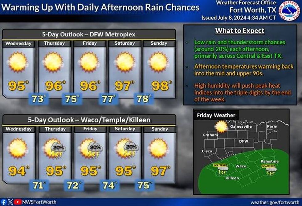 Five-day outlook for North Texas.National Weather Service
7-Day Headlines
DFW reached 96 degrees yesterday.
Hurricane Beryl made landfall shortly after 4 a.m. Wind at 80 mph.
Beryl's rain spreads into the eastern half of North Texas on Monday. 0.10"– 2.00" of rain from west to east.
Tornado threat and Flood Watch affect East Texas. Rapid clearing on Tuesday.
Dry with mid to upper 90s return late week into the weekend. After Friday, no rain for a while.
_____________________________________________________
*Sunday Rain: 0.00"; Sunday High: 96 Low: 78
*Monday's Averages: High: 95; Low: 75
*Record high: 107 (1956): Record low: 62 (1952)
________________________________________________________
*July Rain: 0.47"; Deficit: 0.22"
*2024 Rain: 29.21"; Surplus: 8.23"
*Sunrise: 6:27am; Sunset: 8:39pm ________________________________________________________
Monday: Morning showers and isolated storms, then more later in the day as the remnants Beryl approach. Heaviest rain east of a McKinney to Dallas to Waxahachie line. High: Low 80s. Wind: NNE 15-25, G30 mph.
Monday night: Cloudy, breezy and muggy. Scattered showers and storms moving out by daybreak. Low: Near 70. Wind: East 10-15 mph.
Tuesday: Morning clouds, with a few showers east early. Decreasing clouds. Warm and humid. High: Near 90. Wind: NNW 15-25, G30 mph.
Tuesday and Wednesday: Mostly sunny, warm and humid. Highs: Low to mid-90s.
Thursday – Sunday: Partly cloudy, hot and humid. High: Mid to upper 90s.
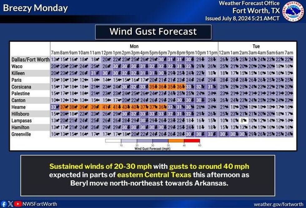 Wind gust forecast for Monday, July 8, 2024.National Weather Service
LISTEN on the Audacy App
Tell your Smart Speaker to "PLAY 1080 KRLD"
Sign Up to receive our KRLD Insider Newsletter for more news
Follow us on Facebook | Twitter | Instagram | YouTube


