


A major winter storm across the Plains States, a severe weather outbreak across the Arklatex and the Mississippi River Valley today, and a level 1 out of 5 for severe storms across DFW. Those are your weather stories on the second day of 2023.
It's the dreaded clash of air masses, and a strong upper level and surface low that will produce this wild weather across the heartland and south today.
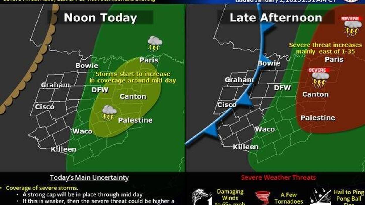
We're waking up to a very thick and humid air mass this morning across north Texas. Don't be surprised if you see a few heavy showers or a possible rumble of thunder by late morning into the early afternoon across the Metroplex. These will not be severe.
As the upper level dynamics and surface features creep closer to the area through the day today, mainly after the noon hour, more storms will start to form. As of now, the timeline that parts of north Texas will see scattered severe storms will be between about 3:00 p.m. and 7:00 p.m... as of now, those of you that live east of a Whitesboro, to The Colony, to Hurst- Euless-Bedford, to Mansfield, and Hillsboro line need to stay weather aware.
All facets of severe weather are possible, including isolated tornadoes. The threat increases five fold late this afternoon through the evening once you drift east of Central Expressway and Interstate 45. This includes the cities of Greenville, Sulfur Springs, Canton, Palestine and points east into the Piney Woods and The Arklatex. This is where levels 2 and 3 out of five are in place for severe weather.
The threat is over in the eastern parts of DFW after 7:00 p.m... areas Mid Cities and points west of I-35W won't see much rain at all.
 National Weather Service - Fort Worth
A Pacific cold front will press through the area between 10:00 p.m. and midnight. A thin line of storms will form along this boundary, somewhere along and east of a Sherman to Euless to Mansfield line. This will be just be a wind and small hail maker. This line will increase in intensity as it moves into east Texas after midnight.
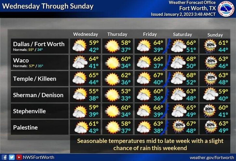
The air behind this front is not that cold, but it will have much drier air accompanying it. A second stronger front will move into the area early Wednesday dropping temperatures to near seasonal averages through the rest of the week.

LISTEN on the Audacy App
Tell your Smart Speaker to "PLAY 1080 KRLD"
Sign Up and Follow NewsRadio 1080 KRLD


