A brief return to winter, a slight chance of showers, and then a rapid warm up into the weekend.
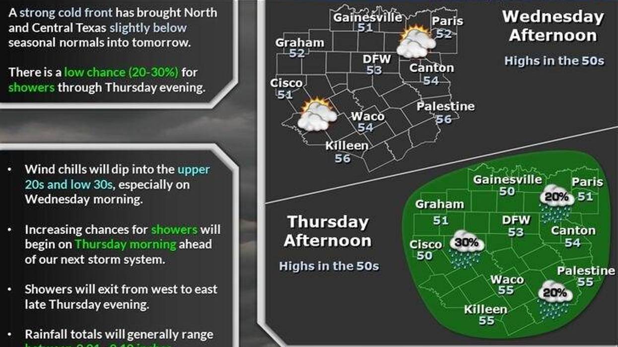
It's a bit of a shock this morning as temperatures have fallen into the low to mid-40s, and wind chills are in the 30s. Skies will remain cloudy with afternoon highs in the low 50s. A north wind will gust to 30 mph throughout the day.
Tonight will be cloudy with less wind. Morning lows Thursday will dip into the upper 30s to the low 40s.
A strong upper-level disturbance will cross the area tomorrow. There's a decent chance of rain showers in the second half of the day, but a lot of the rain will not reach the ground due to the dry air mass that will be in place. Rainfall totals will be less than 0.05". Afternoon highs will struggle to get above 50°.
 National Weather Service - Fort Worth
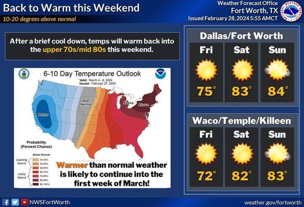
Sunshine returns Friday and our warm-up starts. Afternoon highs will reach the mid-70s with a south wind at 10 to 20 mph.
Our warm-up will continue into the weekend. Plenty of sunshine, warm and breezy. Daytime highs will warm into the low 80s.
Our next weather change arrives on Monday as a weak cold front crosses the area. As of now, it looks like the upper-level dynamics will be well to the north of us, so rain chances are slim. Afternoon highs will reach the mid-70s. Sunshine returns Tuesday with highs in the upper 60s.
*Yest Rain: 0.00"; Yest High: 79 Low: 66
*Today's Averages: High: 64; Low: 44
*Record high: 88 (1932); Record low: 19 (1962)
*February Rain: 1.88"; Deficit: 0.76"
*2024 Rain: 5.08"; Deficit: 0.09"
*Sunrise: 6:58am; Sunset: 6:24pm
LISTEN on the Audacy App
Tell your Smart Speaker to "PLAY 1080 KRLD"
Sign Up to receive our KRLD Insider Newsletter for more news
Follow us on Facebook | Twitter | Instagram | YouTube