


We're waking up to temperatures in the seventies once again but we have a mid level stratus deck of clouds moving in from the south. These clouds will be around most of the morning keeping temperatures a few degrees cooler than the past several days into the lunchtime hour. There's also nothing showing up on radar right now, but that will change late this afternoon and evening as some bands of showers with imbedded thunder sneak in from the south. Best rain chances, albeit slight, will be south of interstate 30. Afternoon highs will creep towards 90゚.
Not much going on overnight tonight or tomorrow. One thing you will notice is the wind. We'll feel gusts to 25 mph from the South, ahead of a rare July cold front, as it approaches late Saturday night.
 NWS
NWS
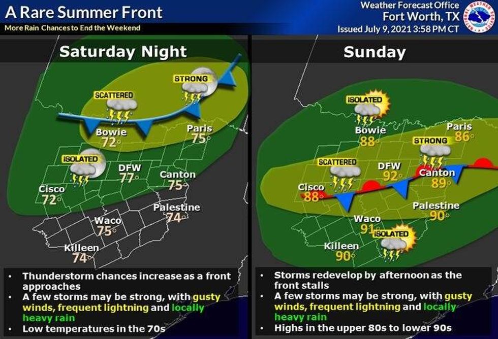
A large complex of storms will form Saturday evening in Oklahoma and stretch all the way into the Midwest. This line of strong storms will sag south crossing the Red River overnight Saturday into Sunday morning. These storms will weaken a bit as they approach north Texas before daybreak Sunday morning.
Wherever that front decides the stall Sunday afternoon will be the focal point for storms to regenerate. Some storms may can contain strong gusty winds, dangerous lightning, and a quick inch of rain or higher in some areas. High temperatures will be in the mid to upper eighties.
 NWS
NWS
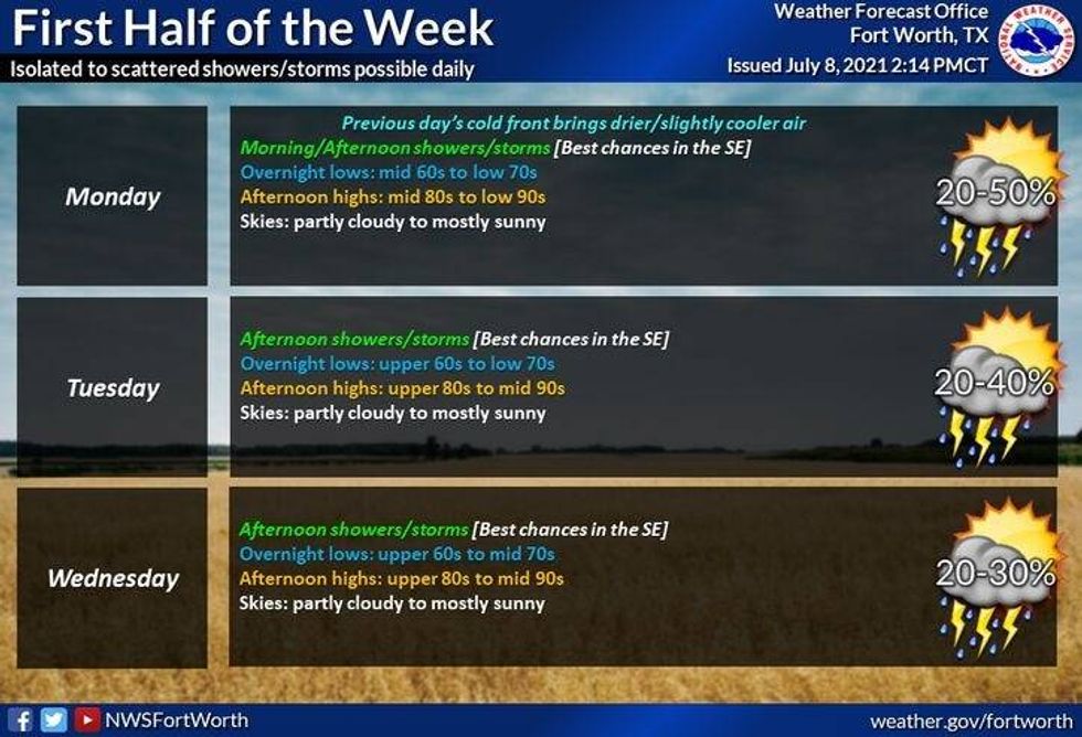
Storm chances will decrease on Monday, but I can't rule out a few leftover storms during the afternoon and evening hours. High temperature will touch the 90゚ mark
The rest of your extended forecast looks sunny, hot, humid, and dry Tuesday through the end of next week. Temperatures will get back into the middle nineties, which is average for this time of the year. By Thursday and Friday, heat index values will be slightly over 100゚
I hope everyone has a fabulous weekend and tries to enjoy the weather, when you can, it's the only weather you've got!
7-Day Headlines:
* Isolated late day showers and storms today.
* Saturday looks OK, but HOT.
* Storms approach from the north late tomorrow evening.
* Storm chances continue Sunday and part of Monday.
* Heating back up and drying out next week.
*Yest Rain: 0.00"; *Yest High: 93; Low: 76
*Today's Averages: High: 95; Low: 75
*Record high: 106 (1980); Record low: 61 (1905)
*July rain: 0.50"; July deficit:
*2021 Rain: 21.02"; 2021 deficit
*Sunrise: 6:27am; Sunset: 8:39pm
Today: Mostly to partly cloudy, breezy and warm. A few late day showers and storms, especially south of Interstate 30. High: Near 90. Wind: SE 10-20 mph.
Tonight: Partly cloudy, breezy and muggy. Low: Mid to upper 70s. Wind: SE 10-20 mph.
Tomorrow: Partly cloudy, breezy and hot. Increasing chance of strong storms toward midnight. Threats: Wind, heavy rain and lightning. High: Low to mid 90s. Wind: SE 10-20 mph.
Sunday and Monday: Mostly cloudy, warm and humid.
Stalled cold front produces scattered showers and storms. A few strong on Sunday. High: 88-92.
Tuesday - Thursday: Partly cloudy, hot and muggy.
High: Low to mid 90s.
LISTEN on the Audacy App
Sign Up and Follow NewsRadio 1080 KRLD


