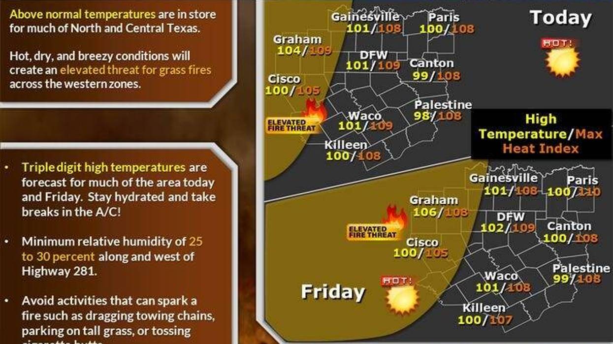
High pressure remains in control in the upper levels of the atmosphere. The hottest days over the next seven will be today, tomorrow, Sunday, and Monday. Afternoon highs will range between 99° and 104°. The hottest weather will be along and west of Interstate 35W.
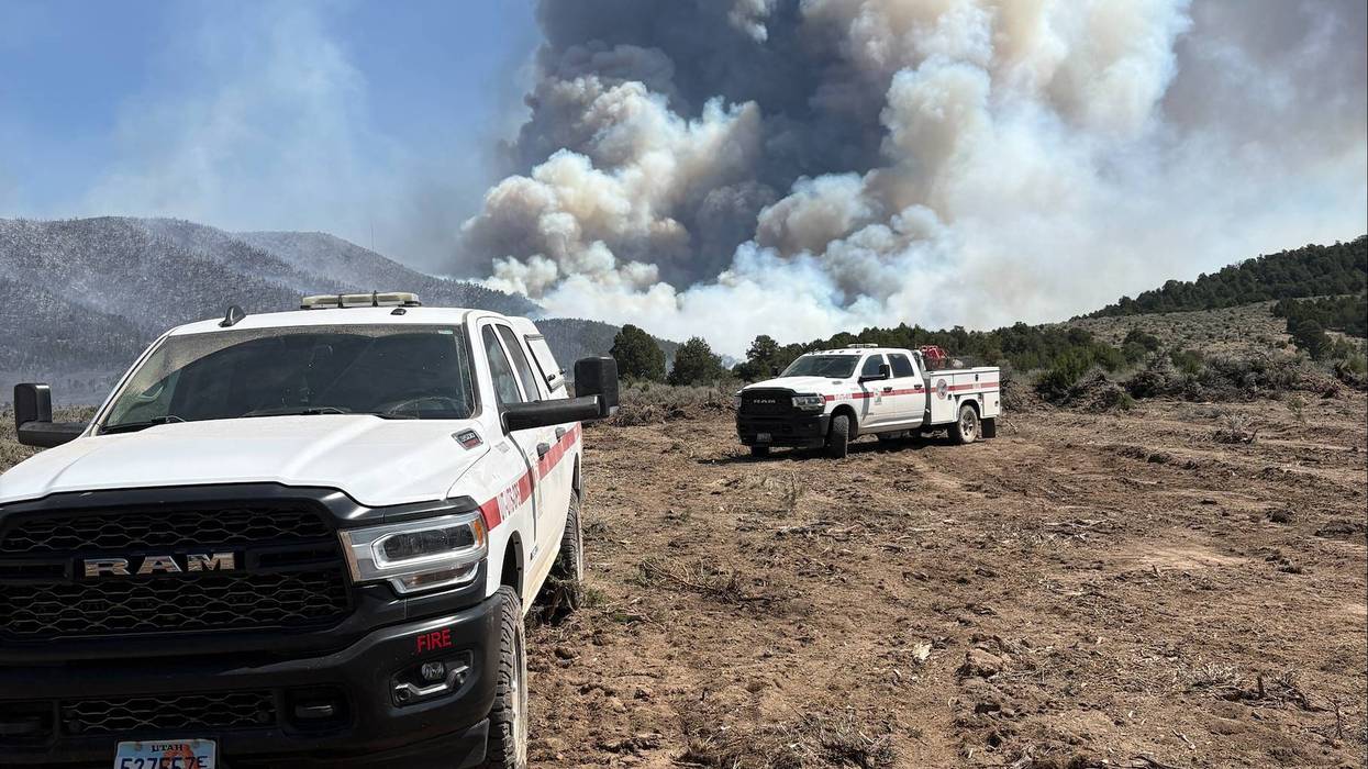
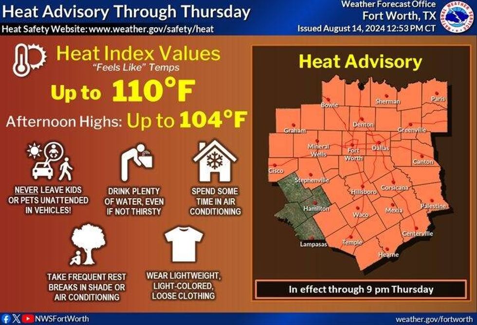
Critical grass fire danger will also be in place in these areas. Plus, our Heat Advisories will continue through early next week as well. Heat index values will range between 105° and 110°.
A weak front will approach the Red River Valley this evening into Friday. There will be a few scattered showers and storms forming along this front trying to edge south of the Red River, but will fall apart as they do so. This front lift back to the north this weekend with high pressure remaining and control.
 National Weather Service
No major changes through next week, but temperatures may drop a few degrees. Speaking of a drop in temperatures, our average high drops to 96° today. It's been stuck at 97° for over 2 weeks now. Or average high at the end of the month drops to 92°, low 80s for average highs by the end of September.
Have a great day today, stay hydrated, and enjoy the weather when you can, it's the only weather you've got!
LISTEN on the Audacy App
Tell your Smart Speaker to "PLAY 1080 KRLD"
Sign Up to receive our KRLD Insider Newsletter for more news
Follow us on Facebook | Twitter | Instagram | YouTube