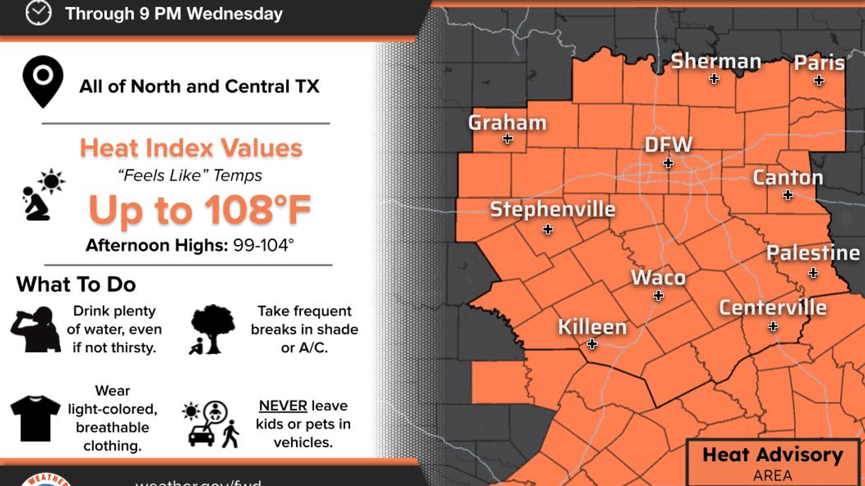

ONLY 101° YESTERDAY — HOW DO YOU LIKE THEM APPLES?
We can thank the shower activity and cloud cover during the first half of yesterday for keeping our temperatures down. That actually felt pretty nice, didn't it?
We have some clouds around this morning, and they're producing a few light showers to the east of the Dallas-Fort Worth area.
And yes… I'm tracking a COLD FRONT! I have to call it that because there's no such thing as a "not-as-cold front"!
The front is now across southern Oklahoma and moving into the Texas Panhandle. There's also a disturbance in the Panhandle that will head our direction this afternoon. That system will drag the cold front through our northern counties shortly before noon and then across the rest of North Texas before sunset.
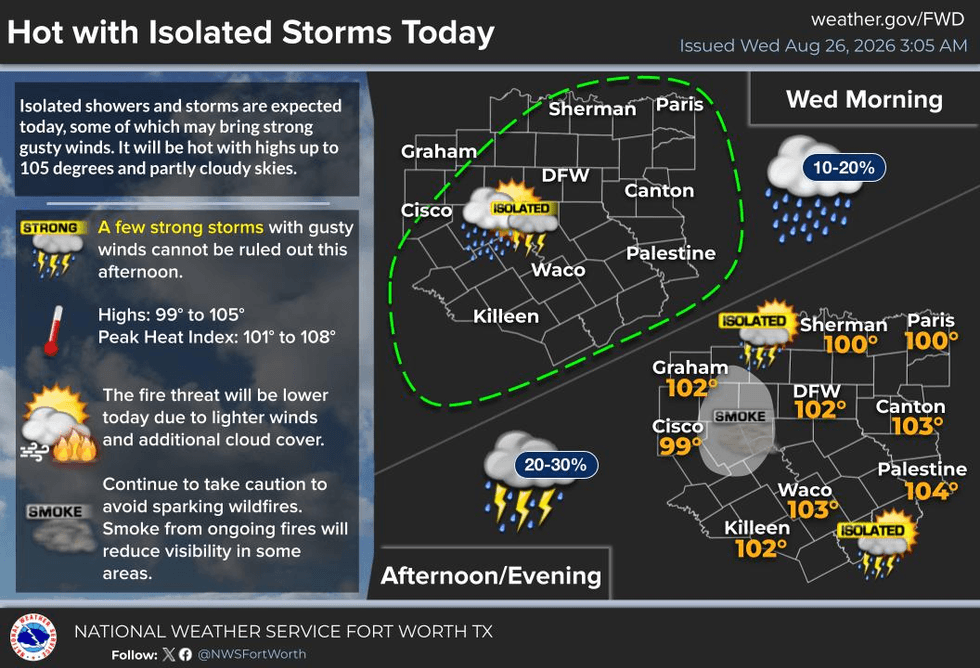
RAIN CHANCES TODAY: We could see a few scattered showers and thunderstorms, but the latest data suggests the more widespread rain — around 40–50% coverage — will once again be across East Texas and the Ark-La-Tex. Unfortunately, North Texas will probably miss out on much of it.
TODAY: Highs generally 101°–103°, with some of our northern counties a little cooler depending on cloud cover. Only about a 20% chance of a shower or storm locally.
The winds will turn northerly behind the front, and hopefully that will help push the Ross Fire back on itself to the west of Fort Worth. It won't be a strong north wind, but every little bit helps the courageous firefighters battling this dangerous fire.
THURSDAY & FRIDAY: Temperatures drop into the upper 90s, with perhaps a pop-up shower or storm.
Then… here comes the heat again. High pressure builds back in Friday and especially this weekend into early next week. We're probably not talking 109° again, but 100°+ temperatures will return.
GRASS FIRE DANGER: South winds will really begin to increase Sunday, Monday and Tuesday, which means fire danger could ramp back up again. Unfortunately, there is little to no meaningful rain in sight.
And before you know it… SEPTEMBER!
LUNAR ECLIPSE TONIGHT: If you want to stay up late, we're looking at roughly a 92% lunar eclipse beginning around 9:30 PM, with maximum eclipse around 11:15–11:30 PM.
Guess what? I'll be in bed!
Have a great day today, everybody! Hopefully you see some rain, and enjoy the weather whenever you can.
7-Day Headlines:
- DFW Airport ONLY hit 109 degrees on Monday. NEW record!
- 31 triples this summer
- 40 days with no measurable rain at DFW
- HIGH GRASS FIRE DANGER!
- Heat Warnings gone/Heat Advisories replace
- Slight rain chance today
- A tad cooler Thursday - 100’s back this weekend
- Download our AUDACY app! Listen to KRLD LIVE at home or at work
Almanac:
- Yest Rain: 0.00”; Yest High: 101; Low: 82
- Today’s Averages: High: 94; Low: 75
- Record high: 110 (2023); Record low 60 (1926)
- August rain: Trace; Deficit: <1.65”>
- 2026 Rain: 22.61”; Snow: 2.4”; Deficit: <1.41”>
- Sunrise: 7:00am; Sunset: 7:59pm
Forecast:
Wednesday: **Heat Advisory** Early afternoon cold front. Isolated showers and storms. High:102. Heat index:105. Record high: 110 (2023). Wind: South to north 5-10 mph.
Wednesday night: Partly cloudy and mild. Slight rain chances south and east of DFW. Low: Near 80. Wind: North 5-10.
Thursday: **Possible Heat Advisory** Partly cloudy and hot. High: Upper 90s. Wind: North 5-10 mph.
Friday: Mostly sunny and hot. High: Near 100.
Weekend: Mostly sunny, breezy and hot. Grass fire danger returns! Highs: 101.
Monday and Tuesday: Mostly sunny, breezy and hot. Grass fire danger! High: 102.
LISTEN on the Audacy App
Tell your Smart Speaker to "PLAY 1080 KRLD"
Sign Up to receive our KRLD Insider Newsletter for more news
Follow us on Facebook | Twitter | Instagram | YouTube