


One more decent day today, before on-and-off rain enters the picture starting tomorrow, lasting through Sunday afternoon.
You'll need your jackets this Wednesday morning as temperatures have fallen into the 40s across north Texas. A decent day is ahead today with passing high clouds. Afternoon highs will top out in the mid-60s.
 National Weather Service - Fort Worth
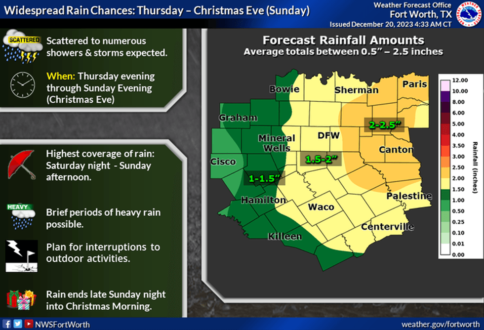
The first in a series of upper-level disturbances will cross the area late tomorrow through overnight. Light to moderate rain will move in from the west by evening. This rain will continue overnight, ending before noon on Friday. Afternoon highs on Friday will reach the mid to upper 60s with some peeks of sunshine.
A few morning showers are possible on Saturday as better rain chances move in towards the late afternoon and evening. High temperatures will reach the upper 60s.
The last wave of showers and some strong thunderstorms will cross the area in the first half of Sunday. Areas of heavy rain are possible, especially east of Dallas. Afternoon highs will reach the upper 60s. Rain should be east of DFW by Christmas Eve.
 National Weather Service - Fort Worth
As of now, I'm thinking everybody will see at least an inch of rain, but some areas will receive close to 2 in before all is said and done. The heaviest rain will fall east of Dallas.
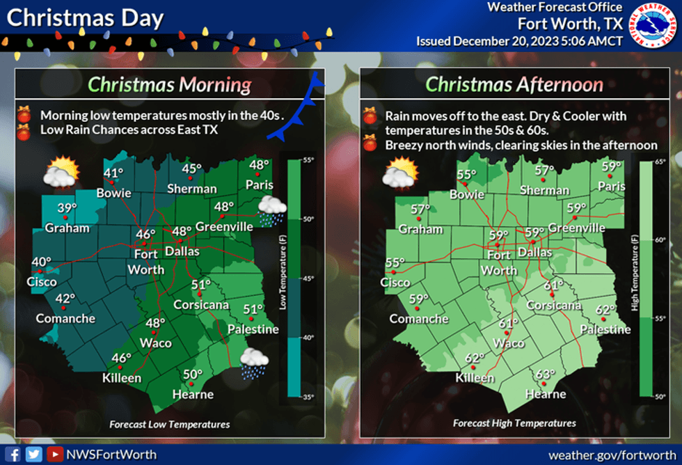
A cold front will move into the area of early Christmas morning. Decreasing clouds and windy and cooler temperatures will arrive behind the front. High temperatures will reach the mid to upper 50s. And Tuesday will be cooler under a partly cloudy sky. Afternoon highs will be in the low 50s.
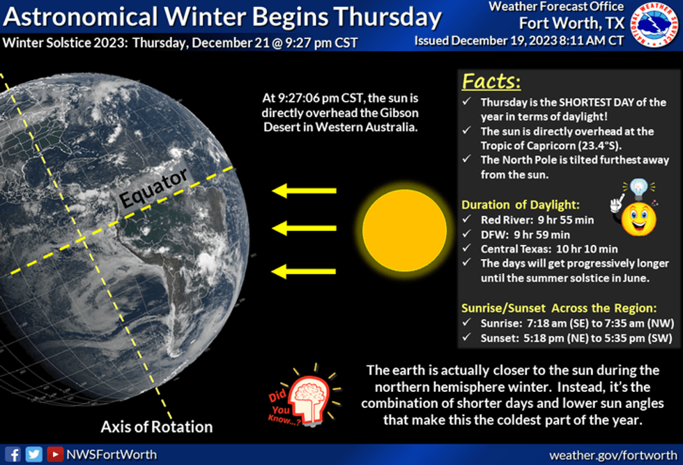
By the way, the Winter Solstice officially arrives at 9:27 p.m. Thursday.
 National Weather Service - Fort Worth
*Yest Rain: 0.00"; Yest High: 60; Low: 37
*Today's Averages: High: 57; Low: 37
*Record high: 79 (2010); Record low: 8 (1924)
*December rain: 0.60"; Deficit: 1.13"
*2023 Rain: 26.36"; Deficit: 9.54"
*Sunrise: 7:26am; Sunset: 5:25pm
Today: Passing high clouds and cool. High: Mid 60s. Wind: SSE 10-20 mph.
Tonight: Passing high clouds, not as cool. Low: Low 50s. Wind: South 10-15 mph.
Tomorrow: "Winter arrives at 9:27 pm" Isolated morning showers, then increasing rain chances toward evening. High: Mid 60s. Wind: South 10-15 mph.
Friday: Morning showers, then some peeks of sunshine by afternoon. High: Mid to upper 60s.
Saturday: A few morning showers, then showers and storms by late afternoon into the evening. High: Mid to upper 60s.
Christmas Eve Day: Cloudy, continued mild. Scattered showers and storms, ending by late afternoon. Pockets of heavy rain and gusty wind are possible. High: Upper 60s.
Christmas: Decreasing clouds, windy and cooler. High: Upper 50s.
Tuesday: Partly cloudy and chilly. High: Low 50s.
LISTEN on the Audacy App
Tell your Smart Speaker to "PLAY 1080 KRLD"
Sign Up to receive our KRLD Insider Newsletter for more news
Follow us on Facebook | Twitter | Instagram | YouTube


