We are waking up to temperatures in the upper 20s to mid 30s across North Texas. Some areas of fog have now developed and some freezing fog is plaguing areas along the Red River, especially along highway 82 west of Gainesville. Please be careful. Bridges and overpasses have a thin coating of ice on them. This will all melt off and burn off by mid morning.
I'm also tracking a cold front that's now entering the Texas Panhandle. It will arrive across North Texas later this afternoon into early this evening. The wind will shift to the northwest and gust to 30 mph overnight and into the day tomorrow. There is also an upper level disturbance that will be diving across the Red River Valley today. This will bring a layer of clouds across the area this evening through the early morning tomorrow, but as of now, it looks like any light precipitation will stay in southeast Oklahoma and the Arklatex.
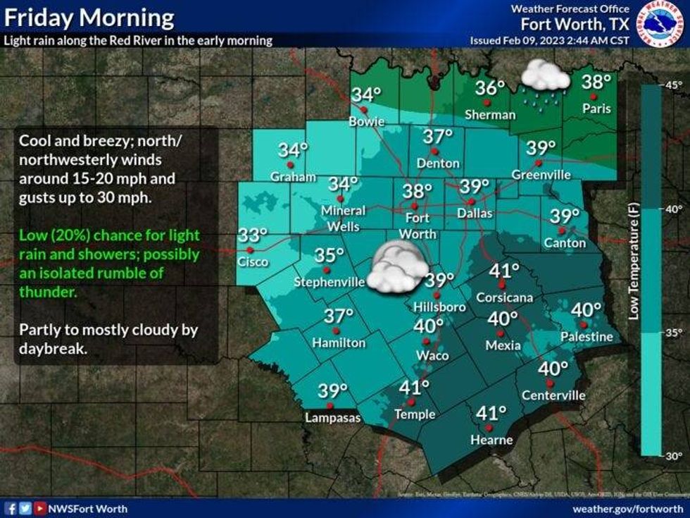
Friday will be sunny, but chilly. Afternoon highs will only reach the mid 40s with a north wind gusting as high as 30mph.
 National Weather Service - Fort Worth
Our weekend looks nice, but cool. After a light freeze Saturday morning, sunshine will greet us during the day with high temperatures only in the low 50s. Sunny upper fifties for Sunday.
Our next weather maker arrives late Monday into Valentine's Day. Look for widespread rain with some thunder to overspread the area. Afternoon highs both days will reach the low 60s.
We are back to sunshine Wednesday with highs in the low seventies. However, don't let your guard down, A strong cold front will usher in some pretty chilly air by the end of next week. More about that as we get closer.
*Yest Rain: 1.11"; High: 49; Low: 39
*Today's Averages: High: 60; Low: 39
*Record high: 87 (1960); Record low: 11 (1933)
*February Rain: 2.90"; Surplus: 2.25"
*2023 Rain: 4.28"; Surplus: 1.10"
*Sunrise: 6:17am; Sunset: 6:08pm
Today: Morning freezing fog (Red River, Hwy 82), then increasing clouds with afternoon cold front. High: Low 60s, falling into the 40s by evening. WINDY! Wind: Shifting WNW 15-25 mph.
Tonight: Mostly cloudy, windy and cold. Low: Mid to upper 30s. Wind: NNW 15-25 mph.
Friday: Sunny and blustery. High: Mid 40s. Wind: Shifting NW 15-25 mph.
Saturday: Sunny and cool. High: Low to mid 50s.
Sunday: Increasing clouds and a tad warmer. High: Near 60.
Monday and Tuesday: Rain chances return late Monday into Tuesday. High: Low 60s.
Thursday: Sunny and mild. High: Low 70s.

LISTEN on the Audacy App
Tell your Smart Speaker to "PLAY 1080 KRLD"
Sign Up and Follow NewsRadio 1080 KRLD