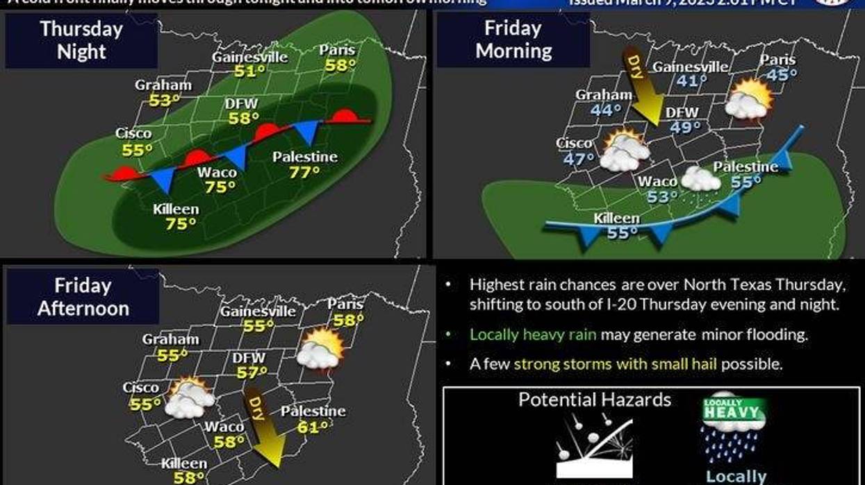
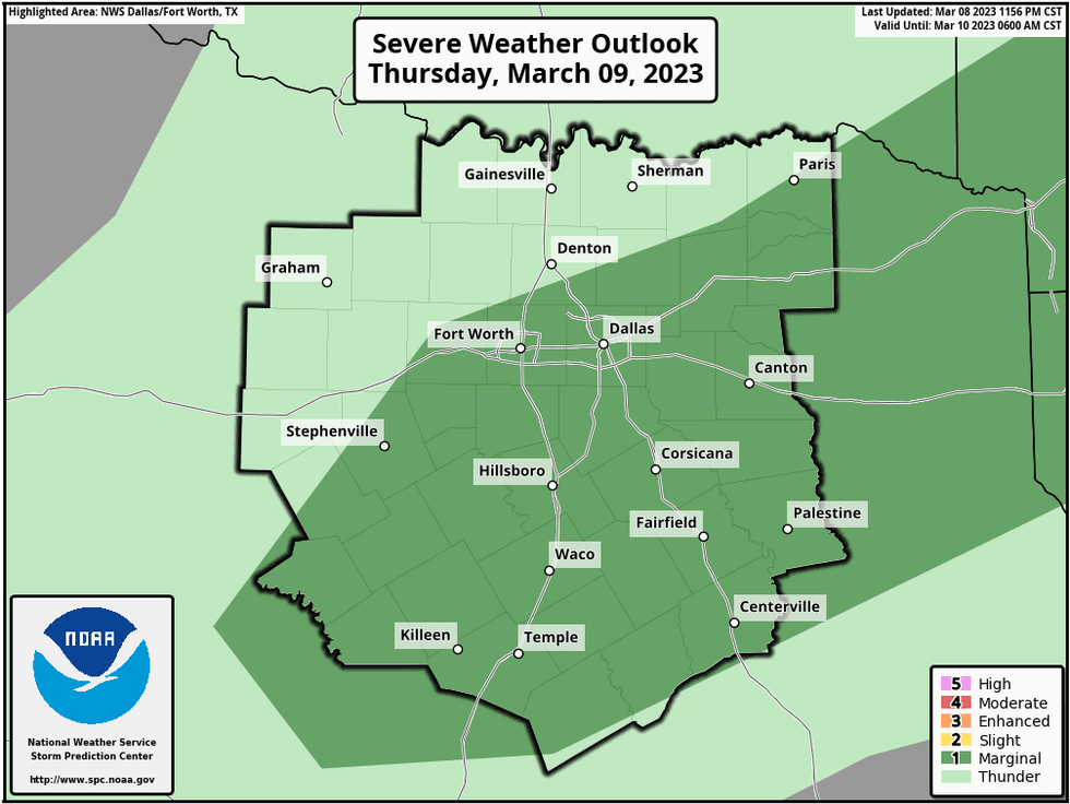
Parts of North Texas are at a marginal risk for severe weather Thursday afternoon through Friday morning, according to the National Weather Service. Scattered showers and thunderstorms began Thursday afternoon.
There is a slight chance for thunderstorms along and south of U.S. Highway 380 before 7 p.m.
By this evening, another cold front will approach the area increasing our rain chances. A couple of these storms could become severe, especially along and south of Interstate 30. Hail and wind will be the threats.
 National Weather Service - Storm Prediction Center
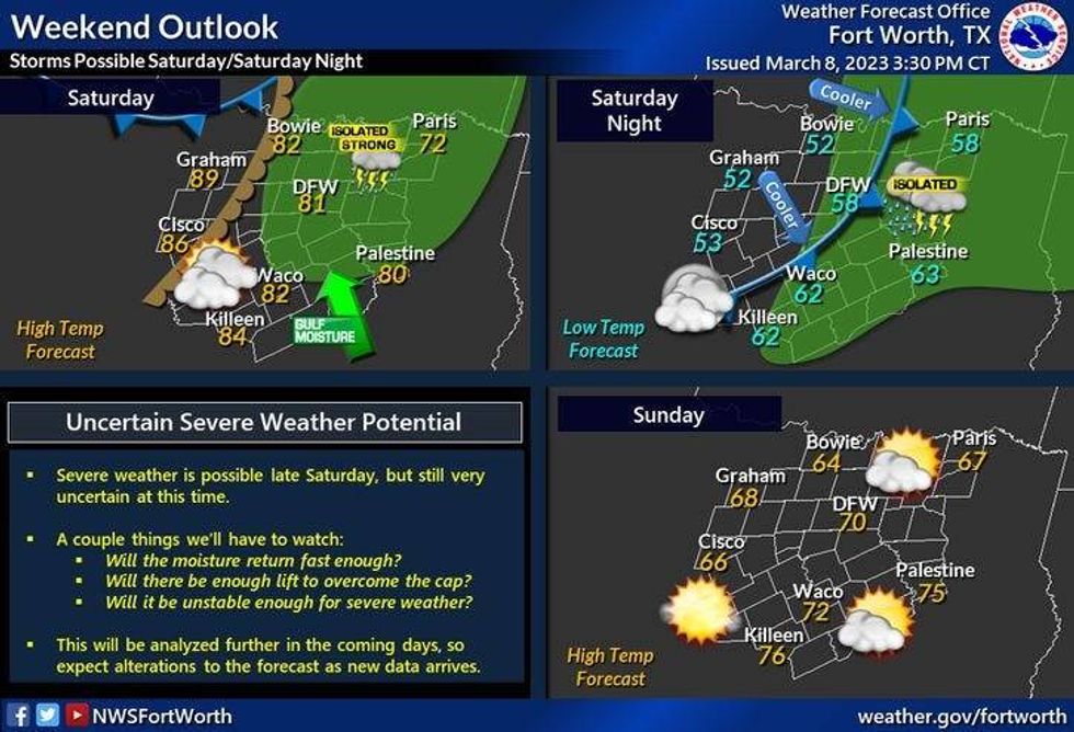
Clouds will decrease Friday morning with morning lows between 44 and 50 degrees. Plenty of sunshine will greet you during the day with high temperatures in the mid-60s. A big warm-up is coming for Saturday, just in time for the Greenville Avenue Saint Patrick's Day parade. Afternoon highs will kiss the 80-degree mark.
 National Weather Service - Fort Worth
Another cold front comes into the area late Saturday night, bringing a slight chance for showers and storms. Sunday looks windy and cool, with highs in the low to mid-60s.
Clouds increase on Monday holding the temperatures down into the mid to upper 50s. There may also be some rain on the radar, but most of it will not reach the ground as the air will be too dry.
Tuesday and Wednesday will continue to be nice and dry, as a slow warm up unfolds.
*Yest Rain: 0.01"; Yest High: 63; Low: 52
*Today's Averages: High: 66; Low: 46
*Record high: 100 (1911); Record low: 20 (1996)
*March Rain: 0.83"; Deficit: 0.07"
*2023 Rain: 6.18"; Deficit: 0.01"
*Sunrise: 6:46am; Sunset: 6:31pm
Today: *Dense Fog Advisory through 9am* Morning drizzle and fog, then cloudy and a tad warmer. A few spotty showers. High: 60-70. Wind: SW 5-10 mph.
Tonight: Cloudy, turning cooler late. Scattered showers and strong storms from 6pm - 6am. Best chance along and south of DFW. Low: 44-50. Wind: NNE 10-20 mph.
Tomorrow: Morning clouds, afternoon sun. Cooler. High: Low to mid 60s. Wind: ENE 5-10 mph.
Saturday: Increasing clouds late, windy and warmer. Scattered showers and storms towards late evening. High: Near 80.
Sunday: Mostly sunny and cooler, but seasonable. High: Low to mid 60s.
Monday: Increasing clouds and cool. A few sprinkles. High: Mid to upper 50s.
Tuesday: Partly cloudy and pleasant. High: Low to mid 60s.
Wednesday: SUnny, breezy and warmer. High: Low to mid 70s.

LISTEN on the Audacy App
Tell your Smart Speaker to "PLAY 1080 KRLD"
Sign Up to receive our KRLD Insider Newsletter for more news