


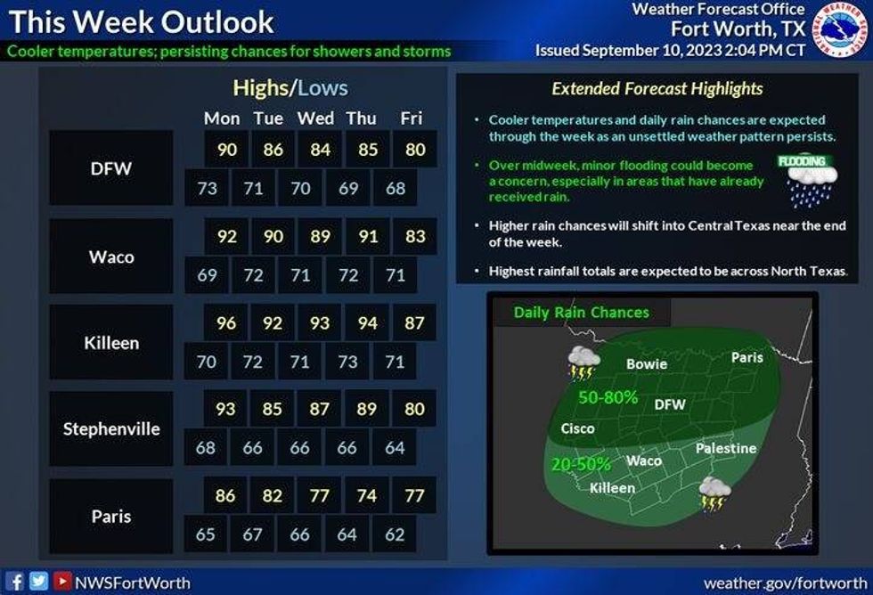
We have a chance of rain and cooler temperatures over the next 4 days across North Texas.
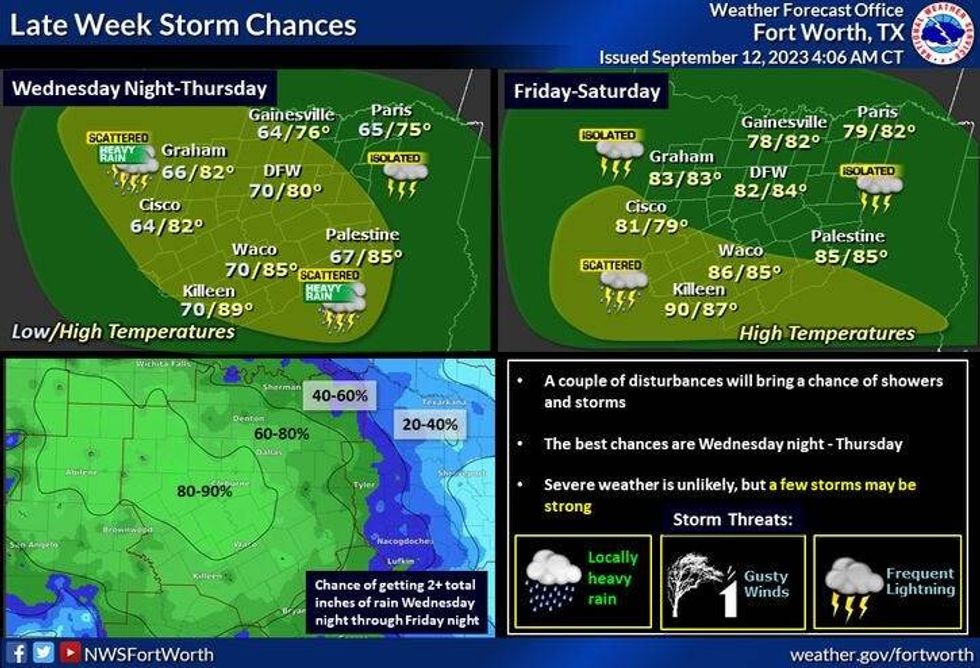
The cold front is now sagging south of the Dallas-Fort Worth area Tuesday morning and a north wind has taken over. I'm also going to be tracking several upper level disturbances that will be riding in the upper level northwest flow through Saturday morning. It's hard to pinpoint exactly where the heaviest rain will fall over the next 4 days so I'll do my best.
The first wave of rain working its way through the area this morning is very scattered in nature. The second wave develops to our west overnight tonight and moves across the southern half of north Texas, mainly along and south of Interstate 30 through the first half of tomorrow.
 National Weather Service - Fort Worth
The next wave moves in late Wednesday night into Thursday across North Texas. The next wave will move across the southern half of North Texas late Thursday into Friday and the last wave will most likely take the same track Friday night into early Saturday. Right now, it looks like the one to two inch rainfall totals will be south and west of DFW. DFW and points will most likely receive close to an inch of rain through the period.
 National Weather Service - Fort Worth
Temperatures will struggle to get above 80° through Friday. By Saturday, we'll be in the mid 80s...pushing 90° on Sunday, low 90s on Monday. No triple digits are in the forecast over the next 7 days.
*Yest Rain: 0.02"; Yest High: 91; Low: 74
*Today's Averages: High: 90; Low: 70
*Record high: 103 (2011): Record low: 50 (1902)
*September rain: 0.25"; Deficit: 0.84"
*2023 Rain: 15.08"; Deficit: 10.56"
*Sunrise: 7:10am; Sunset: 7:39pm

Today: Morning showers, peaks of afternoon sun. High: Upper 70s. Wind: North 10-25 mph.
Tonight: Scattered showers and storms toward daybreak. Low: 65-70. Wind: NNE 5-10 mph.
Tomorrow: Scattered showers and isolated storms. Heaviest south of I-30. Nothing severe expected. High: Upper 70s. Wind: NNE 5-10 mph.
Thursday and Friday: Scattered showers and isolated storms. Pleasant. High 78-82.
Saturday: Partly cloudy and a bit warmer. Isolated showers and storms, mainly in the morning. High: Low to mid mid 80s.
Sunday: Partly cloudy and a bit warmer. High: Upper 80s.
Monday: Mostly sunny and warm. High: Low 90s.
LISTEN on the Audacy App
Tell your Smart Speaker to "PLAY 1080 KRLD"
Sign Up to receive our KRLD Insider Newsletter for more news
Follow us on Facebook | Twitter | Instagram | YouTube


