


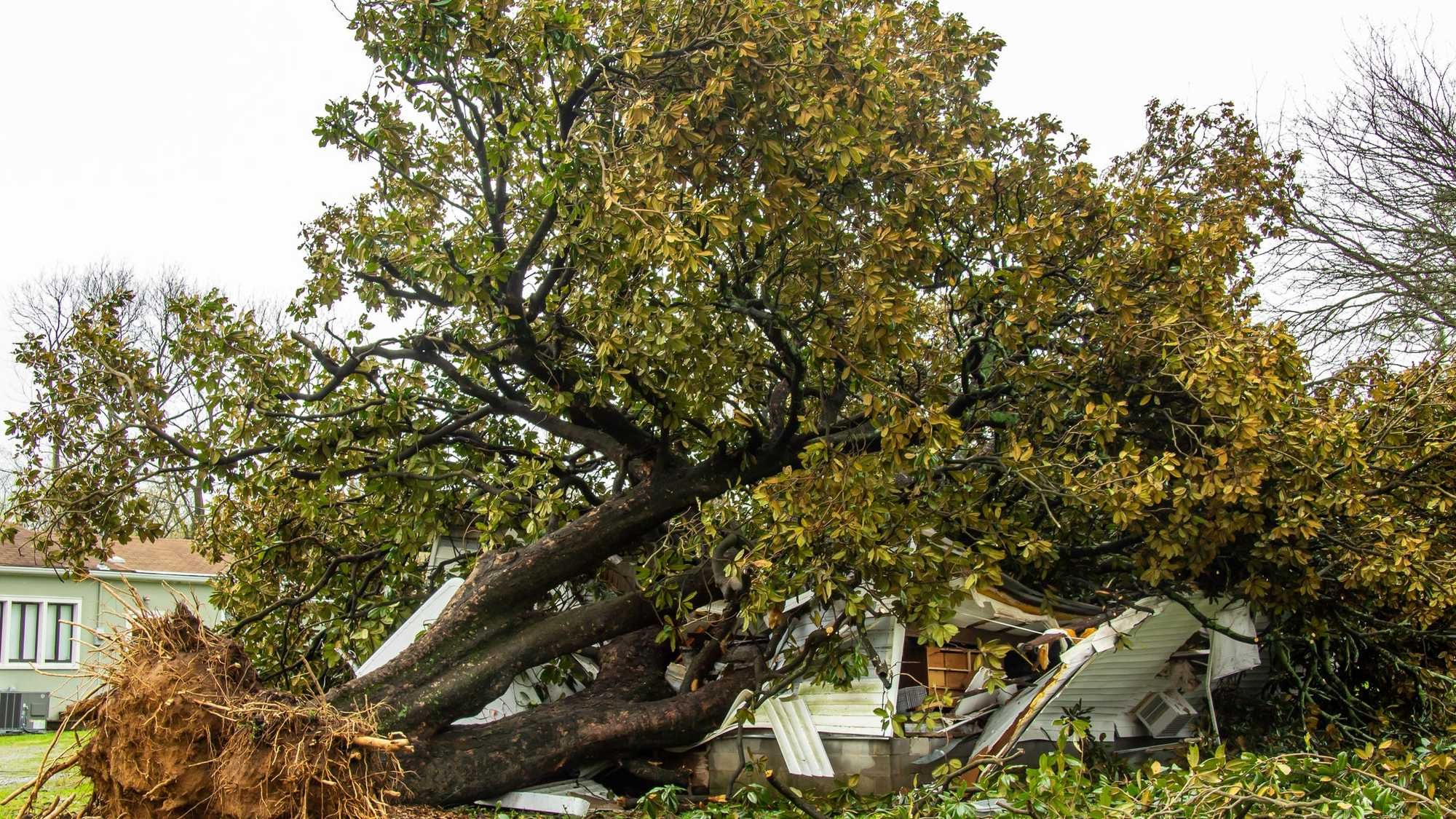
It was a pretty rough late afternoon and evening yesterday across north and east Texas and especially central Texas, where a large tornado did a lot of damage, injuring 23 people west of Salado, TX.
As you probably have seen all over social media, 5.5" hail fell in the Salado area. The state record is 6.4" that fell in Hondo Texas in late April of 2021. Hail that size can fall up to a 100 mph, causing catastrophic devastation in its path. Picture taken by Gina Brown, Salado, TX
Things have quieted down this morning, as clouds have rolled back in and temperatures are very mild and muggy. Readings have settled into the low to mid seventies.
I'm also tracking a cold front right now heading towards Wichita Falls. It's due to arrive a little later than I thought at this time yesterday. ETA sometime by late morning.
There is a slight chance of a thin line of showers and storms, non severe, to form either right on top of us or just south and east of us by late morning.
Skies will clear rapidly behind the front, dry air will filter in and temperatures will be cooler this afternoon, with temps falling through the seventies.
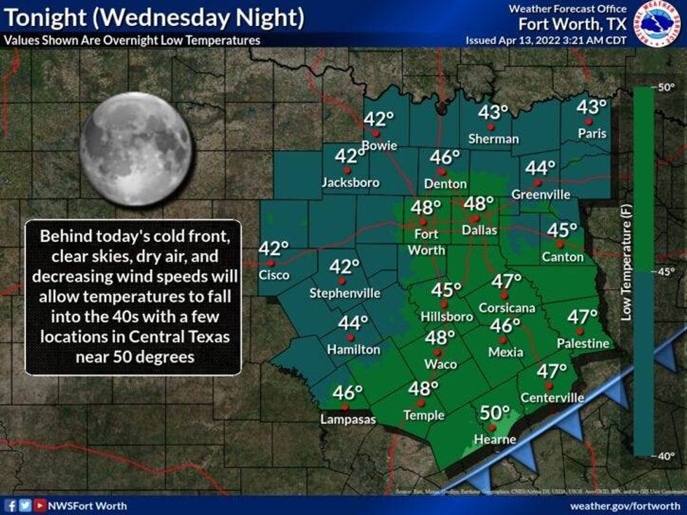 Wednesday night weatherNational Weather Service - Fort Worth
It would be a good idea to bring your potted plants indoors tonight and cover your gardens, especially north and east of the DFW area. Temperatures may fall into the upper thirties in some locations. By the way, today is the latest freeze we've ever felt here across north Texas, when temperatures fell to 30゚ back in 1957.
A beautiful day is in store for all of us tomorrow with plenty of sunshine and highs in the mid seventies.
Warmer temperatures are in the forecast for Friday with readings in the low to mid eighties
The weekend forecast is tricky. I know it's a holiday weekend for everybody, but a cold front will flirt with us on Saturday and Sunday. There may be a big temperature extreme from the Red River down towards Hillsboro. This front is forecast to stall late Saturday and Sunday. Some scattered showers and storms may form along the front, but it's still too early to tell. Either way, this weekend shouldn't be too bad with highs between 75 and 85 from north to south.
This front will get the kick it needs on Monday and blow through the entire area, clearing us out and cooling us off into next week.
*Yest Rain: 0.25"; *Yest High: 84; Low: 66
*Today's Averages: High: 76; Low: 54
*Record high: 93 (1936, 1972); Record low: 30 (1957)
* April rain: 1.58"; April surplus: + 0.41"
*2022 Rain: 5.81"; 2022 deficit: 3.95"
*Sunrise: 7:00am; Sunset: 7:58pm
Today: Morning clouds and muggy. Slight chance for showers and storms before noon, then decreasing clouds, windy and cooler. Lower humidity. High: Upper 70s. Wind: NNW 15-25, G30 mph
Tonight: Protect plants and gardens!! Clear and chilly. Low: 38-45. Wind: Variable 5-10.
Tomorrow: Sunny and beautiful. High: Mid 70s. Wind: SSE 10-15 mph
Friday: Mostly sunny and warmer. High: Low to mid 80s.
Saturday: Partly cloudy and pleasant. Slight chance for showers and storms late. High: Near 80.
Easter Sunday: Partly cloudy and nice. Slight chance for showers and storms. High: Low 80s.
Monday: Partly cloudy, windy and cooler. High: Mid 70s.
Tuesday: Mostly sunny and perfect. High: Near 80.
LISTEN on the Audacy App
Sign Up and Follow NewsRadio 1080 KRLD


