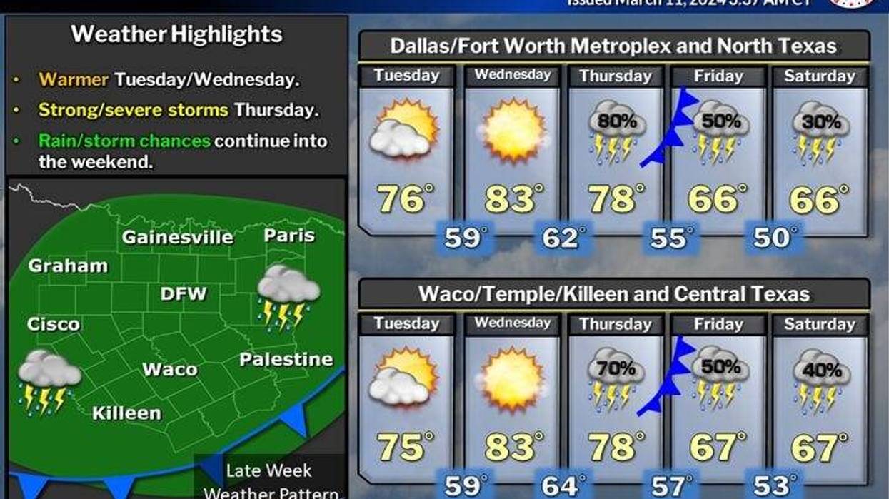
Our Tuesday morning temperatures are in the upper 40s to mid-50s with passing high clouds. Sunny and beautiful today with highs in the mid-70s. A south wind may gust to 30 mph.
Wednesday is partly cloudy, windy, and warmer. Afternoon highs will reach the low to mid-80s. The warmest temperatures will be out west of I-35W.
 National Weather Service - Fort Worth
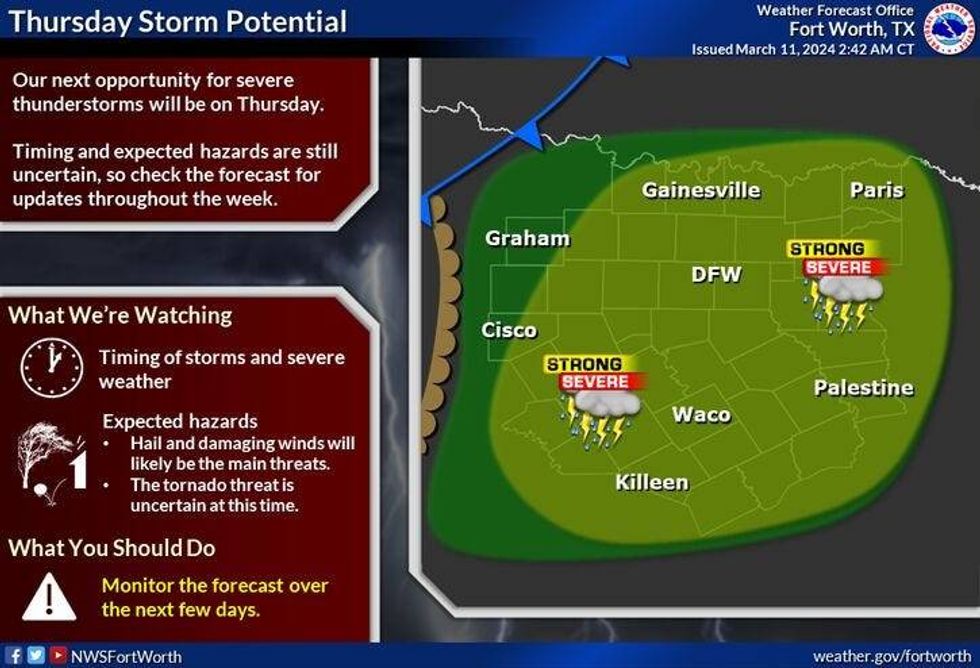
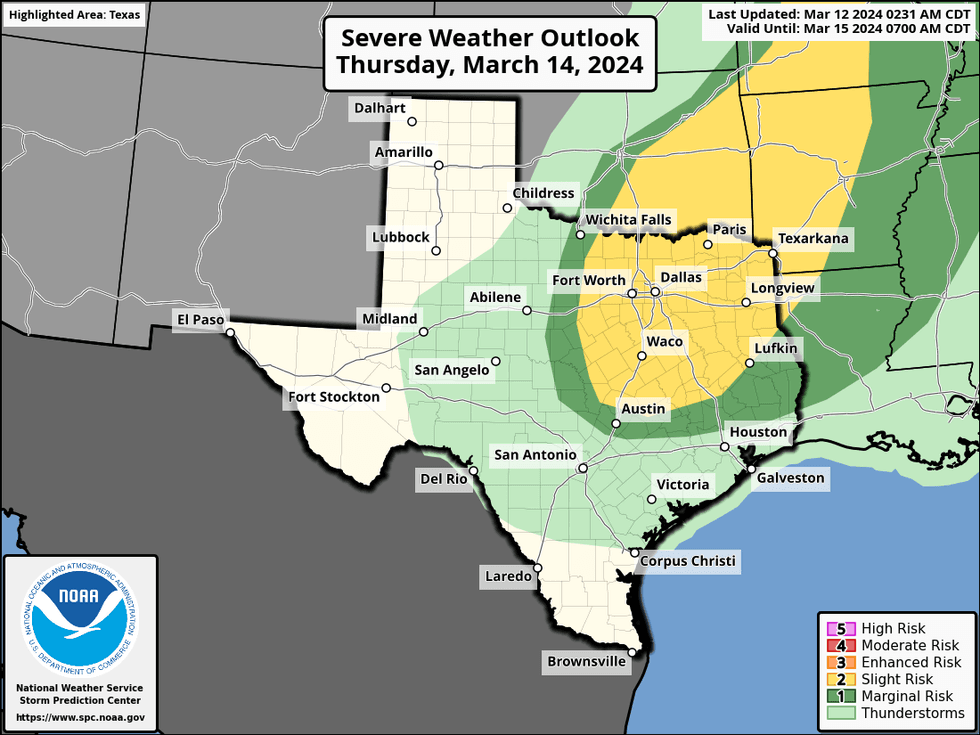
Most of Thursday looks decent with highs near 80 degrees however, a strong cold front arrives towards the late evening bringing a good chance for showers and storms out ahead of it. Some of these storms may become severe.
 NOAA / National Weather Service - Fort Worth
Friday and Saturday look partly to mostly cloudy and cooler with highs in the low to mid 60s. There will be a few showers around, but the heavier rain will stay to the south of DFW.
St Patrick's Day looks decent under a partly cloudy sky. Afternoon highs will top out in the mid to upper 60s. This is average for this time of the year.
Another stronger front will arrive on Monday bringing much cooler air into the area and a threat of more rain.
*Yest Rain: 0.00"; Yest High: 70; Low: 48
*Today's Averages: High: 67; Low: 47
*Record high: 91 (1918); Record low: 14 (1948)
*March Rain: 2.77"; Surplus: 1.55"
*2024 Rain: 7.91"; Surplus: 1.40"
*Sunrise: 7:42am; Sunset: 7:34pm
LISTEN on the Audacy App
Tell your Smart Speaker to "PLAY 1080 KRLD"
Sign Up to receive our KRLD Insider Newsletter for more news
Follow us on Facebook | Twitter | Instagram | YouTube