I hope you've enjoyed the below average temperatures, because a return to above average readings are in your 7 day forecast.
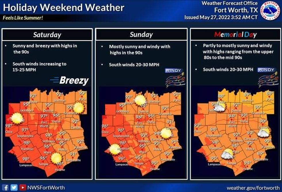
Plenty of sunshine will greet you today through the holiday weekend. South winds will pick up with gusts to 30 mph Sunday and Memorial Day. The wind will be light and variable today. This has prompted an air quality alert to be issued for most of north Texas. Please limit your outdoor activity during peak heating.
Afternoon highs today will touch the 90 degree mark. Mid 90s Saturday through Memorial Day.
 Weekend WeatherNational Weather Service - Fort Worth
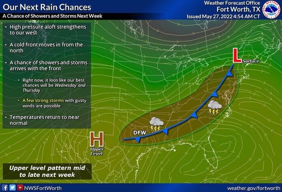
By late Tuesday, a cold front will flirt with North Texas increasing rain chances, especially towards the Red River Valley. This front will slowly creep south of I-20 and most likely stall on Wednesday and Thursday. There is a chance for a few late-day showers and storm each day. High temperatures Tuesday and Wednesday will be in the low 90s, cooling into the upper 80s on Thursday.
*Yest Rain: 0.00"; *Yest High: 88; Low: 54
*Today's Averages: High: 87; Low: 68
*Record high: 103 (1928); Record low: 47 (1901)
* May rain: 3.00"; May deficit: 1.03"
*2022 rain: 9.77"; 2022 deficit: 6.07"
*Sunrise: 6:22am; Sunset: 8:29pm
 Next rain chancesNational Weather Service - Fort Worth
Today: *Air Quality Alert Today* Sunny and warm. High: Near 90. Wind: Lt. Var.
Tonight: Clear and mild. Low: Mid to upper 60s. Wind: ESE 5-10 mph.
Tomorrow: Sunny, breezy and warmer. High: Mid 90s. Wind: South 15-25 mph.
Sunday and Memorial Day: Sunny, windy and continued hot! Highs: Mid 90s.
Tuesday - Thursday: Mostly sunny, windy and hot. Slight chance for a late day shower or storm. High: Upper 80s to Low 90s.

LISTEN on the Audacy App
Sign Up and Follow NewsRadio 1080 KRLD