We're waking up to temperatures in the 50s again this morning, so a light jacket will be necessary. Plenty of sunshine will dominate your day today with afternoon highs near 80 degrees.
A few clouds roam the sky overnight tonight with morning lows 55 - 60 degrees.
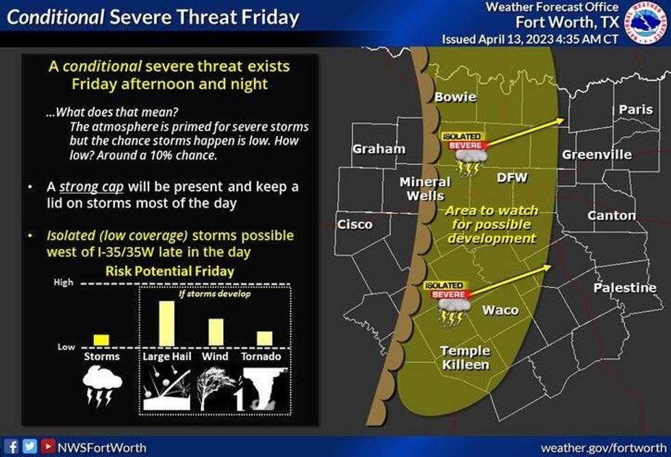
The wind picks up on Friday with afternoon highs in the low 80s. There is a very slight chance of a severe storm along the dryline as it approaches from the west tomorrow evening. However, coverage is only ten percent due to a strong cap in place.
 National Weather Service - Fort Worth
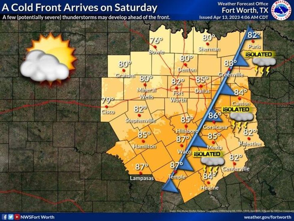
A cold front comes through the area before noon on Saturday. This will usher in cooler- drier air for the weekend. Afternoon highs will reach the middle seventies on Saturday, low seventies on Sunday after morning lows and the 40s across much of the area.
 National Weather Service - Fort Worth
Monday through Wednesday look uneventful, for now. Afternoon highs Monday and Tuesday will reach eighty degrees, low eighties for Wednesday.
*Yest Rain: 0.00"; Yest High: 79 Low: 54
*Today's Averages: High: 76; Low: 54
*Record high: 93 (1936, 1972); Record low: 30 (1957)
*April Rain: 0.60"; Deficit: 0.57"
*2023 Rain: 8.71"; Deficit: 1.05"
*Sunrise: 7:01am; Sunset: 7:57pm
Today: Mostly sunny and beautiful. High: Near 80. Wind: South 5-10 mph.
Tonight: Partly cloudy, breezy and mild. Low: 55-60. Wind: SSE 10-20 mph.
Tomorrow: Partly cloudy, windy and warm. A very slim chance of an isolated severe storm by evening. High: Low 80s. Wind: South 15-25, G30 mph.
Saturday: Morning cold front. Sunny, windy and cooler. Lower humidity. High: Mid 70s.
Sunday: Sunny and perfect. Low humidity. High: Low to mid 70s.
Monday and Tuesday: Partly cloudy and a bit warmer. High: Near 80.
Wednesday: Partly cloudy, windy and warm. Highs: Low to mid 80s.

LISTEN on the Audacy App
Tell your Smart Speaker to "PLAY 1080 KRLD"
Sign Up and Follow NewsRadio 1080 KRLD
Facebook | Twitter | Instagram