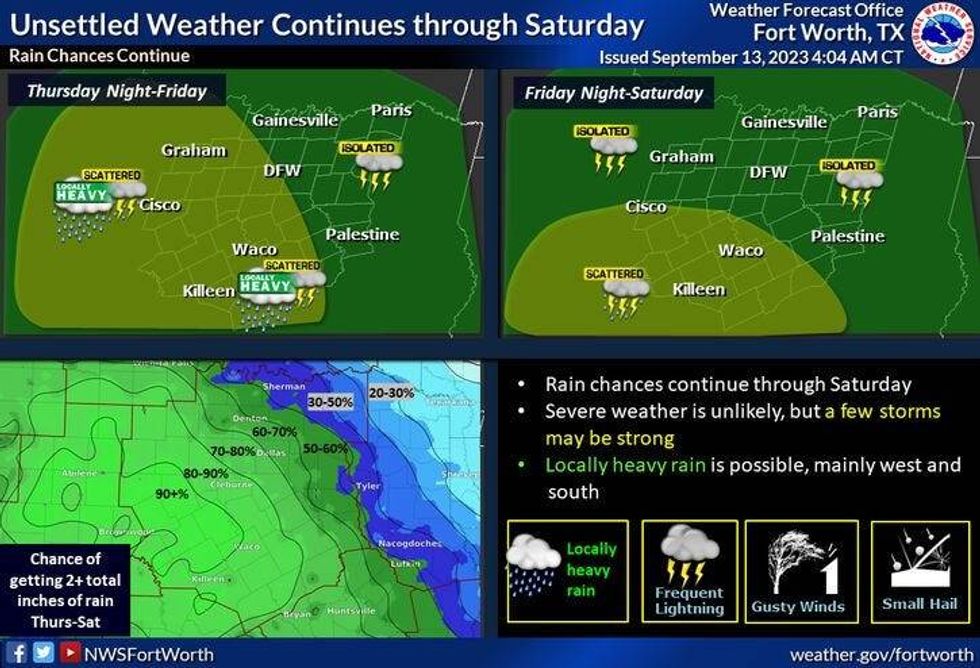
Several upper-level disturbances will propagate across the Lone Star State through Saturday, producing scattered showers and isolated non-severe thunderstorms for large parts of the state.
We're waking up to areas of light rain that continue to work their way across north Texas from west to east but will end by mid-morning north of I-20. Another wave of light to moderate rain will move across areas south of I-20 late this morning through the afternoon. Afternoon highs will top out in the low 80s.
The next disturbance will rapidly move in from the west on the heels of this morning's, producing widespread moderate to heavy rain towards midnight through noon Thursday.
A lot of areas will pick up an inch of rain with isolated higher totals south of DFW, though nothing severe is expected. Afternoon highs on Thursday will only be in the upper 70s.
A third disturbance will work its way across the northern half of the state Friday evening into Saturday morning. As of now, it looks like the more widespread rain will stay west and south of DFW. Friday's high will be near 80°.
A few leftover showers are possible before noon on Saturday before a weak cold front moves through the area. Unfortunately, there will be no cool air behind the front, but the air will dry out significantly through the latter half of the weekend. Saturday's high will be in the mid-80s, upper 80s for Sunday with pleasant mornings.
 National Weather Service
Today: Morning showers, then scattered afternoon showers, mainly south of DFW. High: Low 80s. Wind: NE 5 mph.
Tonight: Scattered showers and storms towards midnight. Low: Near 70. Wind: ESE 5 mph.
Tomorrow: Scattered showers and isolated storms through noon. Up to an inch in some areas. Isolated higher amounts are possible, especially south of DFW. Nothing severe is expected. High: Upper 70s. Wind: SE 5 mph.
Friday: Scattered showers and isolated storms. High: Low 80s.
Saturday: Isolated showers and storms, mainly in the morning, then partly cloudy and pleasant. High: Mid 80s.
Sunday: Partly cloudy and a bit warmer. High: Upper 80s.
Monday and Tuesday: Mostly sunny and warm. High: Low 90s.
LISTEN on the Audacy App
Tell your Smart Speaker to "PLAY 1080 KRLD"
Sign Up to receive our KRLD Insider Newsletter for more news