Welcome rain has fallen all across north Texas over the past 24 hours. Anywhere between 1" to 5" of rain has fallen, with the heaviest totals along the 2 county rows bordering the Red River, just north of DFW. Officially at the airport, 1" of rain has fallen.
Radar trends continue to show this area of rain slowly moving south and east of Dallas and Fort Worth through the morning. The sky will slowly decrease in cloud cover through the day.
We're starting off in the upper fifties this morning, but we'll only warm into the upper sixties by this afternoon, with the north wind gusting the 30mph. It will be a cool and breezy day today.
 National Weather Service - Fort Worth
For tonight, skies will be clear and temperatures will fall into the upper forties to low fifties, with a north wind 10-20mph.
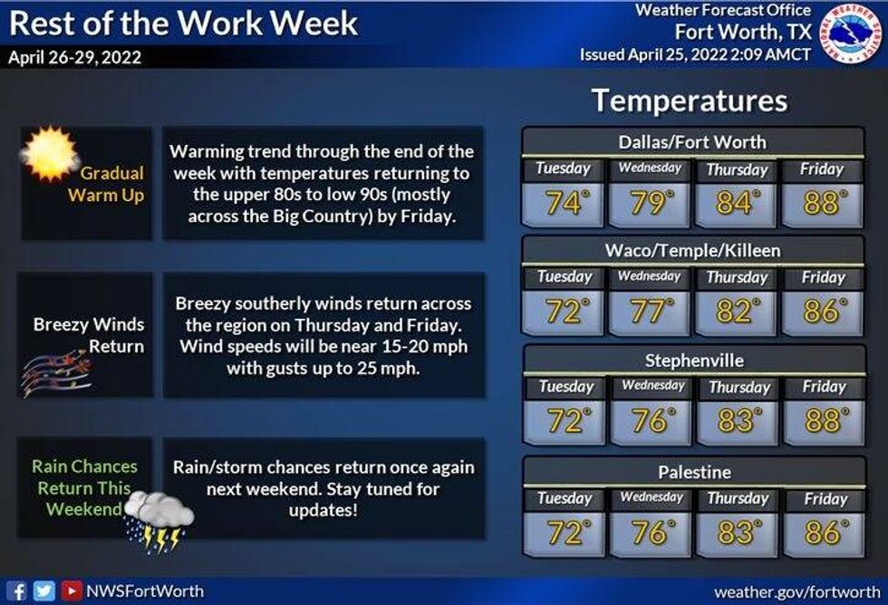
Tomorrow and Wednesday will be downright gorgeous! Plenty of sunshine will dominate with highs in the mid seventies tomorrow, pushing 80゚ by Wednesday.
A south wind will return Wednesday and will increase through the rest of the week and into the weekend. Highs on Thursday will be in the low to mid eighties, we'll push 90゚ on Friday and then back in the mid eighties on Saturday, near 80゚ on Sunday.
Our next storm system will produce some scattered showers and storms late Saturday, but a more widespread rain event may occur on Sunday. We're still days away from this possible event and it is subject to change.

LISTEN on the Audacy App
Sign Up and Follow NewsRadio 1080 KRLD