We're waking up to a cloudy sky, temperatures in the low 40s, and rain is starting to break out to our south and west. This trend will continue through the morning and afternoon as a strong upper level storm system cruises across the Texas Panhandle into Oklahoma through the day.
Widespread showers with rumbles of thunder will continue to affect north Texas through the morning and into the afternoon. As this system cruises east of Oklahoma City this evening, the bulk of the rain will press east of the DFW area, but some wrap-around moisture may bring some snow flurries to the Red River counties before ending by midnight. Temperatures will hold steady in the upper 30s to low 40s all day long.
 National Weather Service - Fort Worth
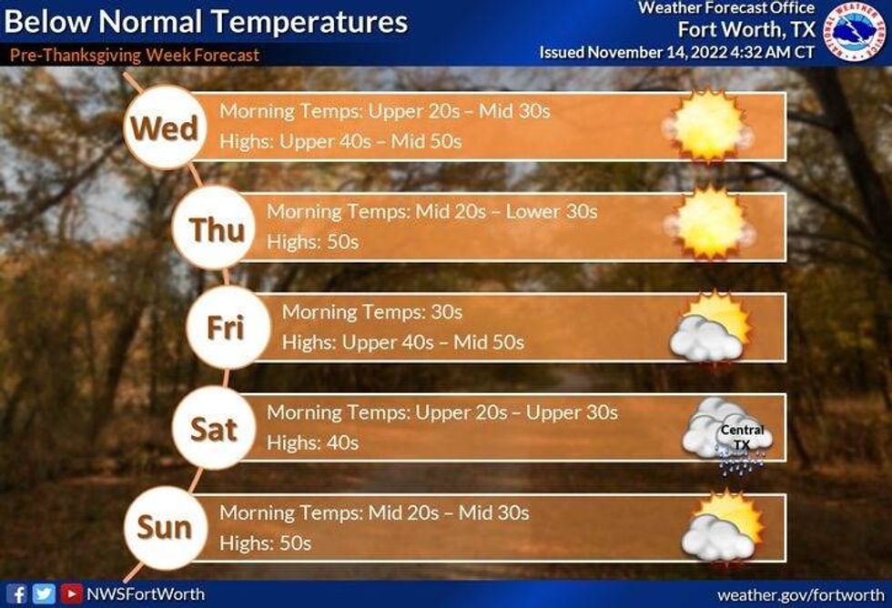
Tuesday through Thursday look decent with passing high clouds and chilly temperatures. Morning lows will be in the 30s and afternoon highs tomorrow will only reach mid to upper 40s, low to mid 50s for Wednesday and Thursday.
By Friday, another cold front will edge through the area dropping temperatures to near 50 for highs. There will be a few showers in central Texas down towards the Texas coast on Saturday, but as of now, it looks like this system will pass too far to the South to give us more welcome precipitation. It will be colder on Saturday with highs only in the mid 40s, near 50 with sunshine on Sunday.
Believe it or not, a slow warm up is in store for us Thanksgiving week, as temperatures try to creep towards the average high in the mid-60s.
*Yest Rain: 0.00"; High: 54; Low: 33
*Today's Averages: High: 67; Low: 47
*Record high: 89 (1989); Record low: 21 (1916)
*November rain: 3.56"; Surplus: 2.29"
*2022 Rain: 31.41"; 2022 deficit: 1.50"
*Sunrise: 6:58am; Sunset: 5:27pm
Today: Cloudy, breezy and cold. Widespread showers and a rumble possible. High: Steady in the low 40s. Wind: East 10-20.
Tonight: Snow flurries north of Hwy 380, then decreasing clouds, breezy and cold. Low: Low to mid 30s. Protect plants and pets. Wind: NNW 10-20 mph.
Tuesday: Mostly sunny, breezy and chilly. High: Mid to upper 40s. Wind: NNW 10-20 mph.
Wednesday: HIgh clouds and cool. High: Low 50s.
Thursday: High clouds, remaining cool. High: Mid 50s.
Friday: Partly cloudy and cool, late day cold front. No rain for now. High: Near 50.
Saturday: Partly cloudy, windy and chilly. Rain to the south of us. High: Mid 40s.
Sunday: Sunny, continued cool. High: Near 50.

LISTEN on the Audacy App
Tell your Smart Speaker to "PLAY 1080 KRLD"
Sign Up and Follow NewsRadio 1080 KRLD