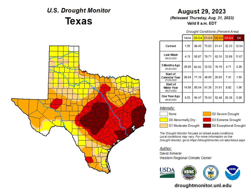
Record-breaking heat is expected today and tomorrow, with Excessive Heat Warnings in place across most of Texas.
Today's record is 104 degrees Fahrenheit, but forecasting shows today has the potential to hit a high of 105 degrees. Even more record-breaking is expected on Friday, with temperatures expected to hit upwards of 109 degrees, with the record being 100.
A backdoor cold front will slide in from the NE late Friday evening, bringing slightly cooler temperatures into the weekend. The best chances for strong storms will be just east and NE of the Dallas-Fort Worth area late Friday.
Some of these could sneak into the Central Expressway and I-45 corridors. It's doubtful they will make it as far west as Fort Worth and Denton, but it's not out of the question. It depends on the location of the outflow boundaries.
Next week, weather patterns will change big time as a couple of cold fronts will move into the area and bring temperatures down across the region.

Thursday: *Excessive Heat Warning* Mostly sunny and hot. Record (104) breaking heat. High: 105. Heat index: Near 110. Wind: Variable 5-10 mph.
Thursday night: Clear and warm. Low: Low 80s. Wind: South 10-15 mph.
Friday: *Excessive Heat Warning* Mostly sunny, breezy, and hot. Scattered late-day storms. More numerous NE of DFW. Record (100) breaking heat. High: 109. Heat index: 110+. Wind: SSW 10-20 mph.
Saturday and Sunday: Partly cloudy, not as hot. Isolated late-day showers and storms. High: Upper 90s.
Monday: Partly cloudy and hot. Scattered showers and storms by late evening along a cold front. High: Mid to upper 90s.
Tuesday: Cloudy and MUCH cooler. Scattered showers and storms. High: Mid-70s.
Wednesday: Mostly cloudy and nice. Scattered showers and storms, mainly south of DFW. High: Upper 70s.
LISTEN on the Audacy App
Tell your Smart Speaker to "PLAY 1080 KRLD"
Sign Up to receive our KRLD Insider Newsletter for more news


