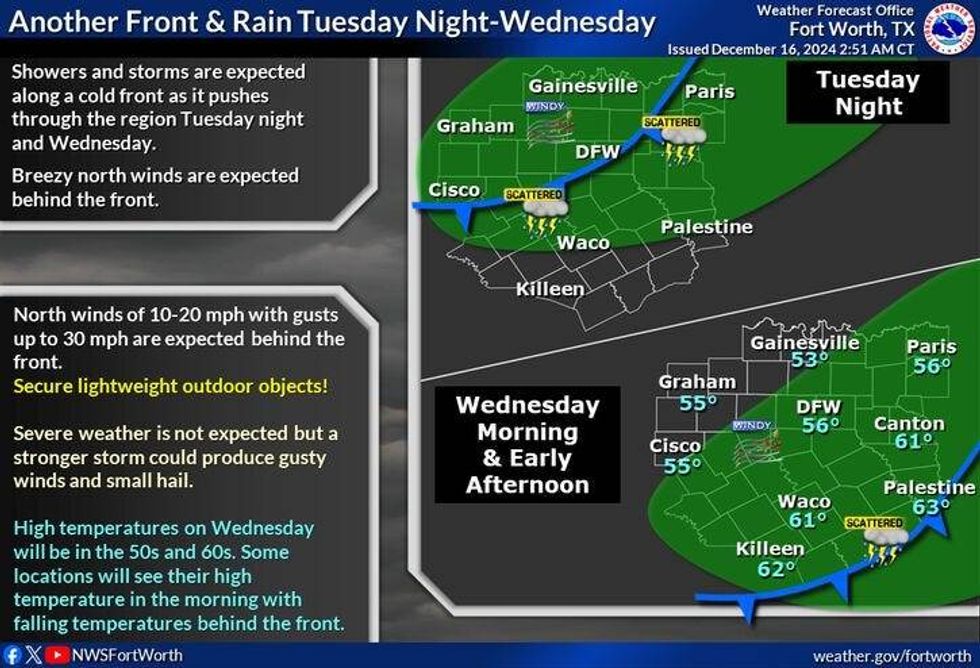
Scattered showers and isolated storms are in the forecast today and Wednesday morning, and then chilly mornings and cool afternoons are in the cards Thursday through the weekend.
DFW reached 78° yesterday. That's 20° above average for this time of the year. We're waking up this morning to readings in the upper 60s. That's 30° above average for this time of the year. Scattered showers will continue to develop across the southeastern half of the area through the morning hours. By this afternoon, a weak cold front will come into the area producing a thin line of showers and non-severe storms very close to your commute home. Afternoon highs will reach the mid-70s!
Skies may briefly clear tonight, but clouds will roll back in tomorrow morning. We'll start the day off in the upper 40s to low 50s, we'll end the day with plenty of cloud cover. High temperatures will reach the low to mid 60s.
A strong cold front will arrive by noon Wednesday, bringing with it a thin line of showers and non severe storms. Skies will rapidly clear by afternoon. Afternoon highs will occur in the morning hours with readings in the mid 60s, falling into the 50s during the day. A north wind will gust to 30 mph.
 NWS
NWS
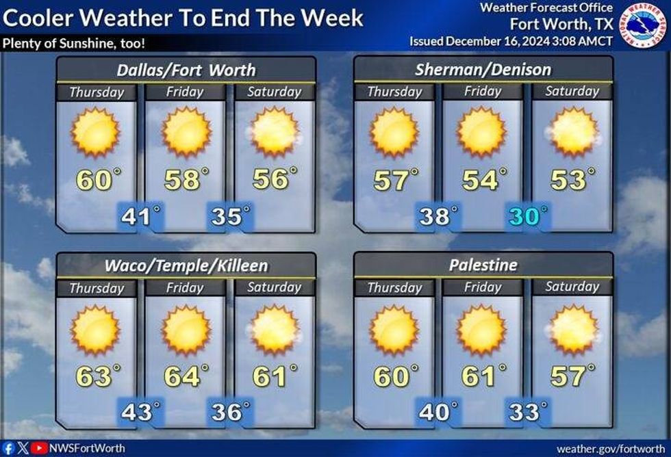
Protect your plants before going to bed Wednesday evening. Thursday morning lows are forecast to be in the upper 20s to low 30s. Sunny and cool by afternoon with highs in the low to mid 50s. It'll feel more like fall as dry air continues to filter into the area.
 NWS
NWS
Chilly mornings and cool afternoon's will be our weather story Friday through the weekend. Highs will be in the 50s, with morning Lows in the 30s.
Have a terrific work week and please enjoy the weather when you can, it's the only weather you've got!
_________________________
7-Day Headlines:
* DFW Airport reached 78 yesterday.
* Scattered showers today.
* More showers and isolated storms Wednesday.
* Cooler/drier air moves in Wednesday afternoon.
* Light freeze Thursday morning.
* Chilly mornings, cool afternoons Thursday morning - Sunday.
_____________________________________________________
*Yest Rain: 0.00"; Yest High: 78; Low: 48
*Today's Averages: High: 58; Low: 38
*Record high: 83 (1908); Record low: 12 (1989)
__________________________________________________________
*December Rain: 0.98"; Deficit:
*2024 Rain: 36.86"; Surplus: 1.34"
*Sunrise: 7:24am; Sunset: 5:24pm
__________________________________________________________
Today: Cloudy and VERY mild for this time of the year. Scattered morning showers, then scattered afternoon showers and isolated non-severe storms. High: Mid 70s. Wind: South to north 10 mph.
Tonight: Mostly cloudy and cool. Low: 48-52. Wind: North 5-10 mph.
Tomorrow: Mostly cloudy and cool. A few light showers. High: Low to mid 60s. South 5-10 mph.
Wednesday: Morning clouds and mild. Scattered showers and isolated non-severe storms through noon, then decreasing clouds, windy and cooler. High: Mid 60s early, then falling into the 50s.
Thursday: Morning light freeze. Sunny, windy and colder. High: Mid 50s.
Friday and Saturday: Sunny and cool. High: Mid 50s.
Sunday: Sunny and cool. High: Near 60.
LISTEN on the Audacy App
Tell your Smart Speaker to "PLAY 1080 KRLD"
Sign Up to receive our KRLD Insider Newsletter for more news
Follow us on Facebook | Twitter | Instagram | YouTube