Good morning my friends and welcome to Tuesday! The KRLD radar is fairly quiet across north Texas at this hour, but a few showers are dotting the area. This will change as the day wears on, as more widespread shower and thunderstorm activity develop anywhere across the area.
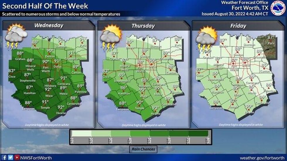
An upper level low is spinning across west Texas at this hour. This upper level low combined with a weak cold front going stationery, plus daytime heating will produce scattered showers and thunderstorms with locally heavy rain, especially during the daylight hours. This means morning, afternoon, and evening. Rainfall rates will exceed 3 inches per hour if something sits over your backyard for an extended period of time. Therefore, I can't rule out some areas of flash flooding over the next 7 days.
It's virtually impossible to say who exactly will see the heaviest rain and at what time. Just be prepared, keep an umbrella handy, and watch out for quick flooding, especially near creeks, streams, river valleys and in construction areas. Rainfall coverage should taper off a bit into the weekend, but I'm keeping it in the forecast.
Some areas may approach 90° if you see the sun for an extended period of time. 80s for highs if you have more cloud cover. Quickly dropping into the 70s if you see heavy rain in your area.
 National Weather Service - Fort Worth
As of right now, I wouldn't cancel your outdoor plans for the holiday weekend, but there will be some scattered showers and storms in the area. I'll have a better idea how widespread the rain may be as we head towards the end of the week.
*Yest Rain: 0.15"; *Yest High: 94; Low: 75
*Today's Averages: High: 93; Low: 74
*Record high: 106 (1954, 2000); Record low: 59 (1915)
*August rain: 10.53"; August surplus: 8.53"
*2022 Rain: 12.84"; 2022 deficit: 1.43"
*Sunrise: 7:02am; Sunset: 8:54pm
Today: Mostly cloudy and muggy. Scattered showers and storms. Pockets of VERY heavy rain. High: Near 90. Wind: Lt. Var.
Tonight: Mostly cloudy and muggy. A few leftover showers. Low: Mid 70s. Wind: Lt. Var.
Tomorrow: Mostly cloudy and muggy. Scattered showers and storms. Pockets of VERY heavy rain. High: Mid to upper 80s. WInd: Lt. Var.
Thursday and Friday. Partly to mostly cloudy, warm and humid. Scattered showers and storms. Pockets of VERY heavy rain. Highs: Upper 80s.
Holiday weeknd: Partly cloudy, warm and humid. Scattered showers and storms. HIghs: Near 90.

LISTEN on the Audacy App
Tell your Smart Speaker to "PLAY 1080 KRLD"
Sign Up and Follow NewsRadio 1080 KRLD