


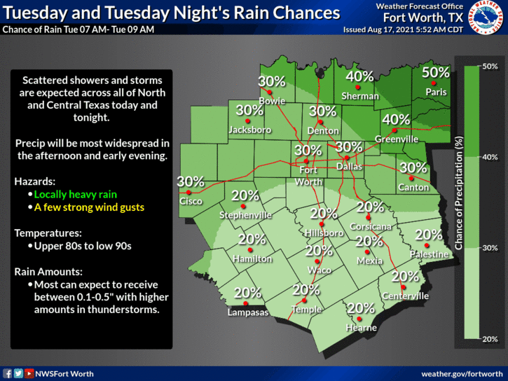
Lots of shower and thunderstorm activity lurking to our west. Look for for aerial coverage to rapidly increase as we heat up into the lower 90s later on this afternoon, lasting through this evening. Locally heavy rainfall, with some flooding, gusty wind and dangerous lightning will be the threats. The same conditions will be around for tomorrow.
Afternoon and evening showers and storms will become less numerous on Thursday and then we dry out and heat up into the weekend! High pressure in the upper levels will return once again.
The heaviest rain is to the northwest of DFW right now. It's moving northeast towards the Texas/Oklahoma border. More storms will fire along a boundary directly to our west later on this afternoon and slowly move through the area. Again, some flash flooding is possible in localized areas. One or two warnings are possible for wind.

LISTEN on the Audacy App
Sign Up and Follow NewsRadio 1080 KRLD


