


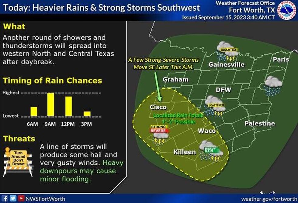
Two areas of rain could affect Texas on Friday. One area in West Texas is healthy and is moving east Friday morning, but a lot of the data is taking it southeast once it approaches Highway 281. Another area doesn't have much precipitation in it, but it may enhance over Friday morning and head east as well.
As of Friday morning, it looks like the heaviest rain, the 2-inch-plus rainfall totals, will stay west and south of the Dallas-Fort Worth area. Some rain across North Texas before the day is done can't be ruled out.
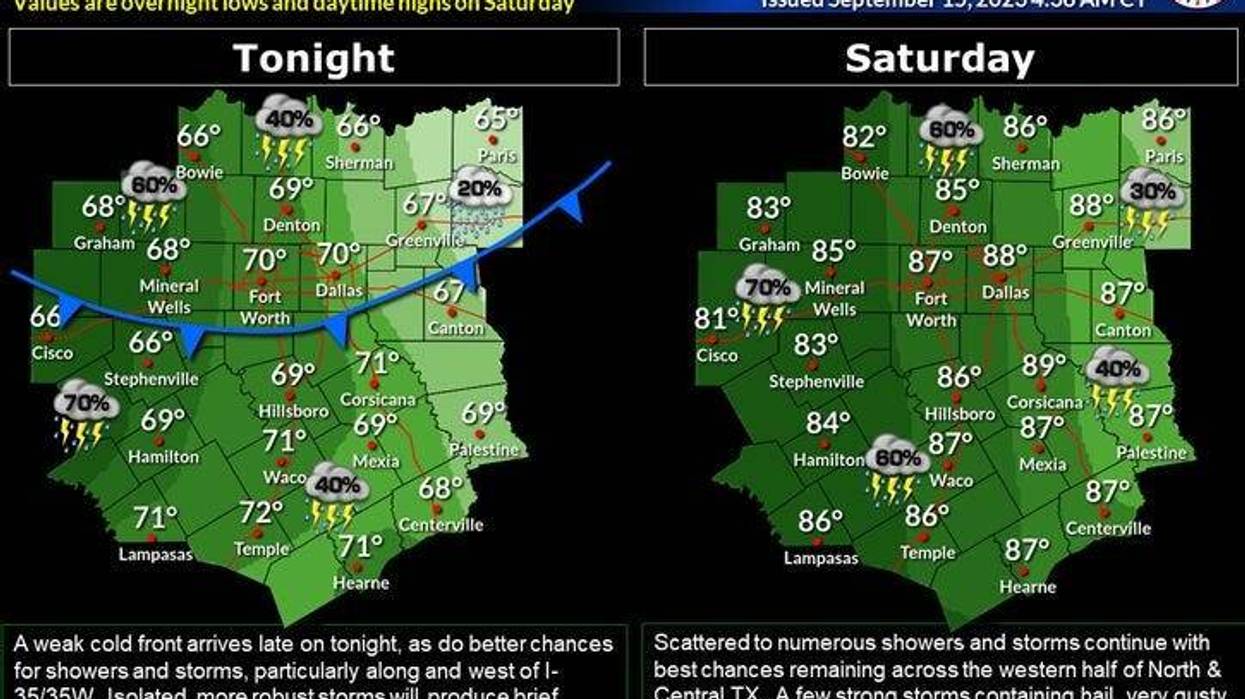
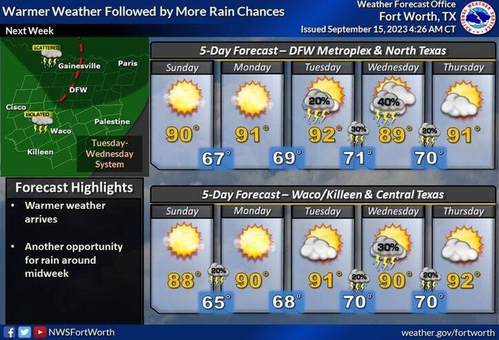
Another disturbance will roll out of West Texas Saturday, but as of now the heaviest rain will stay west and south of DFW once again. A cold front will slide through the area late Saturday bringing an end to the rain for a few days, but unfortunately, there's no cool air behind the front, just dryer air. This will allow temperatures to warm up during the afternoon hours, but keep the mornings pleasant Sunday through Tuesday. High temperatures will be in the upper 80s on Sunday, and low 90s on Monday and Tuesday.
By Tuesday night and Wednesday, a system will swing through the Plains States and try to drag a cold front through the area, but I don't think it'll make it. This front may be close enough to give us some showers and storms, especially along and north of Interstate 20 late Tuesday and Wednesday. Right now, I'm not overly confident this will happen.
Wednesday and Thursday will continue to be warm with highs near 90 degrees. Some extended data is hinting at a stronger cold front coming through by the beginning of the following week. That's still over 10 days out and it's subject to change, however, as we approach the end of September and early October, we usually see our first decent cold front come through the area.
 Five-day North Texas forecastNational Weather Service
7-Day Headlines
* DFW Airport reached 76 degrees yesterday.
* 10.81" rainfall deficit at DFW Airport!
* Isolated showers and storms today and tomorrow, heaviest west and south.
* No severe weather.
* Outdoor events a-go this weekend!
* Drying out and heating up Sunday into next week.
*Yest Rain: 0.03"; Yest High: 76; Low: 71
*Today's Averages: High: 89; Low: 69
*Record high: 100 (1965, 1980): Record low: 51 (1993)
*September Rain: 0.31"; Deficit:
*2023 Rain: 15.14"; Deficit:
*Sunrise: 7:12am; Sunset: 7:35pm
 North Texas rain chances for Friday, Sept. 15, 2023National Weather Service
Friday: Isolated showers and storms (heaviest west and south of DFW). High: Low to mid 80s. Wind: ENE 5 mph.
Friday night: Isolated showers. Low: Near 70. Wind: East 5 mph.
Saturday: Isolated showers and storms. Heaviest west and south of DFW. High: Mid 80s. Wind: East 5-10 mph.
Sunday: Partly cloudy and a bit warmer. High: Upper 80s.
Monday: Mostly sunny and warm. High: Low 90s.
Tuesday and Wednesday: Partly cloudy and warm. Slight chance of showers and storms. Highs: Low 90s.
Thursday: Partly cloudy, continued warm. High: Low to mid 90s
LISTEN on the Audacy App
Tell your Smart Speaker to "PLAY 1080 KRLD"
Sign Up to receive our KRLD Insider Newsletter for more news
Follow us on Facebook | Twitter | Instagram | YouTube


