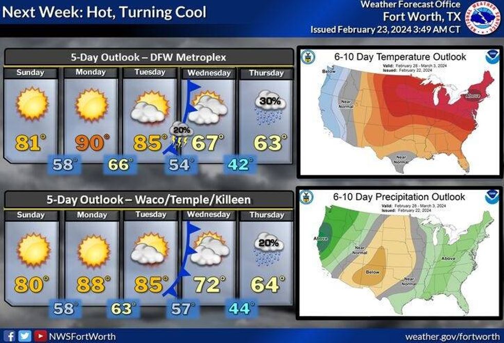
A string of nice days is ahead with a warming trend on the way through Tuesday. We cool off by the middle of next week with rain chances returning as well.
We start Friday with temperatures in the mid-40s to low 50s under a clear sky. There will be plenty of sunshine today and a spectacular afternoon is ahead. Daytime highs will reach near 70° with a north wind at 10 to 20 mph.
We're back in the 40s overnight, warming into the mid-70s with plenty of sunshine Saturday.
A south wind picks up on Sunday under a clear sky. Temperatures will warm rapidly into the low 80s with wind gusts to 30 mph.
 National Weather Service - Fort Worth
Believe It or not, we may tie the record high of 90° on Monday. Clouds invade on Tuesday with highs in the mid-80s.
 National Weather Service - Fort Worth
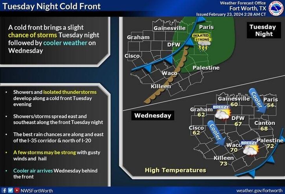
Our next weather change arrives early Wednesday morning as a pretty strong cold front blows through the area. There's a slight chance of rain along the front. Temperatures will start off in the upper 60s early, fall into the 40s by mid-morning, and back into the mid-50s by afternoon. A north wind will gust to 30 mph.
Clouds roll back in on Wednesday night with a chance of rain finally returning to the area. This rain looks to continue through Thursday afternoon before we clear out by evening. As of now, I'm going mid-50s for Thursday due to the cloud cover and rain in the area. *Please keep in mind this is a 7 day forecast and is subject to change.
*Yest Rain: 0.00"; Yest High: 81 Low: 61
*Today's Averages: High: 63; Low: 42
*Record high: 88 (2017); Record low: 16 (1901)
*February Rain: 1.88"; Deficit: 0.19"
*2024 Rain: 5.08"; Surplus: 0.48"
*Sunrise: 7:03am; Sunset: 6:20pm
LISTEN on the Audacy App
Tell your Smart Speaker to "PLAY 1080 KRLD"
Sign Up to receive our KRLD Insider Newsletter for more news
Follow us on Facebook | Twitter | Instagram | YouTube