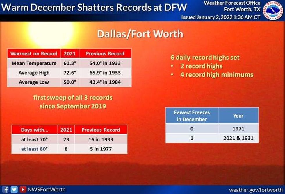
What a crazy New Year's weekend it was. It was also the 6th warmest New Year's Day on record...as we touched 73゚ in the early afternoon. By early Sunday morning, temperatures had fallen well down into the teens. Hope your pipes faired well.
 National Weather Service
It's another chilly start this morning, as readings have fallen into the teens and and low twenties across north Texas. At least the wind has relaxed!
Our weather story this week, a quick warm up, another cool down, and then we warm back up into the weekend. Unfortunately, no rain is in the forecast... at least through midday Sunday.
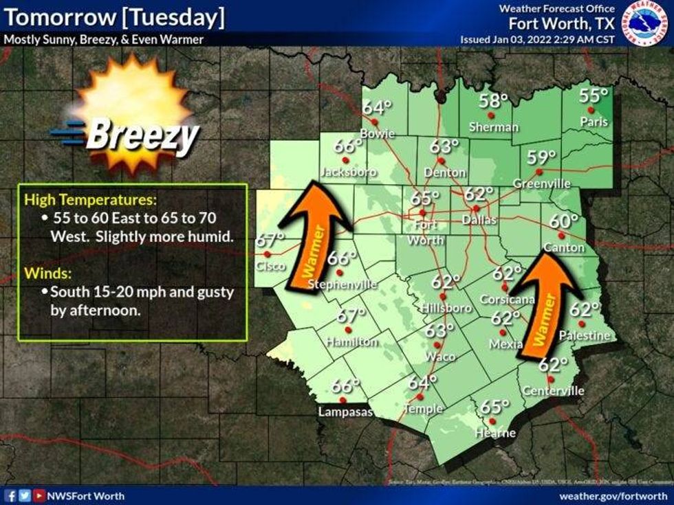
A south wind is back today and tomorrow, warming us up into the low fifties today. low to mid sixties for tomorrow... with plenty of sunshine.
 NWS
NWS
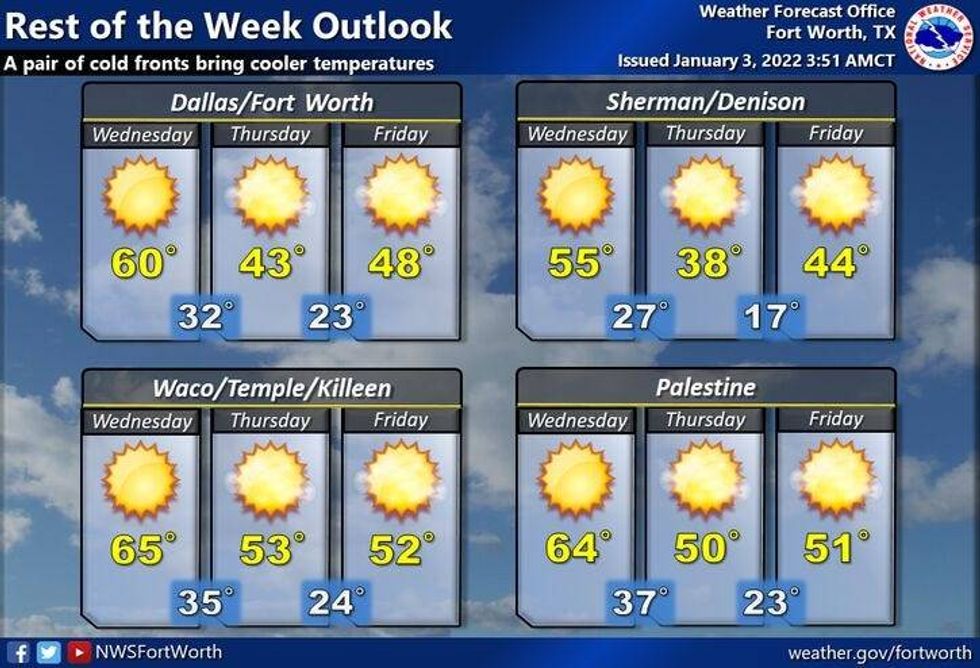
Two cold fronts will impact our weather by midweek. The 1st one arrives early Wednesday, dropping temperatures into the mid fifties for highs. A stronger cold front will move through early Thursday morning dropping high temperatures into the low forties . Factor in wind gusts over 30 mph, it'll feel like it's in the thirties all day long.
A hard freeze is expected for Friday morning with temperatures in the upper teens to low twenties. It'll remain chilly on Friday with highs in the upper forties.
 NWS
NWS
South winds return this weekend warming us backup into the low to mid sixties!
Our next front will arrive late Sunday into early Monday dropping temperatures back to below seasonal averages. There could be a little rain along that front, but it's still way too far away to be completely accurate.
7-Day Headlines:
* High yesterday: 40 degrees at DFW.
* Warmest December EVER!
* A cold start to 2022.
* Quick warm up, then we cool down again.
* No rain this week.
_________________________________________________________
*Yest Rain: 0.00"; *Yest High: 40; Low: 19
*Today's Averages: High: 56; Low: 36
*Record high: 84 (2006, 2009); Record low: 4 (1911)
_________________________________________________________
*January rain: 0.05"; January deficit: ">
*2022 Rain: 0.05"; 2022 deficit ">
*Sunrise: 7:31am; Sunset: 5:34pm
Today: Sunny and a bit warmer today, but still chilly. High: Low 50s. Wind: SE 5-10 mph.
Tonight: Clear and cold. A light freeze in areas. Low: 28-33. Wind: South 5-10 mph.
Tomorrow: Sunny, breezy and warmer. High: Low 60s. Wind: South 15-25 mph.
Wednesday: Sunny and a bit cooler. High: Mid 50s.
Thursday: Sunny, windy and much colder. High: Low 40s. Wind chills in the 30s!
Friday: Morning HARD freeze, otherwise, sunny and cold. High: Near 50.
Weekend: Sunny and perfect! Highs: Low to mid 60s.
LISTEN on the Audacy App
Sign Up and Follow NewsRadio 1080 KRLD